Day 13 · Interactions — When three lifelines meet
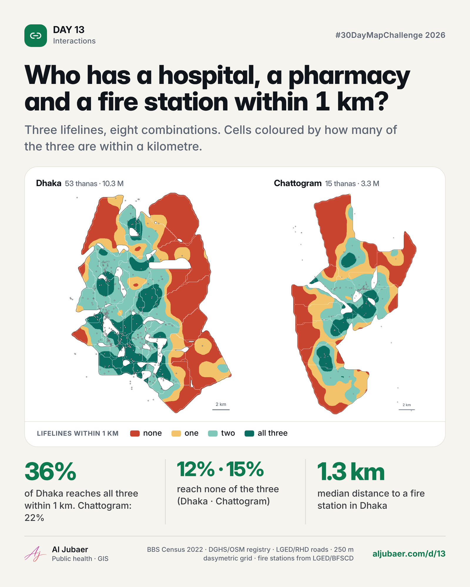
Hospital, pharmacy and fire station: who can reach all three, who reaches none — and how that changes as the walk gets longer. Dhaka: 35.5% of Dhaka people have a hospital, a pharmacy and a fire station within 1 km. Chattogram: 22.3% of Chattogram people have a hospital, a pharmacy and a fire station within 1 km.


Write-up
The question
Where can people in Dhaka and Chattogram reach a hospital, a pharmacy and a fire station — and where do the three lifelines fail to meet?
Data
BD Hospital Dataset (hospitals, clinics, pharmacies), fire stations, garment factories, economic zones and major roads from the GIS Data folder; BBS Population and Housing Census 2022 thana populations; city-corporation boundaries. The registry is incomplete and urban-biased; population per 250 m cell is a dasymetric model; distances are straight lines in UTM 46N.
Methods
- Study areas: the two Dhaka city corporations (DNCC + DSCC, 53 thana polygons, 10,250,630 people) and Chattogram City Corporation (15 thanas, 3,273,329 people), BBS Population and Housing Census 2022. White gaps on the maps are outside the corporations (cantonment, airport, water).
- Health facilities: the BD Hospital Dataset in the GIS Data folder, split into hospitals, clinics and pharmacies from the type and name keywords; pharmacies within 25 m of each other merged; an ‘emergency / 24 h’ flag from the name and type. Dhaka: 475 hospitals, 507 clinics, 2,049 pharmacies, 44 fire stations. Chattogram: 160, 51, 405 and 24.
- Where people live: the census gives thana totals only, so each thana total is spread over a 250 m grid in proportion to a Gaussian kernel (σ = 400 m) of settlement proxies — mobile-phone towers, mosques, schools, health points, pharmacies, hospitals — plus a small floor. Cell sums equal the census total exactly (checked).
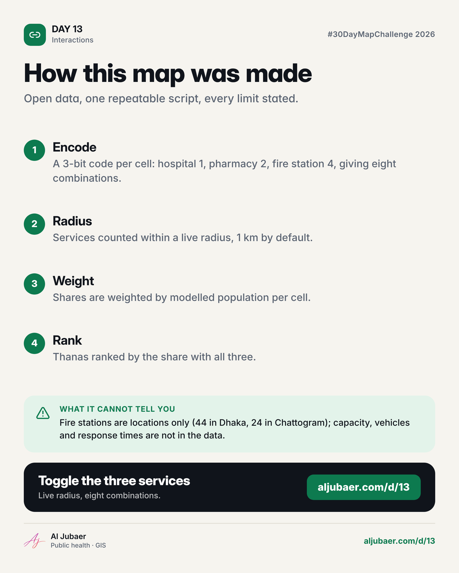
- Every 250 m cell gets three distances (nearest hospital, pharmacy, fire station). For a chosen reach R each cell has a 3-bit code (H = 1, P = 2, F = 4); the eight codes are the eight combinations in the legend.
- Shares are people-weighted; the web map recomputes the codes, the eight shares, the thana ranking and the colours for any R from 250 m to 3 km, and for any subset of the three services.
- Thana coverage = people with every selected service within R ÷ people in the thana (cells carry a thana id). Tables show the five worst and best thanas with more than 20,000 residents.
Findings
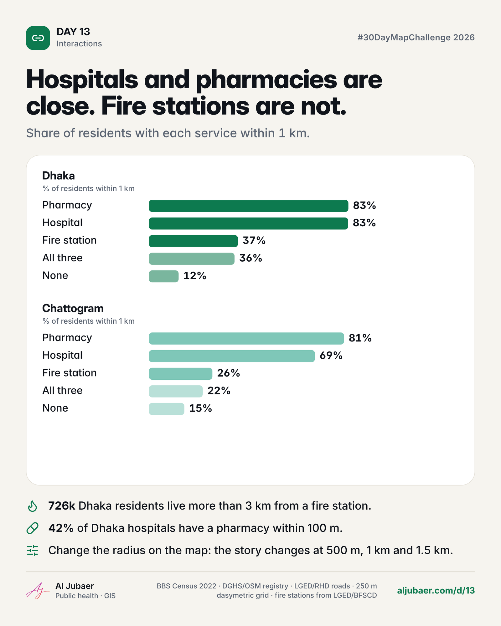
Dhaka — At 1 km, 82.6% of Dhaka residents reach a hospital, 82.7% a pharmacy but only 36.9% a fire station; all three: 35.5%; none: 12.3%.
Dhaka — The picture moves fast with distance: at 500 m only 8.2% have all three, at 1.5 km 58.0%. Fire stations set the pace — 44 stations for 10.3 million people.
Dhaka — 725,930 people live more than 2 km from any fire station. The median resident is 1.3 km away.
Dhaka — Lowest all-three coverage at 1 km: Bhasantek (0%), Hatirjheel (0%), Dhanmondi (DNCC) (0%). Best: Sutrapur (100%), Lalbag (100%).
Chattogram — At 1 km, 68.8% of Chattogram residents reach a hospital, 80.9% a pharmacy but only 26.3% a fire station; all three: 22.3%; none: 14.7%.
Chattogram — The picture moves fast with distance: at 500 m only 3.1% have all three, at 1.5 km 42.7%. Fire stations set the pace — 24 stations for 3.3 million people.
Chattogram — 574,376 people live more than 2 km from any fire station. The median resident is 1.7 km away.
Comments & reviews
What you write appears here once it has been approved.
 Web map & dashboard
 Web map & dashboard
 Web map & dashboard
 Web map & dashboard