Projects & case studies
Atlases, WebGIS, research & map design
Research, maps, web GIS, design, 3D and video from icddr,b, AIT, the Institute of Remote Sensing & GIS (JU), consultancies and my own builds — sorted by discipline, each with its year, place and the job it was done in.
LIVE WEBGIS — OPENS INSIDE THIS SITE
 Research & analysis
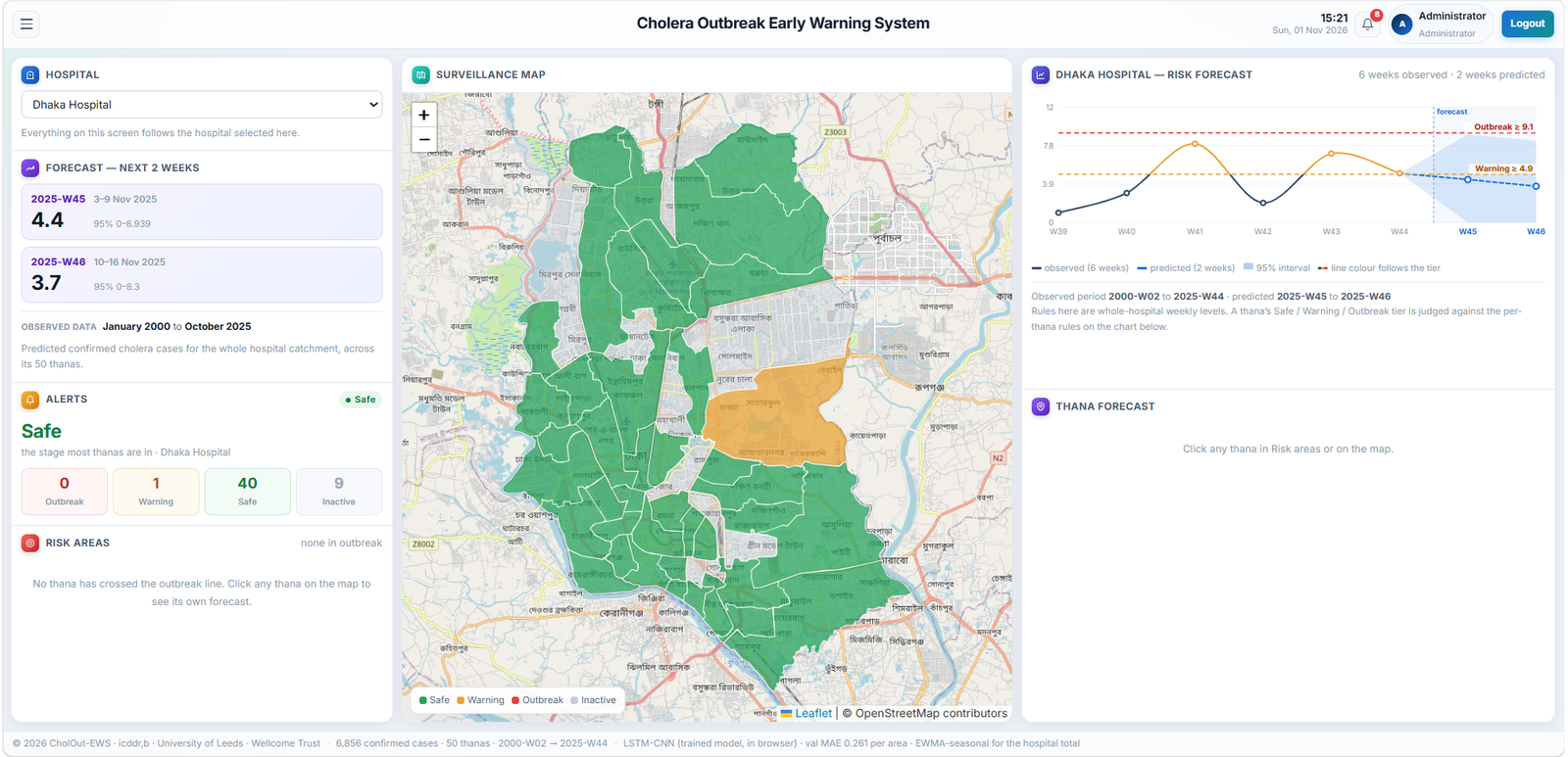
Cholera Outbreak Risk Prediction & Early Warning (CHOLOUT-EWS)
Environmental and hydrological predictors combined into a cholera outbreak early-warning framework.
Bangladesh Crop Suitability Atlas
Zone-level suitability for sixteen crops, matched to administrative geography and queryable by district and upazila.
 Maps & atlases
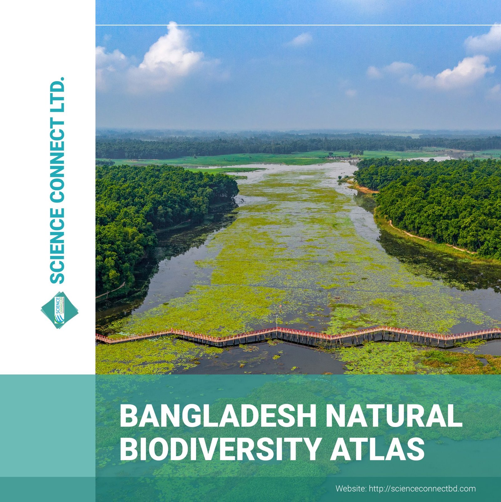
Bangladesh Biodiversity Atlas — design
Cartographic design and page layout for a national biodiversity atlas.
 Maps & atlases
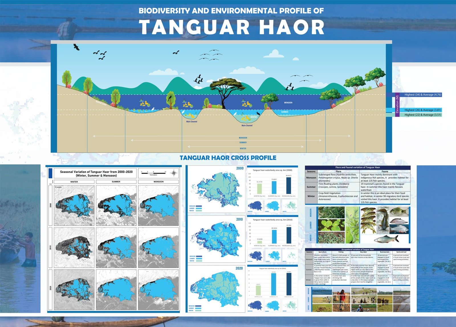
Biodiversity & Environmental Profile of Tanguar Haor
Infographic poster combining the haor cross profile, seasonal maps and biodiversity facts.
 Maps & atlases
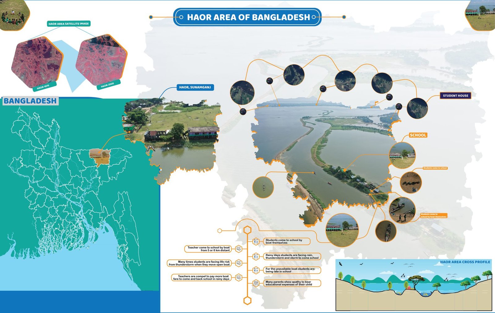
Haor Areas of Bangladesh
Infographic map of the haor wetlands of north-eastern Bangladesh.
 Research & analysis
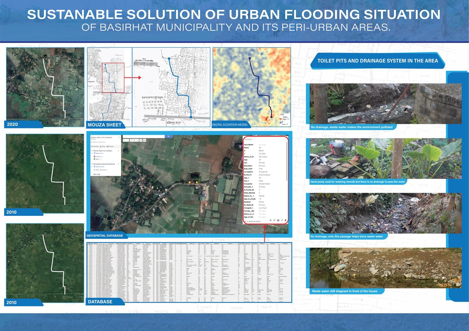
Sustainable Solutions for Urban Flooding — Basirhat
Poster on waterlogging, drainage and sustainable solutions for Basirhat Municipality and its peri-urban areas.
 Graphic design & publications
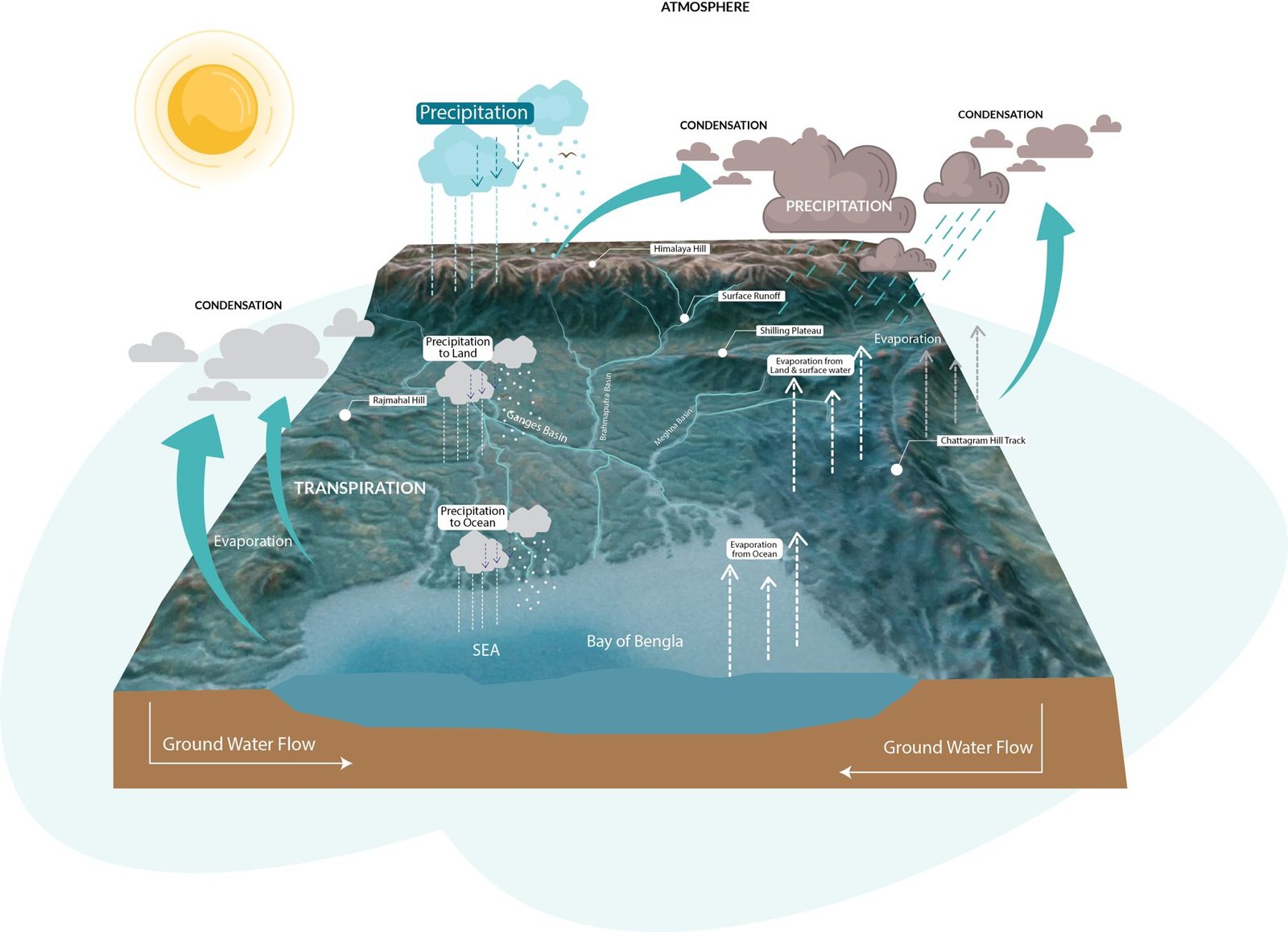
The Hydrological Cycle of the Bengal Basin
3D infographic of precipitation, run-off and groundwater flow towards the Bay of Bengal.
 Graphic design & publications
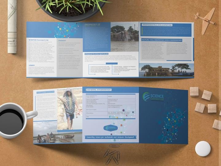
Design work for Science Connect Ltd.
Brand and publication design for Science Connect Ltd.
 Graphic design & publications
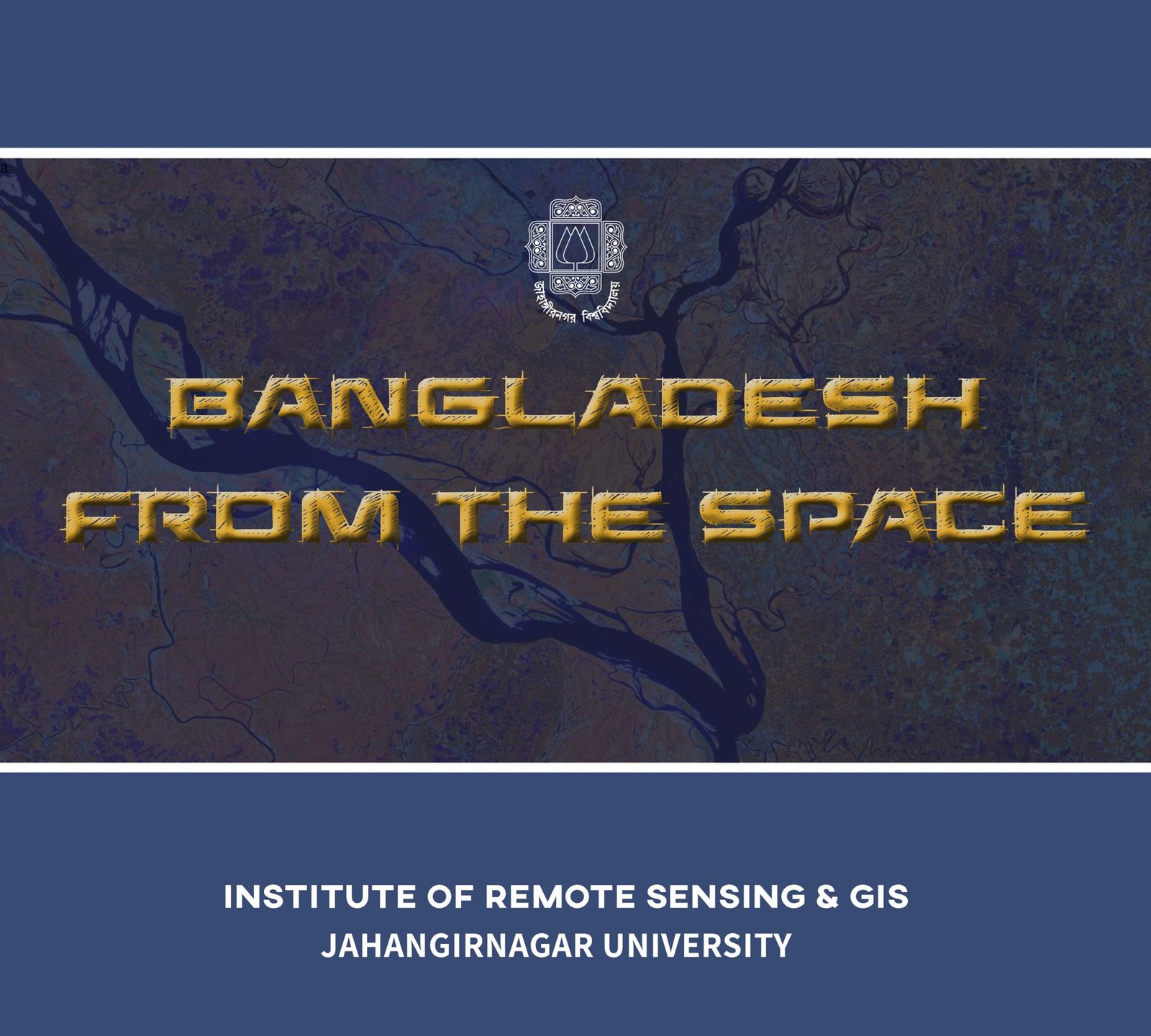
Bangladesh From the Space — publication design
Satellite-imagery publication: image selection, colour treatment, layout and production.
 Maps & atlases
Bangladesh Wetland Atlas — design and layout
Map series, figure design and full layout for a national wetland atlas.
 Maps & atlases
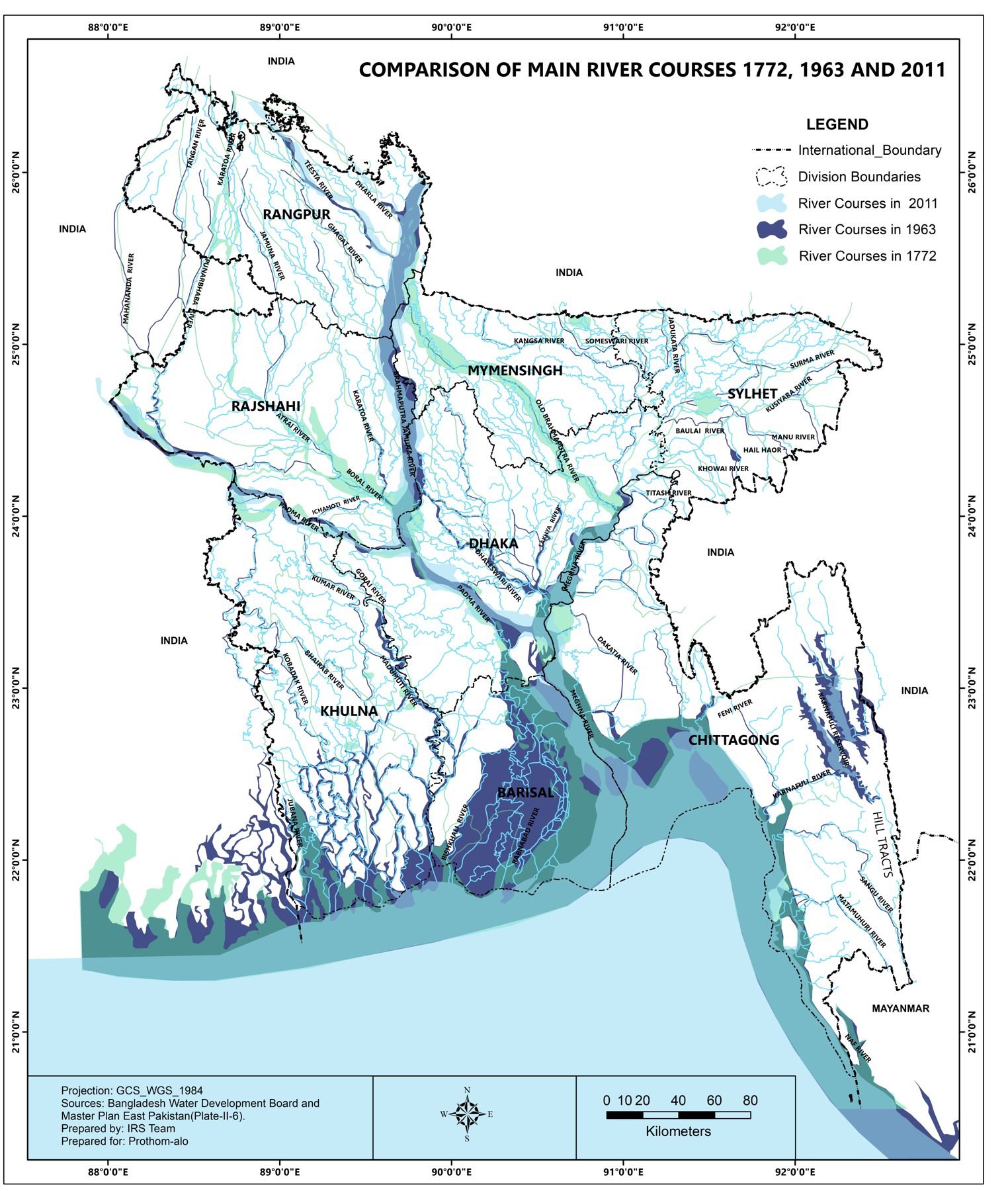
River Courses of Bangladesh: 1772, 1963 and 2011
Comparison map of the main river courses of Bangladesh across three centuries.
 Maps & atlases
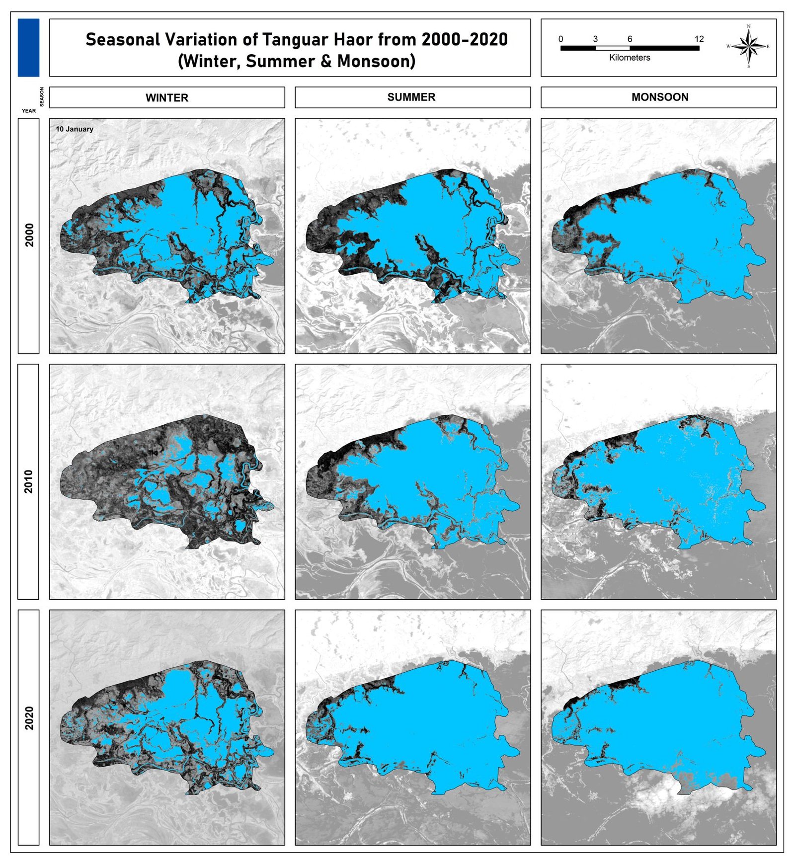
Seasonal Variation of Tanguar Haor, 2000–2020
Winter, summer and monsoon water extent of Tanguar Haor from satellite imagery, 2000–2020.
 Maps & atlases
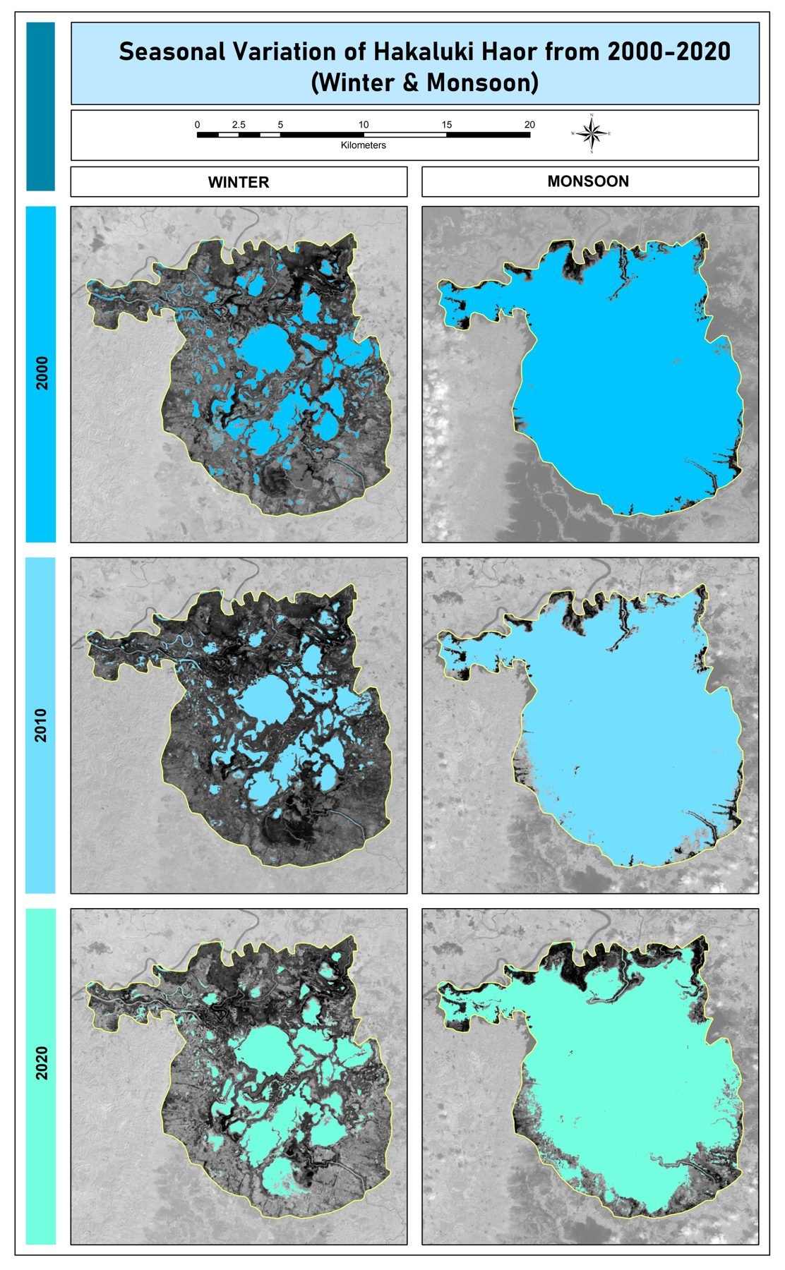
Seasonal Variation of Hakaluki Haor, 2000–2020
Winter and monsoon water extent of Hakaluki Haor from satellite imagery, 2000–2020.
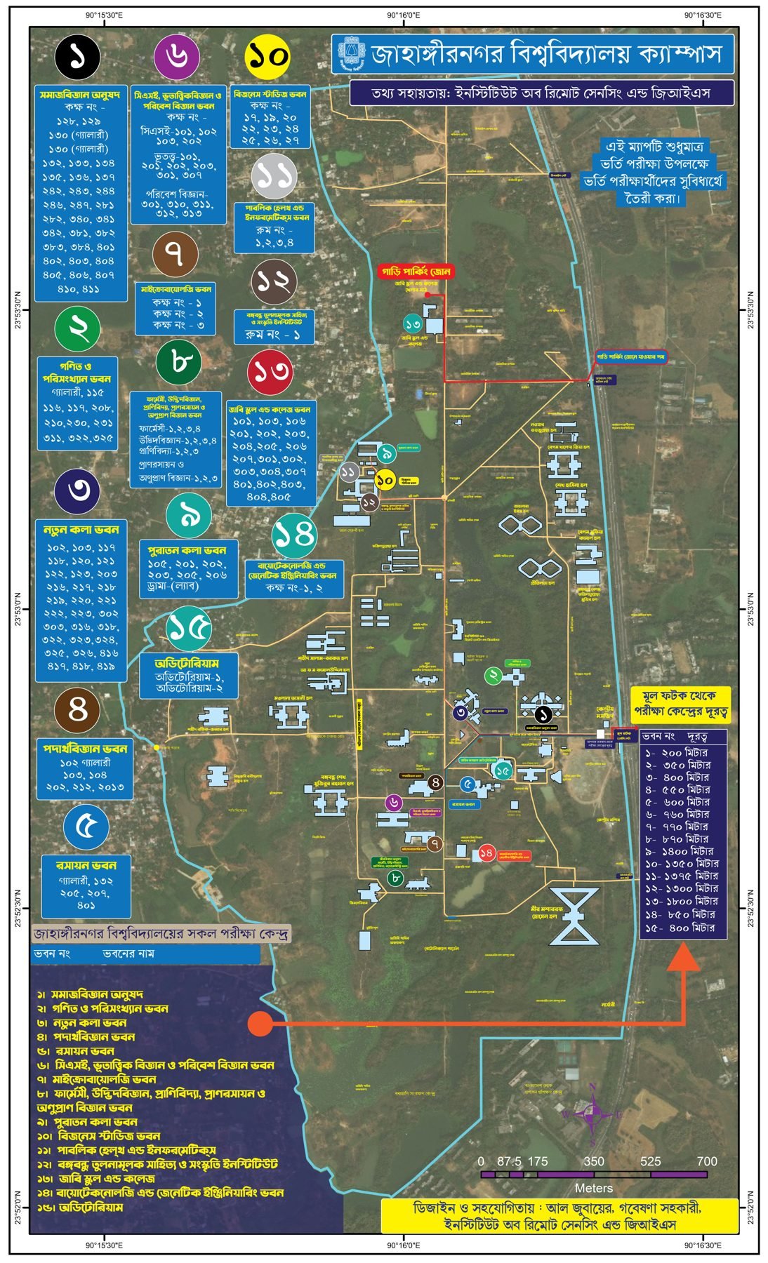 Maps & atlases
Jahangirnagar University Campus Map
Bilingual campus map of Jahangirnagar University with halls, departments and landmarks.
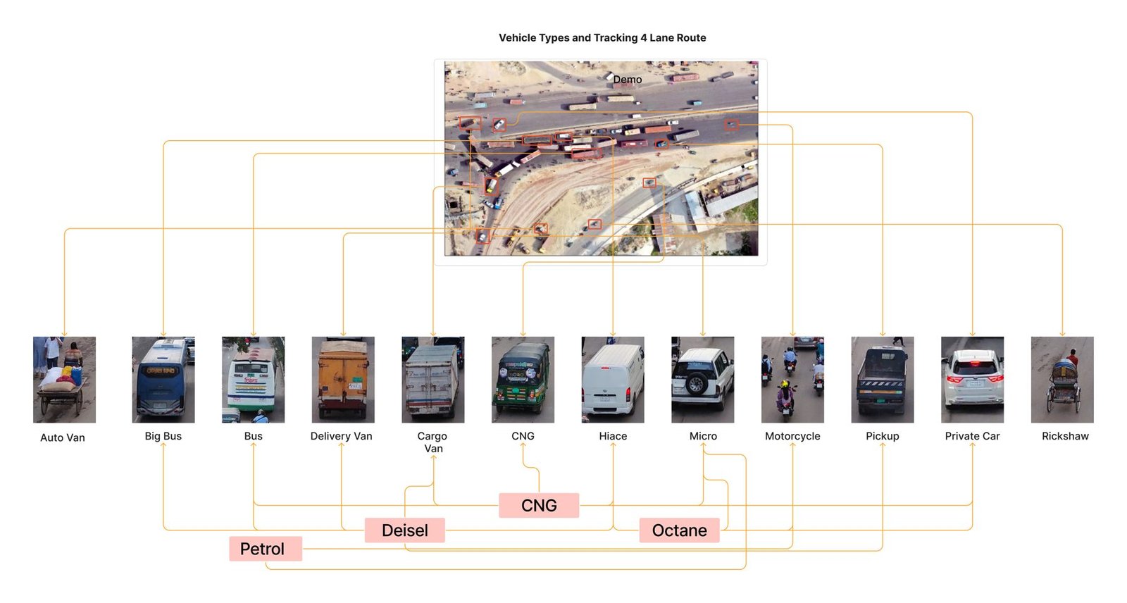 Graphic design & publications
Vehicle Types & Fuel — Air Quality Study Infographic
Infographic of vehicle types and fuel use (CNG, diesel, petrol, octane) for a road air-quality study.
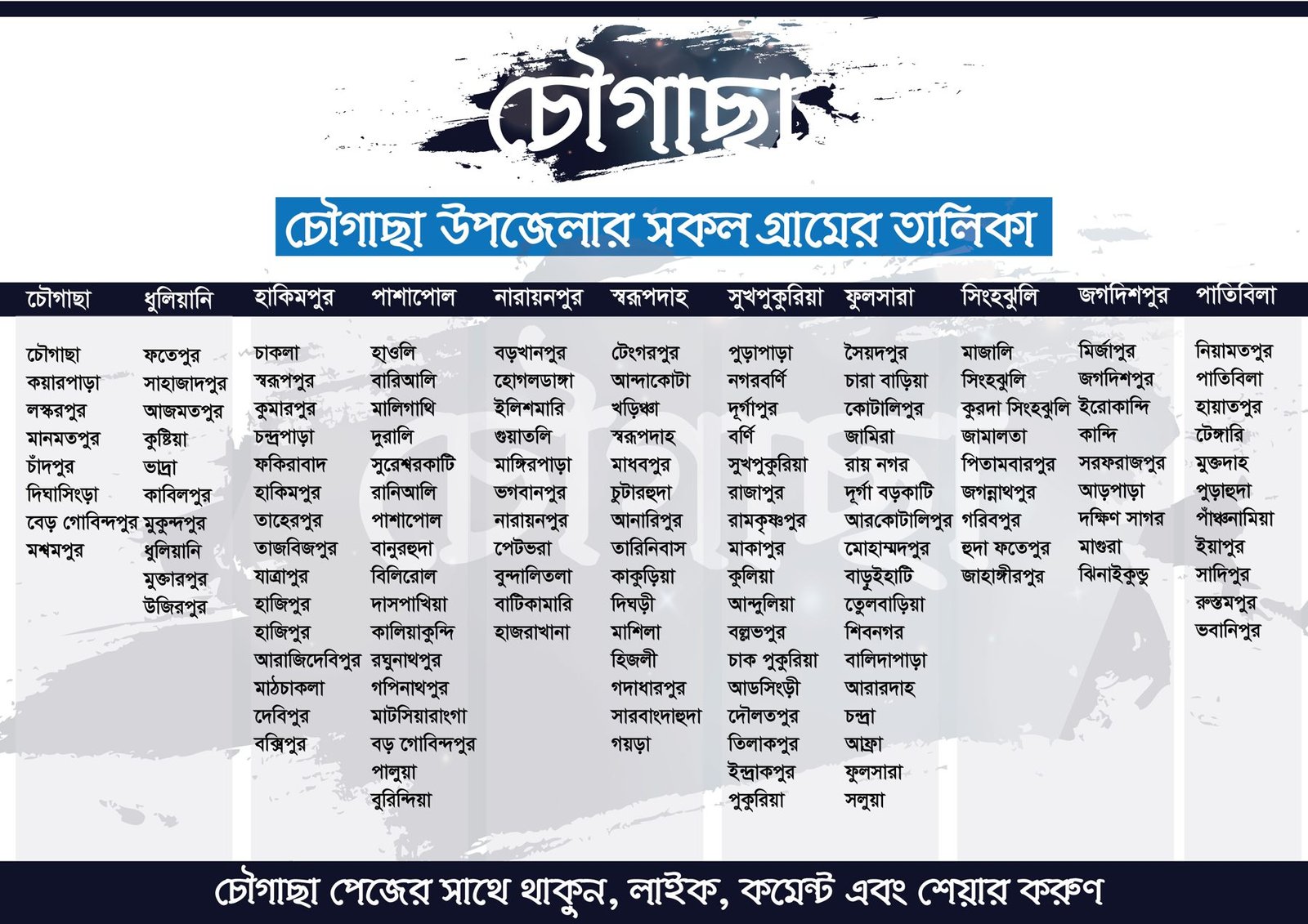 Maps & atlases
Villages of Chougachha Upazila
Bangla infographic listing every village of Chougachha Upazila, Jashore, by union: my home upazila.
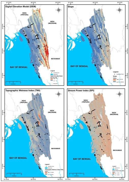 Research & analysis
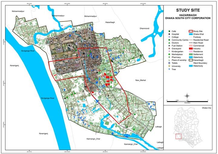
Causes & Consequences of the 2017 Landslides in Southeastern Bangladesh
Post-event assessment of the 2017 landslide episode in the southeastern hill districts.
 Research & analysis
Child Labour Action Research — Southern & South-Eastern Asia
Mapping and spatial analysis contribution to a multi-country action research programme.
Citizen Science for Reduction of Flood Vulnerability
Community-collected observations integrated with satellite data to improve local flood vulnerability mapping.
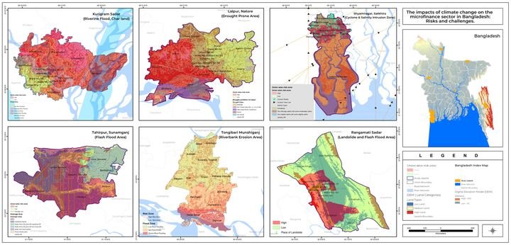
Climate Change Impacts on the Microfinance Ecosystem in Bangladesh
Spatial exposure analysis of microfinance operations to climate hazards.
Climate Innovation Challenge — OUSA Replicability in Bangladesh
Feasibility and replicability assessment for a climate innovation intervention.
 Research & analysis
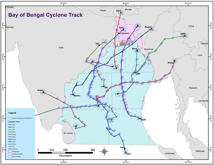
Sea Surface Temperature Dynamics in the Bay of Bengal, 1999–2018
Two decades of satellite-derived sea surface temperature analysed for spatial and seasonal pattern.
 Maps & atlases
UNDP project maps
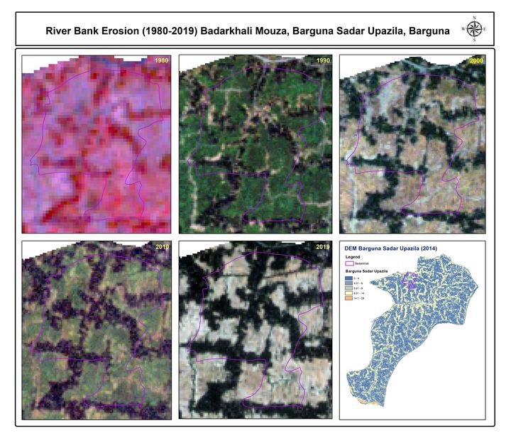
River-bank erosion (1980–2019), base, elevation and stream-network maps for coastal mouzas such as Badarkhali (Barguna), Bara Baisdia, Char Gazi and Patharsi, made for a…
 Maps & atlases
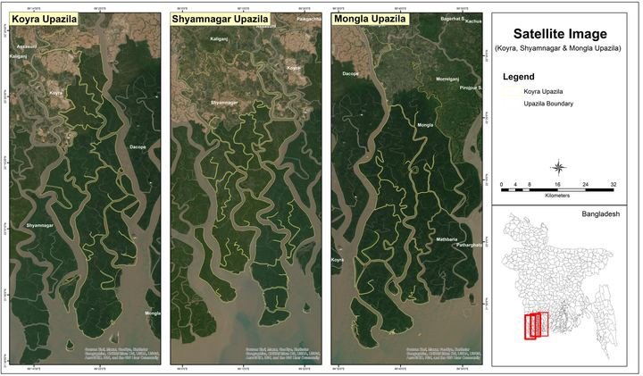
Microcredit Regulatory Authority (MRA) project maps
Map work for a Microcredit Regulatory Authority (MRA) study.
 Maps & atlases
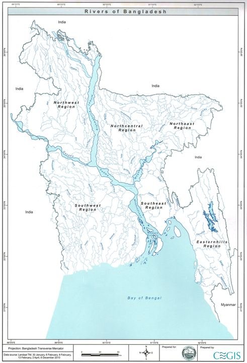
KAU project maps
Maps and layout for a KAU project inception report.
 Maps & atlases
Variety maps collection
A collection of thematic maps: Dhaka and Kathmandu city maps, forest, hazard-zone, industry and regional maps.
 Maps & atlases
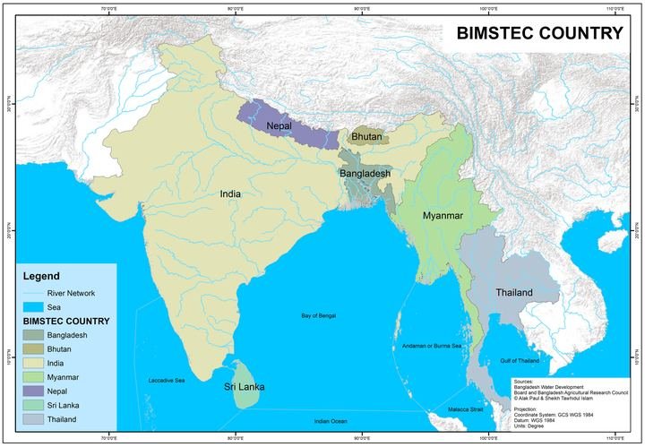
Geography book: maps and illustrations
Maps for a geography book: BIMSTEC countries, climate zones and regions, and the maritime exclusive economic zone.
 Graphic design & publications
Design work for the Institute of Remote Sensing and GIS, JU
Atlas pages, maps, infographics, posters, brochures and report covers designed for the Institute of Remote Sensing and GIS.
 Maps & atlases
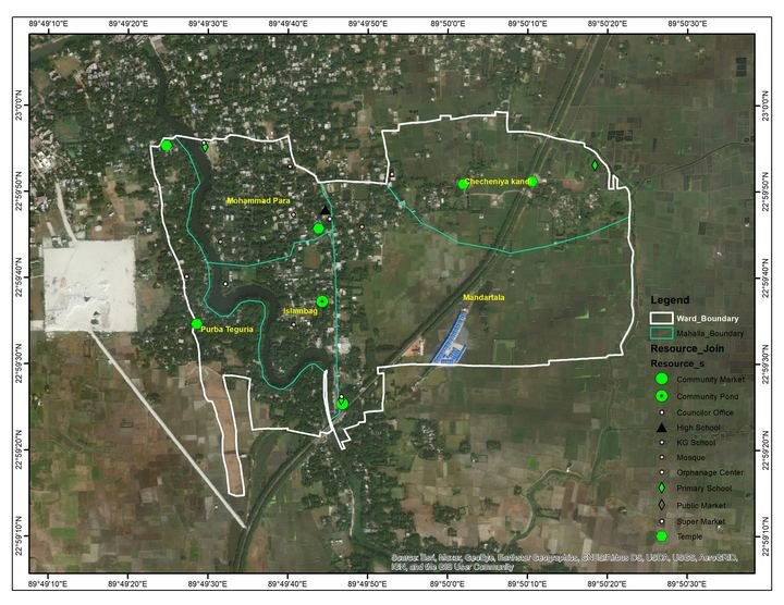
Maps for DM Watch
Maps prepared for DM Watch.
 Maps & atlases
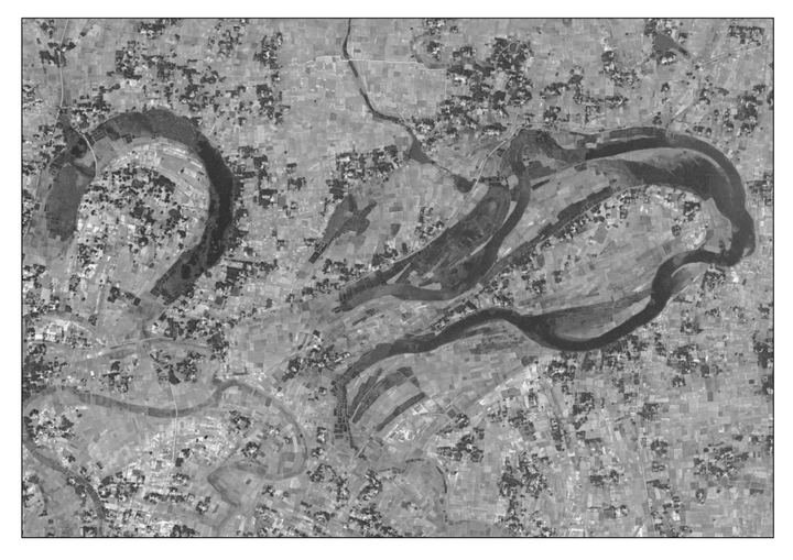
Maps for Jamuna TV (and a river interview)
River-change maps (1972 and 2021, Rajarhat Union) for Jamuna TV, with a TV interview on rivers.
 Graphic design & publications
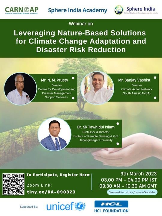
Work for CARN-AP
Design work for the Climate Action Resources Network – Asia Pacific.
 Maps & atlases
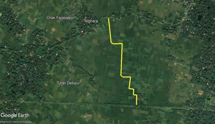
Work for PRISM India
Land-use change maps of Basirhat Municipality (2000, 2010, 2020) for PRISM India.
 Maps & atlases
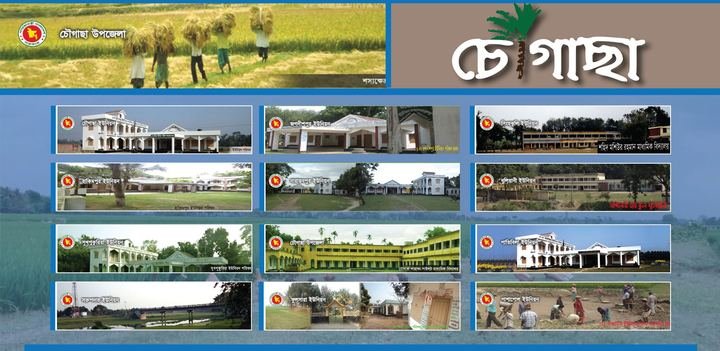
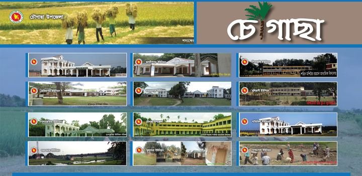
Work for the Chougachha community
Maps and designs for the Chougachha community, my home upazila.
 Maps & atlases
Work for Chougachha (Chougasa)
Draft from Google Drive: add the year, place, pictures and what I did.
 Maps & atlases
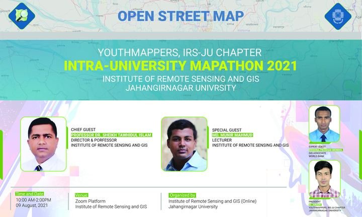
YouthMappers at IRS: maps and mapathons
Mapathon banners and disaster-risk mapping events with YouthMappers at IRS.
 Maps & atlases
Freelance map work for Dr. Billal Hossain
Draft from Google Drive: add the year, place, pictures and what I did.
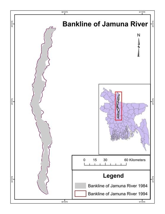 Maps & atlases
Freelance map work for Humayun Kabir
Draft from Google Drive: add the year, place, pictures and what I did.
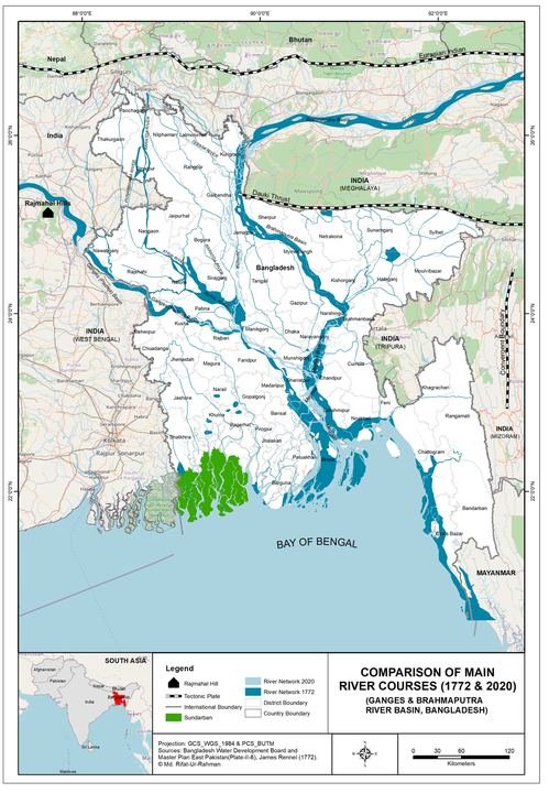 Maps & atlases
Freelance map work for Mahfuz
Draft from Google Drive: add the year, place, pictures and what I did.
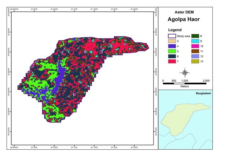 Maps & atlases
Freelance map work for Mitu
Draft from Google Drive: add the year, place, pictures and what I did.
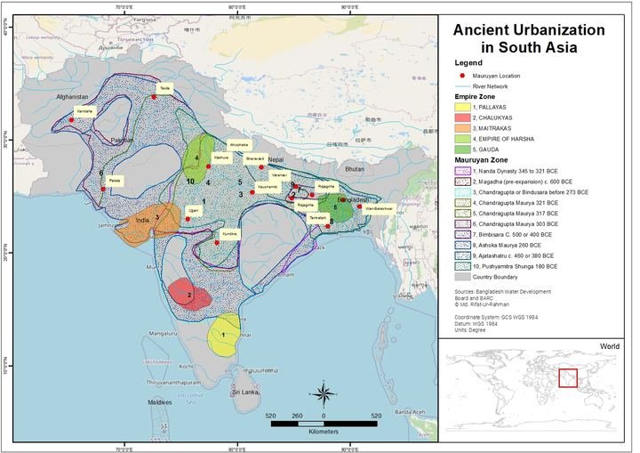 Maps & atlases
Freelance map work for Rifat Shakil
Draft from Google Drive: add the year, place, pictures and what I did.
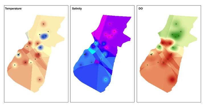 Maps & atlases
Freelance map work for Royhanul Islam
Draft from Google Drive: add the year, place, pictures and what I did.
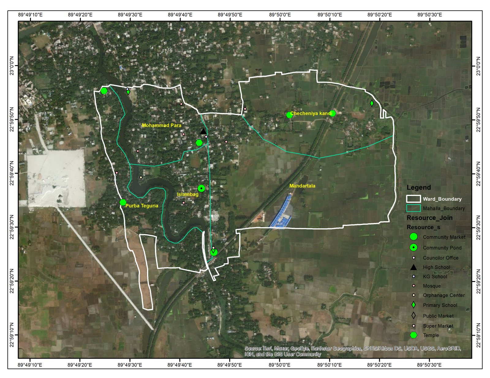
 Maps & atlases
Freelance map work for Azhar Mukul
Draft from Google Drive: add the year, place, pictures and what I did.
 Research & analysis
Ans 1 C
Photo uploaded successfully
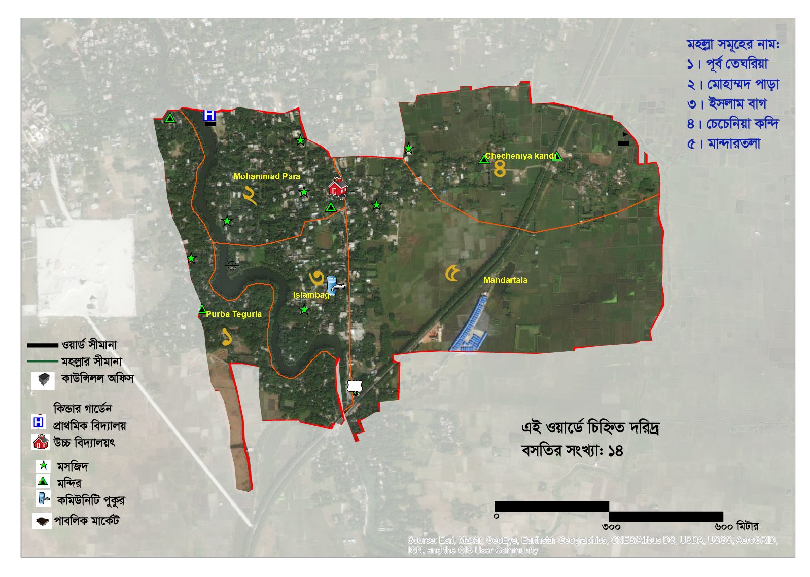 Research & analysis
Ans 1 D S-01
Photo uploaded successfully
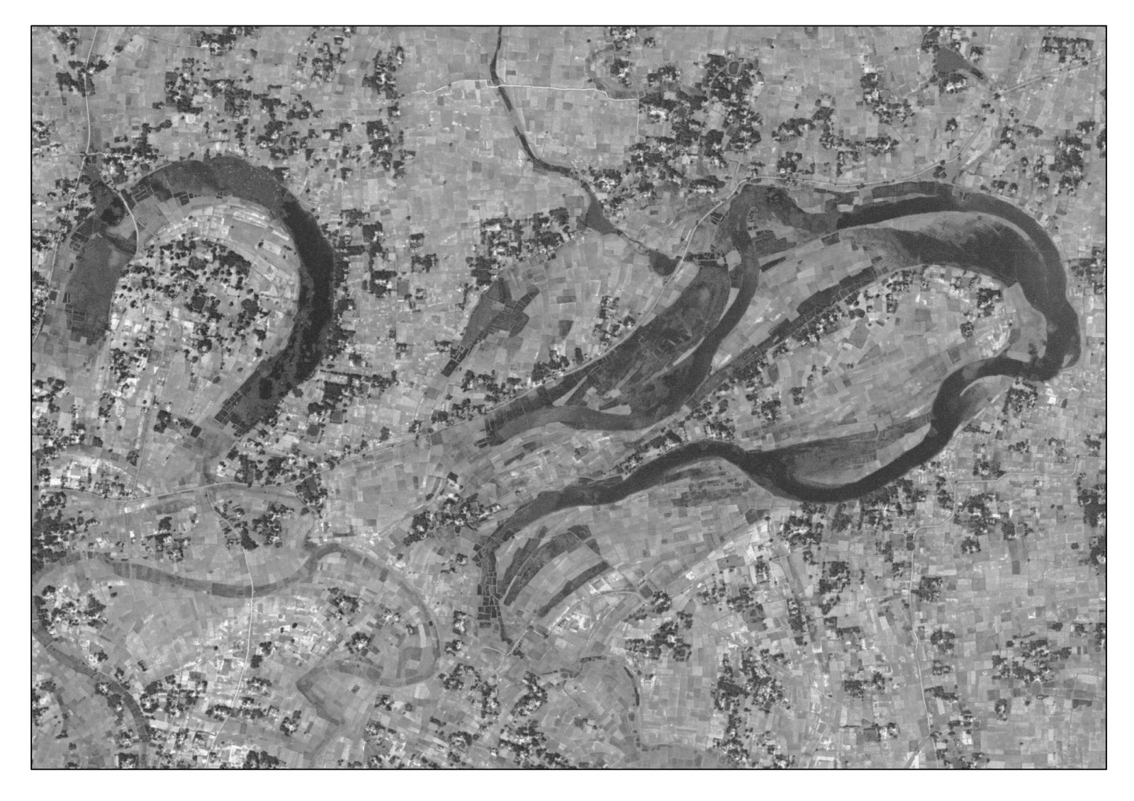 Maps & atlases
1972 Map
Photo uploaded successfully
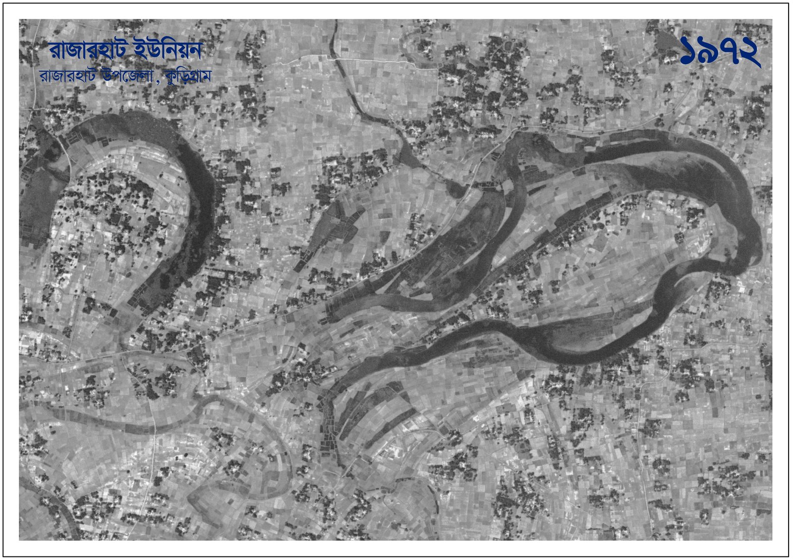 Research & analysis
1972
Photo uploaded successfully
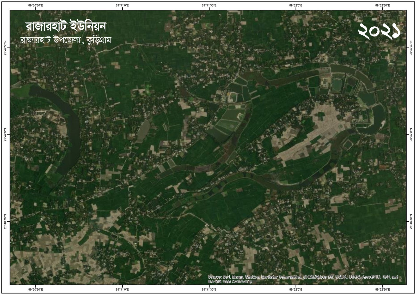 Research & analysis
2021
Photo uploaded successfully
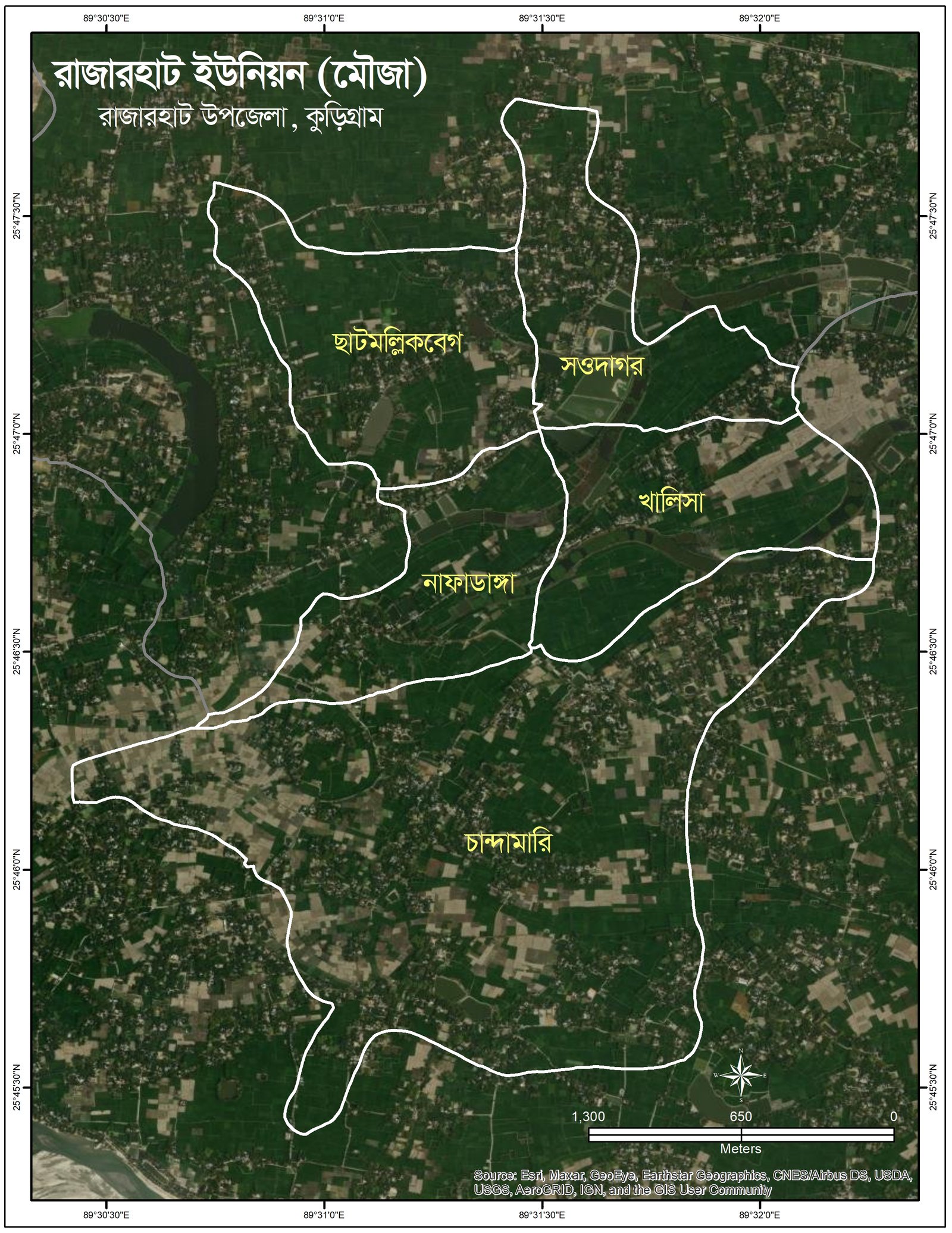 Research & analysis
Rajarhat Union
Photo uploaded successfully
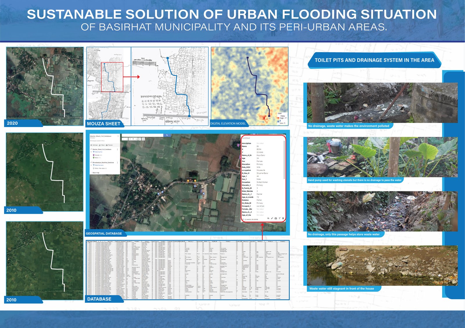 Research & analysis
SUSTANABLE-SOLUTION-OF-URBAN-FLOODING-SITUATION-of-BASIRHAT-Municipality-and-its-Peri-urban-areas
Photo uploaded successfully
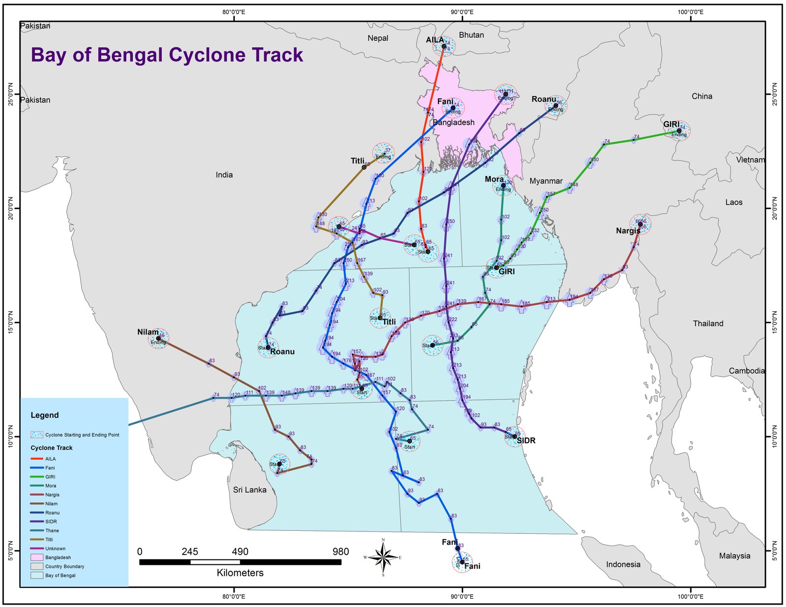 Research & analysis
Cyclone Tract
Photo uploaded successfully
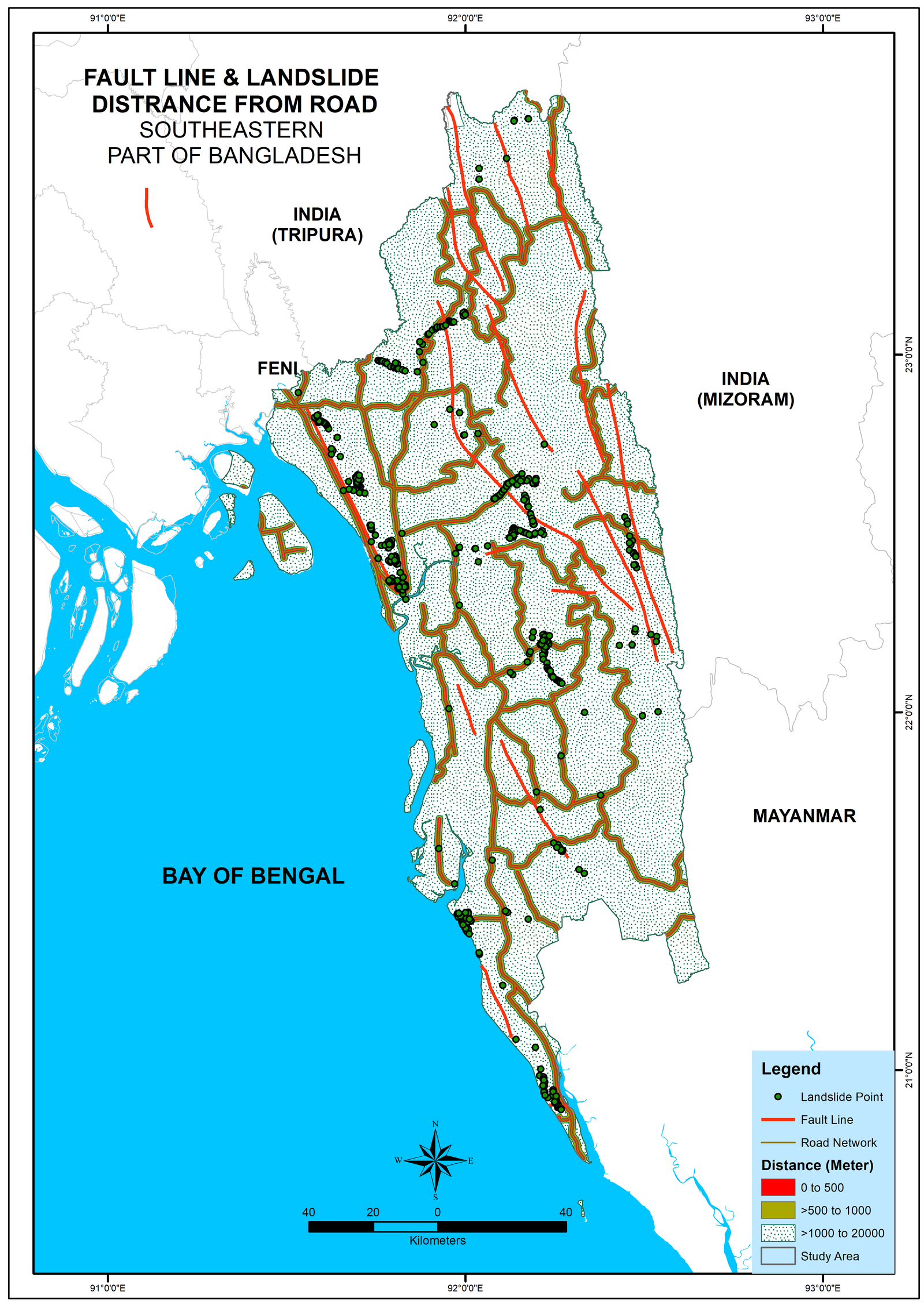 Research & analysis
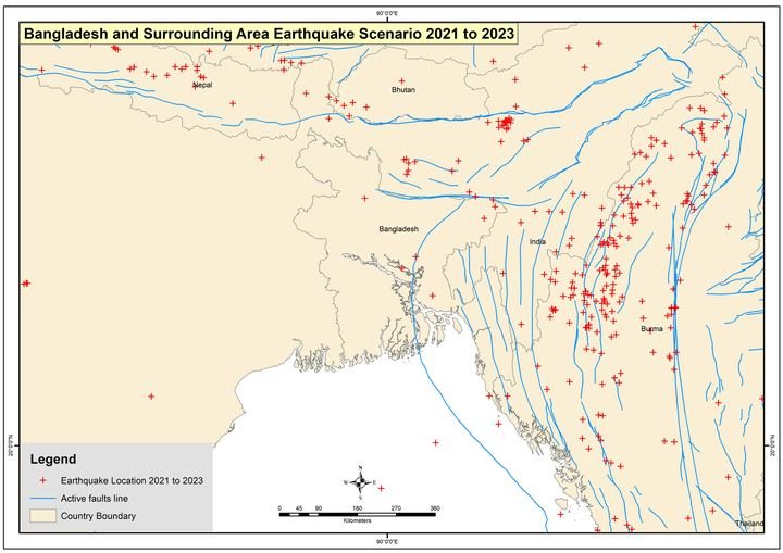
Earthquake & Fault Line
Photo uploaded successfully
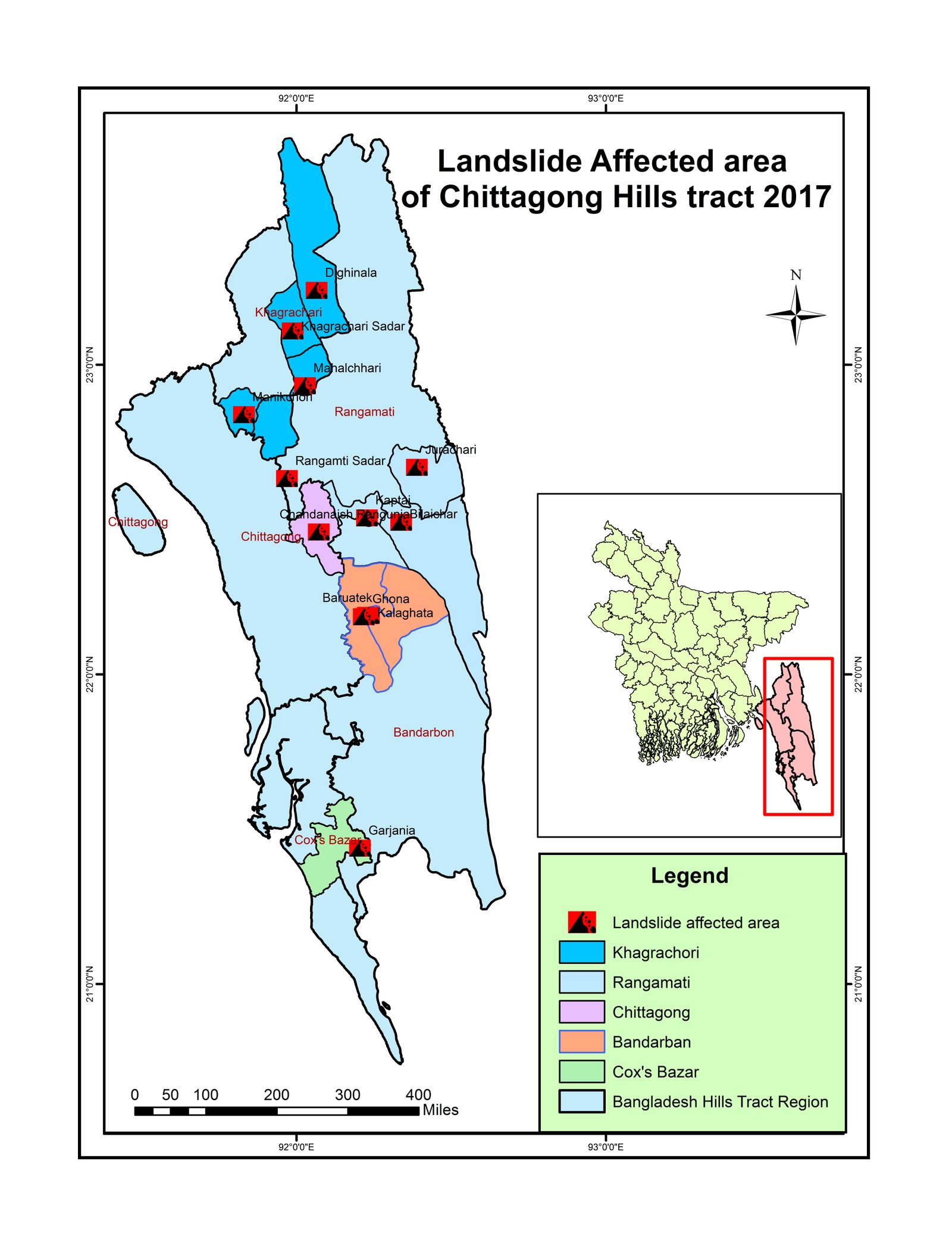 Research & analysis
landslide
Photo uploaded successfully
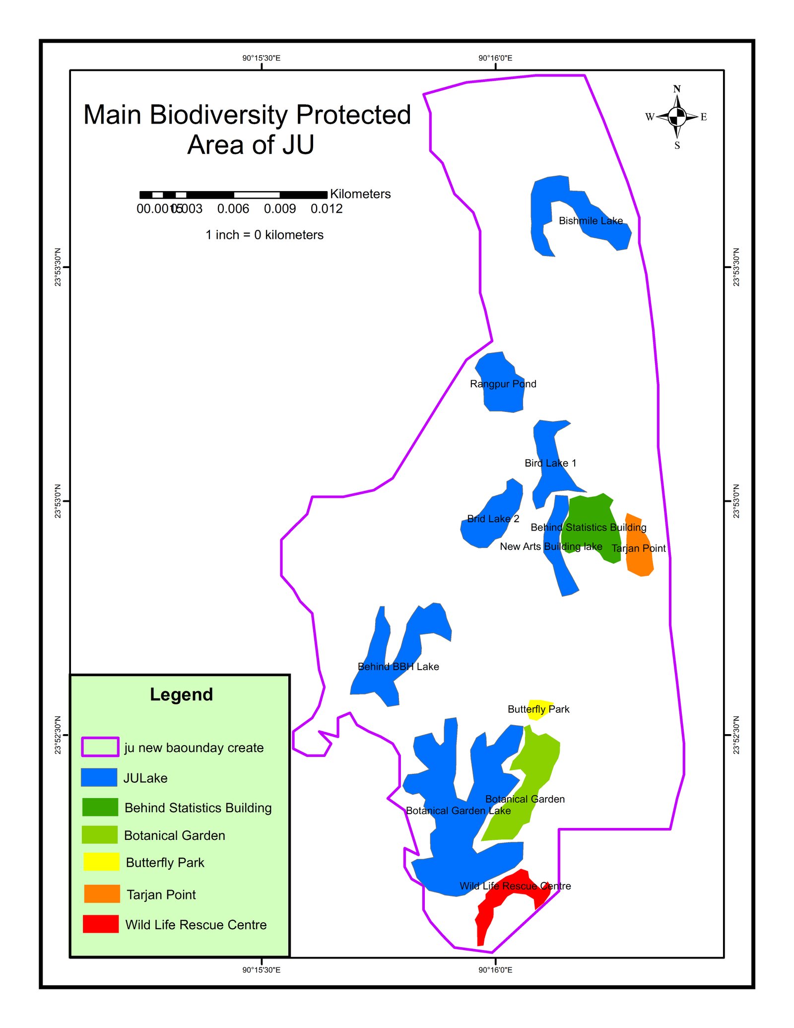 Maps & atlases
JU Map Biodiversity
Photo uploaded successfully
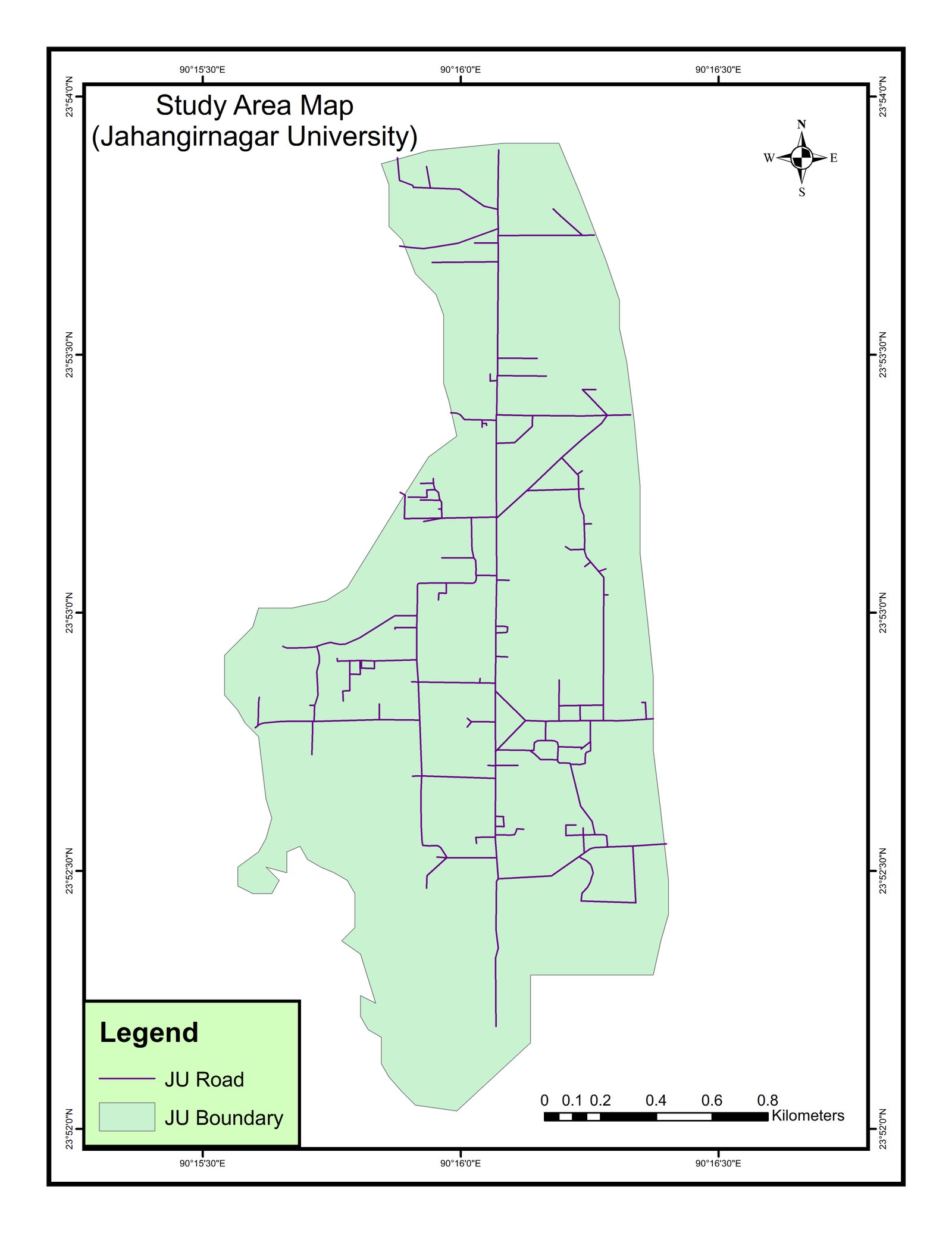 Maps & atlases
JU Map
Photo uploaded successfully
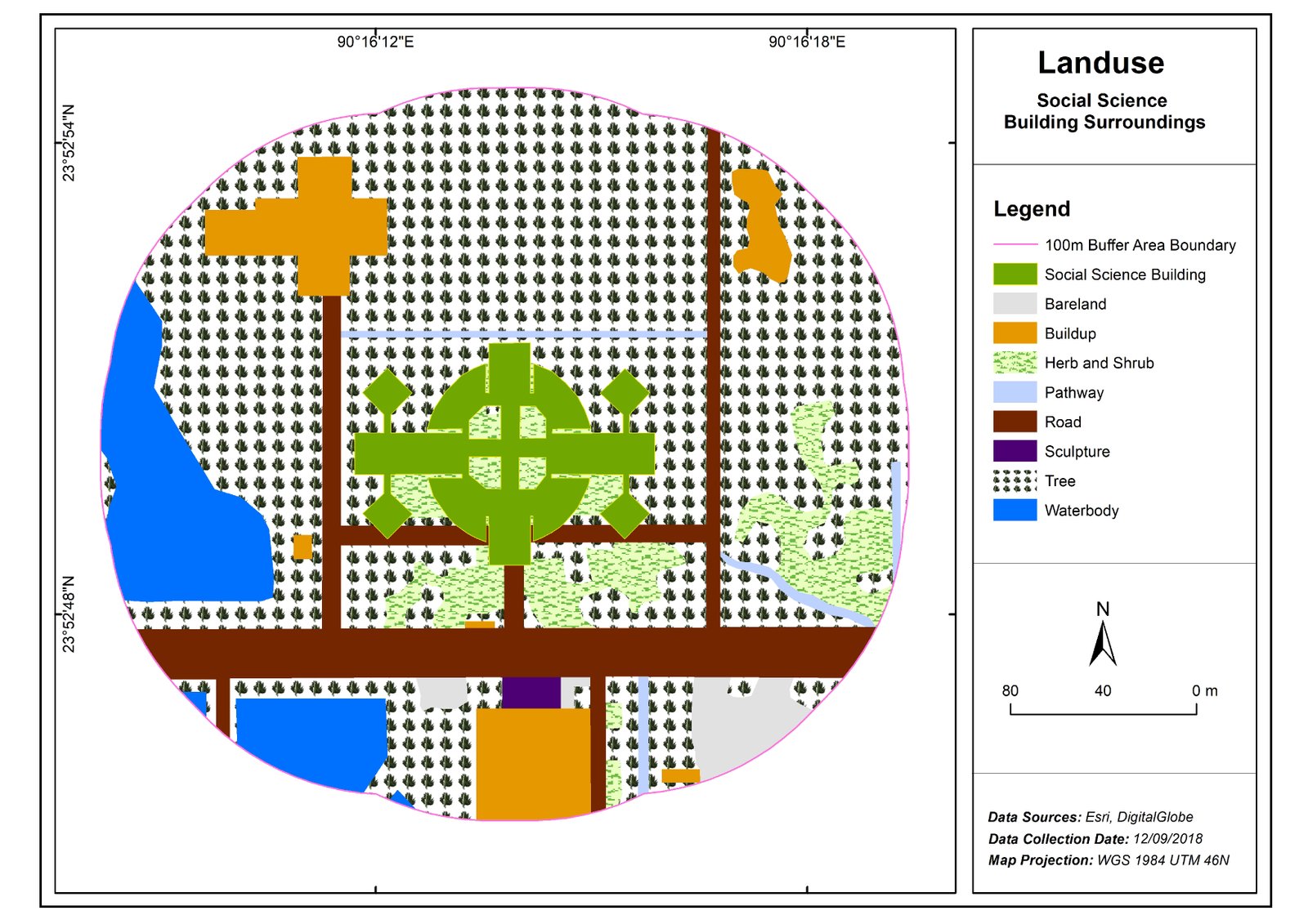 Research & analysis
SSA-01
Photo uploaded successfully
 Web GIS & programming
Day 5 · Senses: Sight — Out of sight: how far Bangladesh lives from an eye hospital
 Maps & atlases
Day 1 · Points — Where Bangladesh's health care is mapped
8,230 OpenStreetMap health facilities across Bangladesh, coloured by type, with district rates per 100,000 people and the distance from every upazila to its nearest mapp…
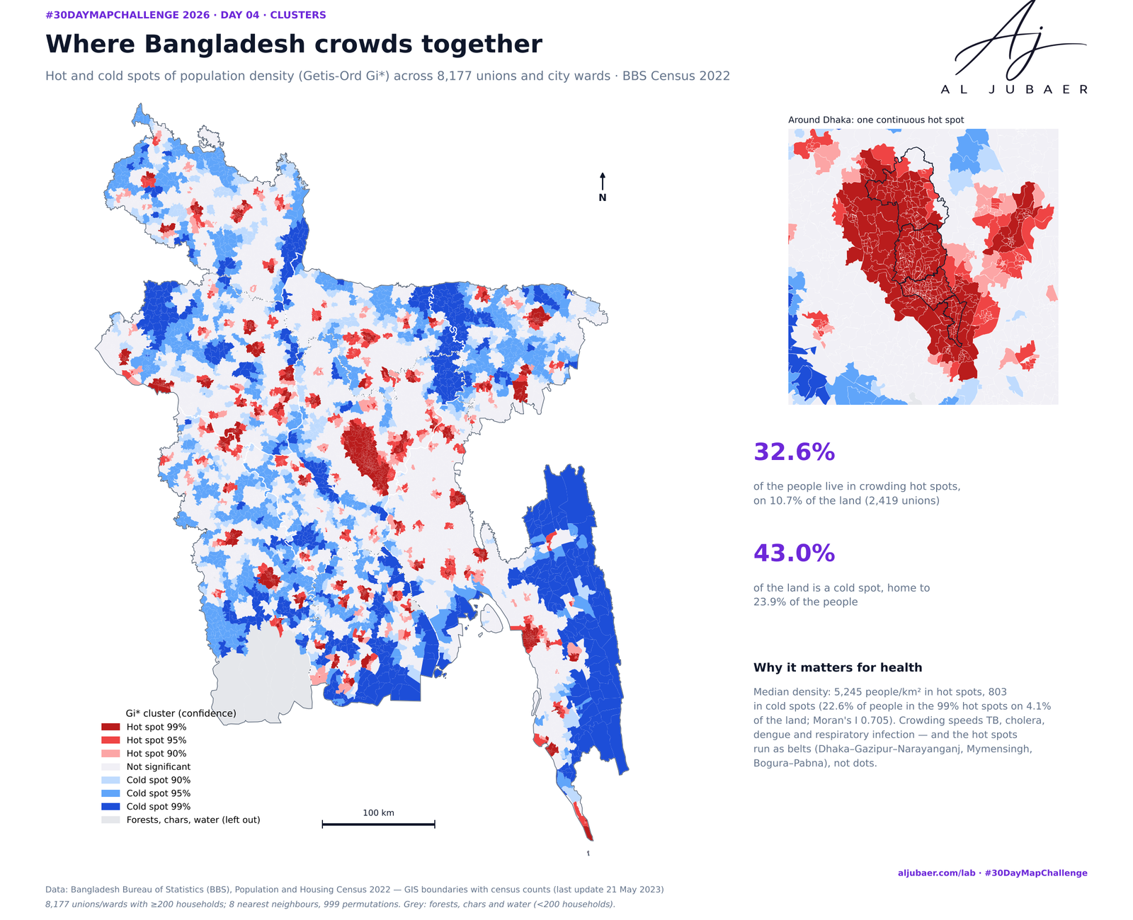 Web GIS & programming
Day 4 · Clusters — Where Bangladesh gathers: crowding, leaving and the missing men
Three kinds of clusters in the 2022 census, union by union. Crowding: 32.6% of Bangladeshis live in density hot spots on 10.7% of the land. Leaving: emigration clusters …
 Web GIS & programming
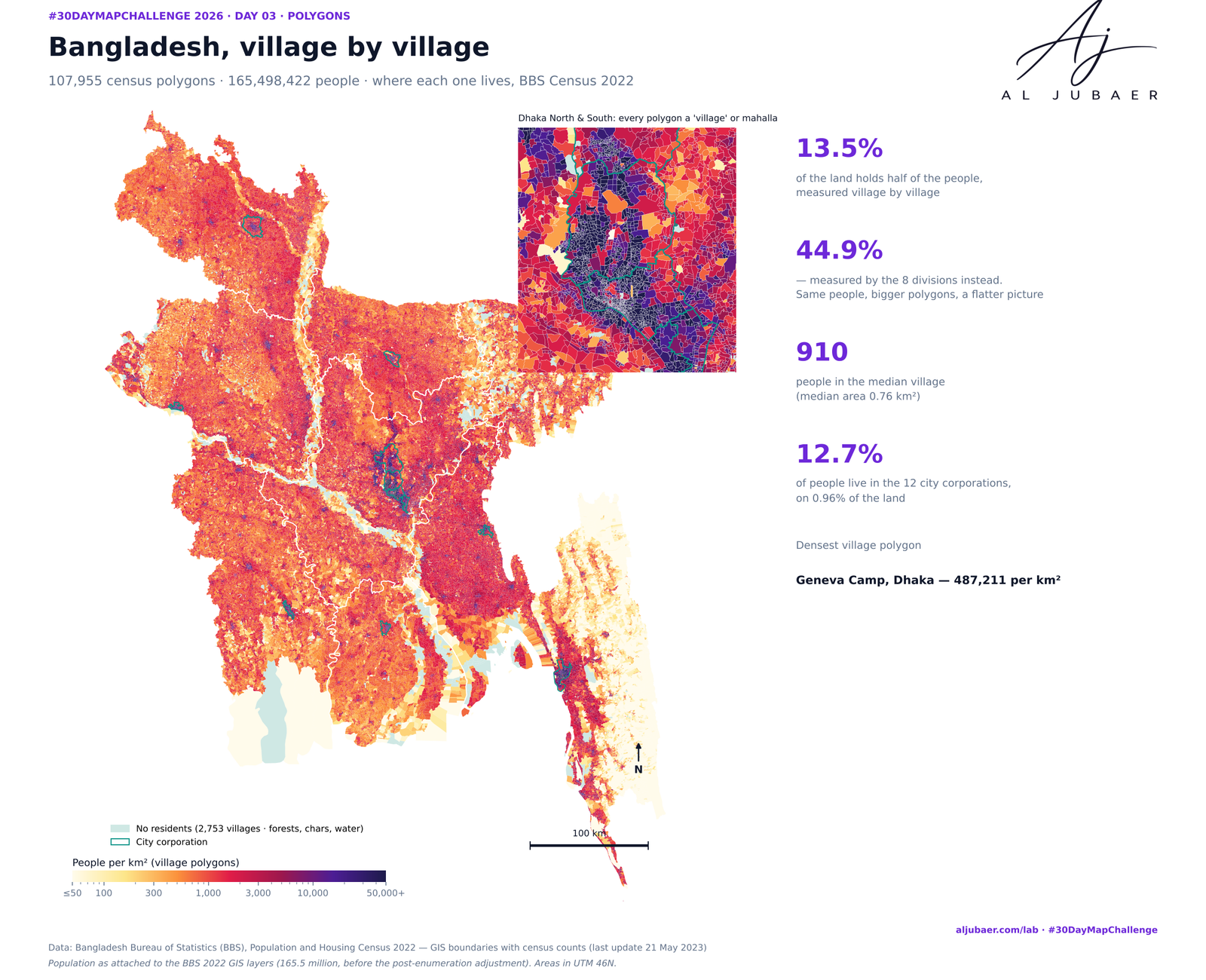
D_3_Polygon Bangladesh Population Density Map
The same 165.5 million people, drawn with 8, 64, 600, 8,202 and 107,955 polygons. By division, half of Bangladesh lives on 44.9% of the land; village by village it is 13…
 Web GIS & programming
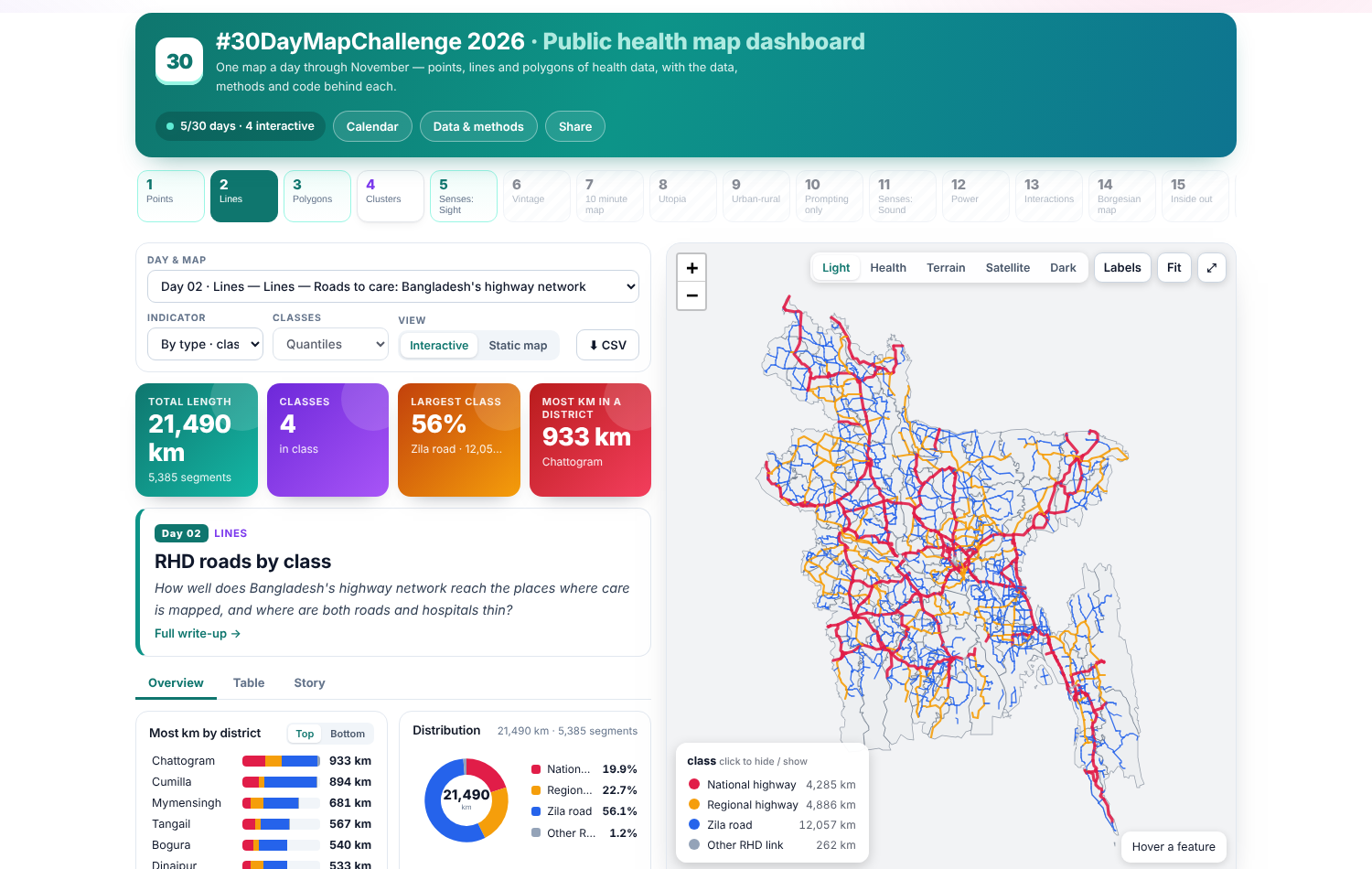
Day 2 · Lines — Roads to care: Bangladesh's highway network
21,564 km of national, regional and zila roads from the Roads and Highways Department, mapped by class and measured against the 2,234 hospitals mapped in OpenStreetMap (…
 Web GIS & programming
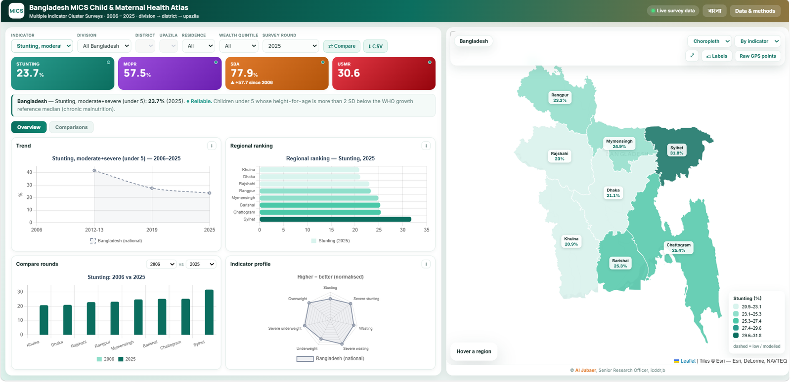
Bangladesh MICS Child & Maternal Health Atlas
Bangladesh MICS Child & Maternal Health Atlas