D_3_Polygon Bangladesh Population Density Map
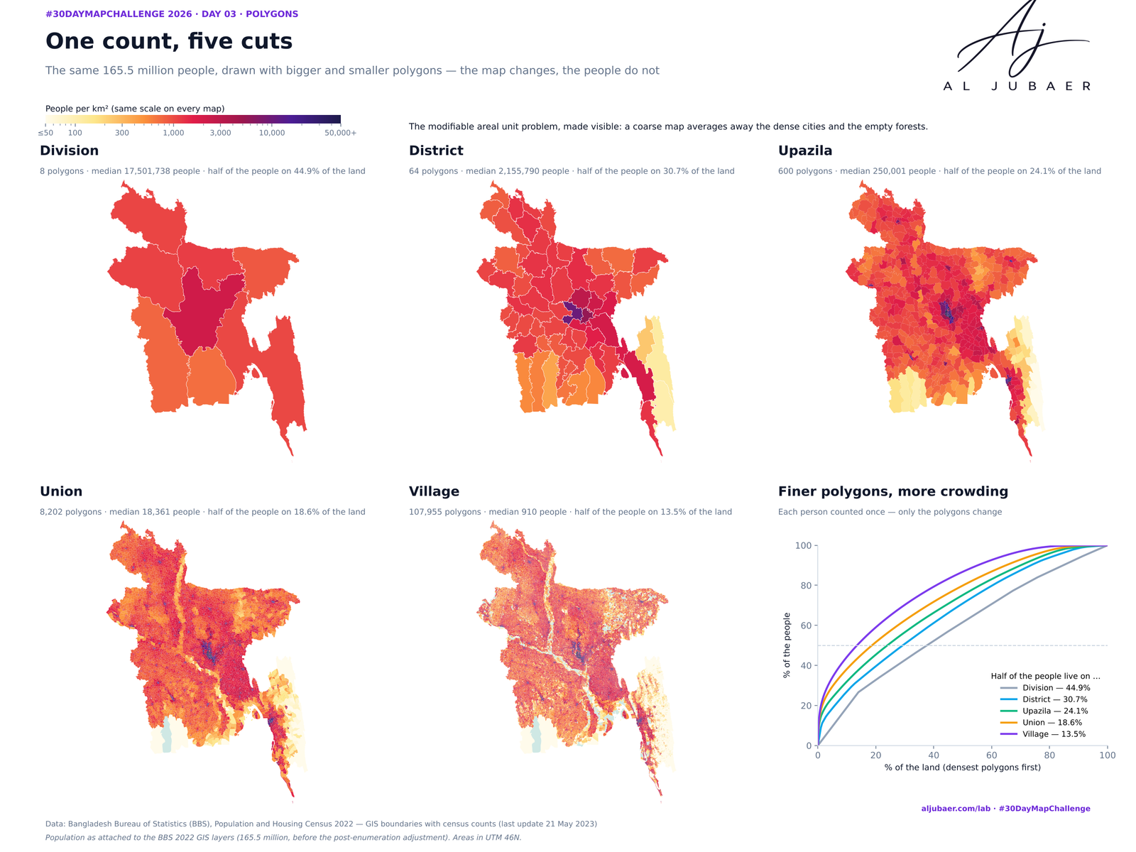
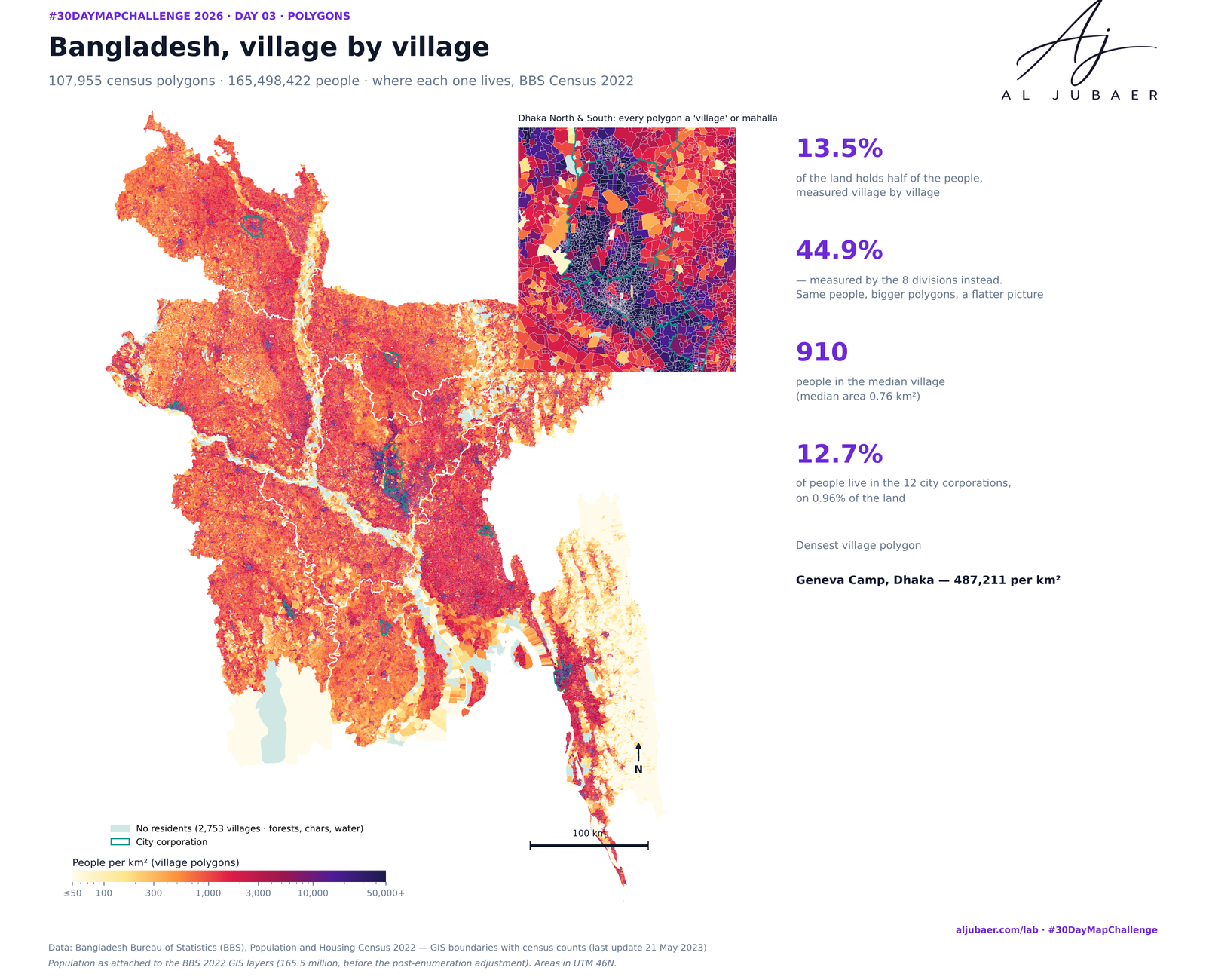
The same 165.5 million people, drawn with 8, 64, 600, 8,202 and 107,955 polygons. By division, half of Bangladesh lives on 44.9% of the land; village by village it is 13.5%. Behind the count: the 2022 census enumerated 106.8% of the households its quick count had listed, 2,753 villages have nobody living in them, and 12 city corporations hold 12.7% of the people on 0.96% of the land.



Write-up
The question
How does the picture of where Bangladesh's people live change as the same census is cut into smaller and smaller polygons — and what happened behind the count?
Methods
- BBS Population and Housing Census 2022 GIS layers (last update 21 May 2023): 8 divisions, 64 districts, 600 upazilas/thanas, 8,202 unions and city/municipal wards, 107,955 villages/mahallas, 12 city corporations and 328 municipalities, each with population, sex, household size, people abroad (NRB) and census household counts.
- Areas computed in WGS 84 / UTM zone 46N (EPSG:32646); density = people per km² of each polygon.
- The ladder: at each level, polygons are ranked from densest to emptiest and the share of land that holds half of the people is read off the cumulative curve — the modifiable areal unit problem in one number.
- Village check: villages were summed by union. In 81 unions (mostly city-corporation wards) several village polygons repeat the ward's population (3,403,360 people too many); there, villages were scaled to the union total, so the villages add up to exactly 165,498,422.
- Behind the count: households enumerated ÷ households in the pre-census quick count (BBS 'completion'), people abroad per 1,000 residents, and household size — mapped by union; unions with fewer than 200 households (forests, chars) are greyed out.
- Urban: city corporations and municipalities taken from their own BBS polygons; villages carry the BBS rural/urban (RMO) code.
- Maps and charts in Python (GeoPandas, Matplotlib). Web map: TopoJSON (simplified, quantized; 107,955 villages split into 600 upazila files of ~80 kB loaded on demand) in Leaflet on open basemaps.
Findings
Same people, five cuts: half of Bangladesh lives on 44.9% of the land by division, 30.7% by district, 24.1% by upazila, 18.6% by union and 13.5% by village.
The median village has 910 people on 0.76 km²; the densest village polygon, Geneva Camp in Dhaka, packs about 487,211 people per km².
2,753 village polygons have no residents — 6,397 km² (4.4% of the land): the Sundarbans, river chars, reserved forests and water.
12 city corporations hold 21,078,551 people (12.7%) on 0.96% of the land; 328 municipalities hold 17,913,989 more (10.8%). Dhaka South is the densest at 43,322 people per km².
Behind the count: enumerators interviewed 41,068,281 households, 106.8% of the 38,453,495 in the pre-census quick count — highest in Chattogram division (110.2%), lowest in Mymensingh (102.8%); 1,038 unions were above 120%.
5,077,160 Bangladeshis were counted as living abroad (30.7 per 1,000 residents): 61.5 per 1,000 in Chattogram and 52.0 in Sylhet, but 6.6 in Rangpur; Titas (Cumilla) tops the upazilas at 128.3.
Data note: summing the villages as published gives 168,901,782 people, 3,403,360 more than the union totals, because 81 city wards repeat their population on several village polygons.
More from the Open Lab
 Web map & dashboard
Day 5 · Senses: Sight — Out of sight: how far Bangladesh lives from an eye hospital
 Map
Day 1 · Points — Where Bangladesh's health care is mapped
 Web map & dashboard
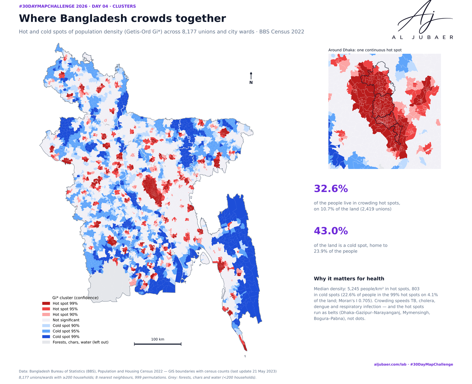
Day 4 · Clusters — Where Bangladesh gathers: crowding, leaving and the missing men
 Map
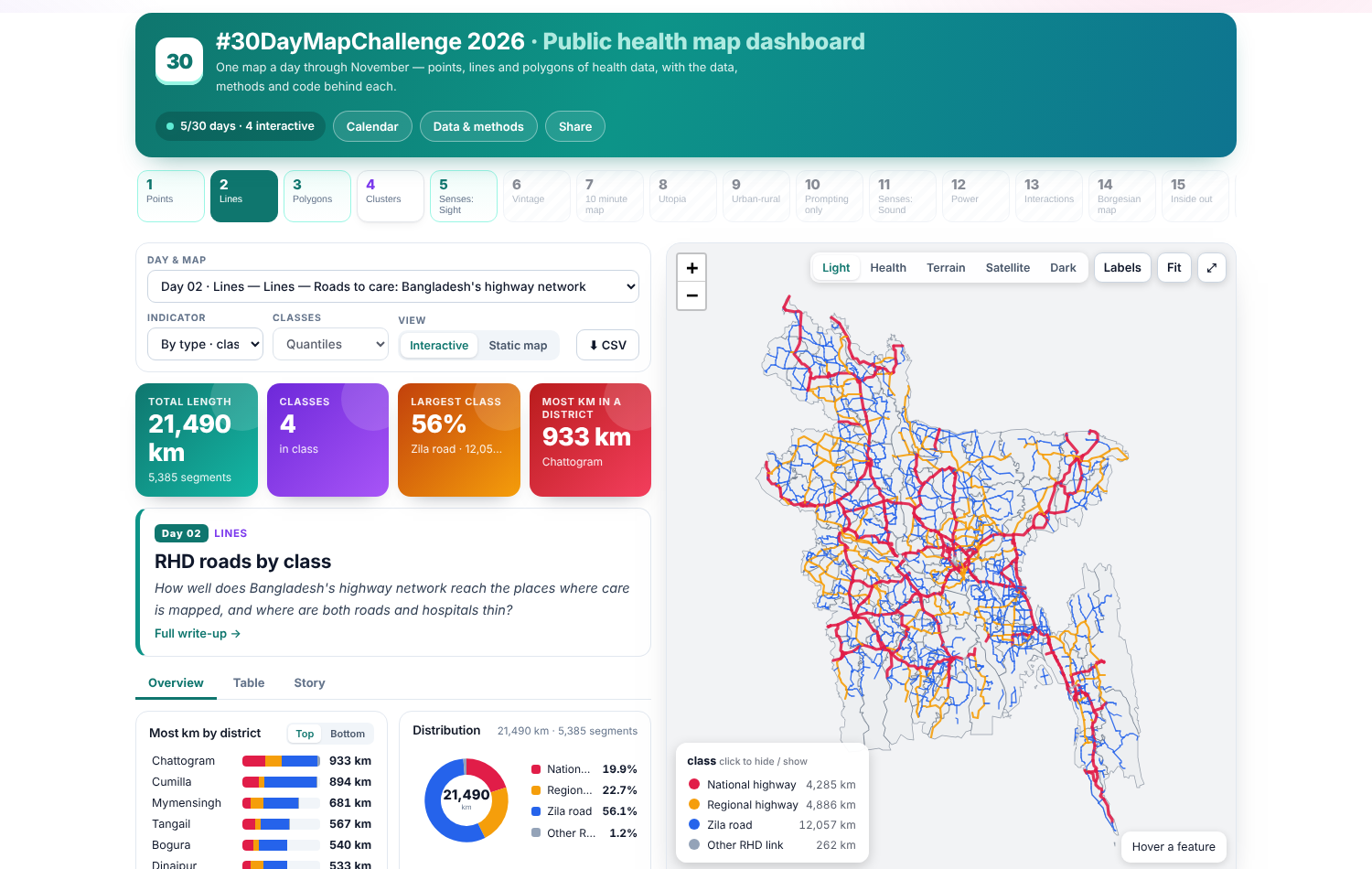
Day 2 · Lines — Roads to care: Bangladesh's highway network