Day 5 · Senses: Sight — Out of sight: how far Bangladesh lives from an eye hospital


Write-up
The question
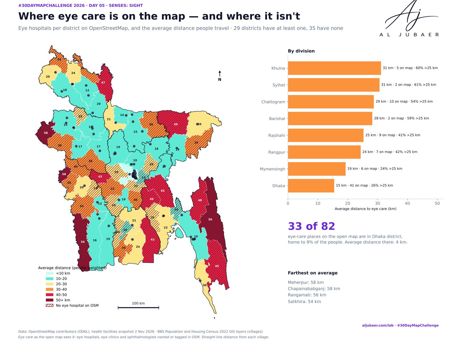
How far does each village in Bangladesh live from eye care — and how much of Bangladesh's eye care can the open map actually see?
Data
OpenStreetMap contributors, health facilities for Bangladesh (oex export, snapshot 2 Nov 2026), ODbL. BBS Population and Housing Census 2022 GIS layers (villages), last update 21 May 2023. Eye care is what OpenStreetMap shows: hospitals with eye departments that are not tagged are missing, so real distances are shorter in places. Straight-line distance, not travel time. Context: Dineen et al. 2003 (Br J Ophthalmol, PMC1771736); Nationwide Blindness Survey 2020 (The Daily Star).
Methods
- Eye care: OpenStreetMap health facilities for Bangladesh (oex export, snapshot 2 Nov 2026, 8,230 points, ODbL — the Day 1 file). Kept: points whose name in English or Bangla (eye, চক্ষু, chokkhu, ophthalmology, phaco, retina, glaucoma) or healthcare:speciality=ophthalmology mark an eye hospital, eye clinic or eye doctor. Left out: optical shops, pharmacies, gates and points across the border. Points within 300 m of each other are counted once: 82 places.
- People: BBS Population and Housing Census 2022 GIS layers — 105,202 villages with residents (double counting corrected as on Day 3), 165,498,422 people.
- Distance: straight line from each village's inside point to the nearest eye-care place, in WGS 84 / UTM 46N (k-d tree). Road distance and travel time are longer, especially across rivers and in the hills.
- Summaries: people within 5, 10, 25 and 50 km; people-weighted average and median distance by union, district and division; people per eye-care place; districts with none on the map.
- The map's own eyesight: share of OSM health points with a name and with a healthcare:speciality tag.
- Context: National Blindness and Low Vision Survey 1999–2000 (Dineen et al., Br J Ophthalmol 2003) and the Nationwide Blindness Survey 2020 (CIPRB / National Eye Care).
- Python: GeoPandas, SciPy, Matplotlib. Web map: TopoJSON in Leaflet on open basemaps.
Findings
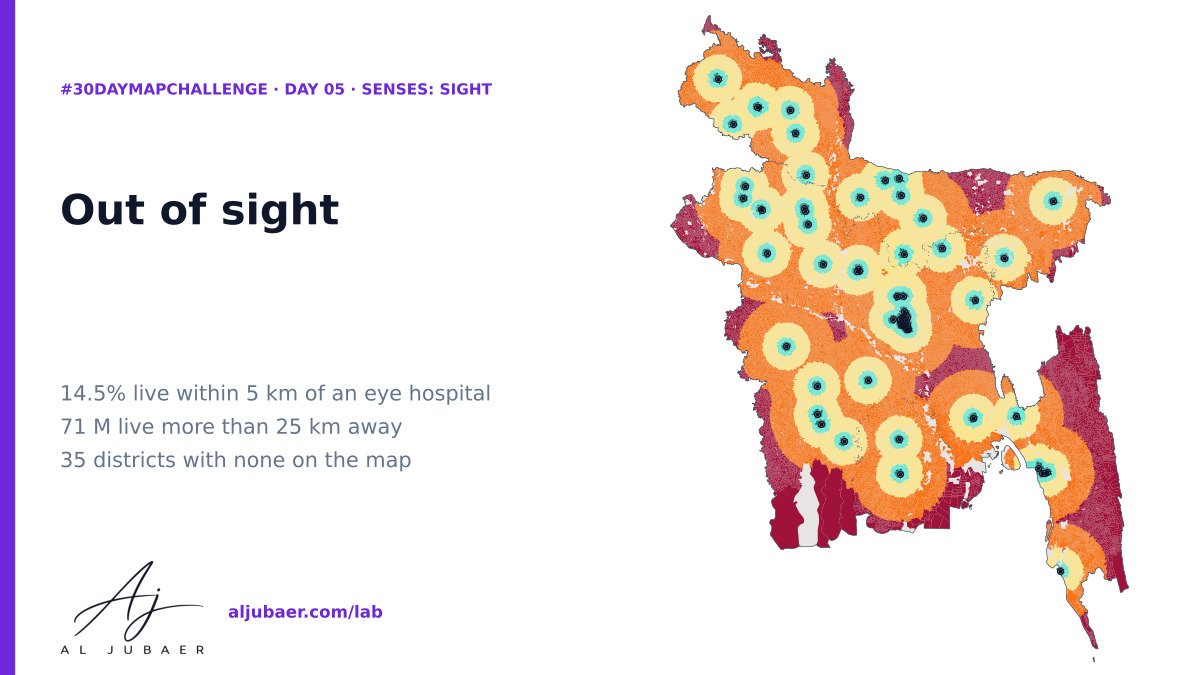
1. Only 14.5% of Bangladeshis (24.1 million) live within 5 km of an eye hospital the open map can see; 23.9% within 10 km, 57.3% within 25 km and 91.4% within 50 km.
2. 70.7 million people live more than 25 km away and 14.3 million more than 50 km. Half of the country lives more than 22 km from eye care on the map (median; average 24 km).
3. 33 of the 82 eye-care places on the map are in Dhaka district, where the average distance is 4 km. 35 of 64 districts — 65.9 million people — have none on OpenStreetMap.
4. By division, Dhaka is closest (average 16 km) and Khulna farthest (31 km, 60% of people more than 25 km away), with Sylhet (31 km) close behind. The farthest districts on average: Meherpur and Chapainababganj (58 km), Rangamati (56 km), Satkhira (54 km).
5. The farthest village is Natunjoipuipara in Sajek union (Baghaichhari, Rangamati): 116 km in a straight line from the nearest eye hospital on the map.
6. The map's own eyesight: 94.3% of OSM's 8,230 health points have a name, but only 2.7% say what they treat and 9 are tagged ophthalmology. District hospitals and medical colleges with eye departments appear as plain 'hospital', so part of this gap is a gap in the open map.
7. Why it matters: cataract causes about four in five cases of blindness in Bangladesh and is cured by one operation; surgical coverage has been lowest among rural, older, female and poorer people. Mapping eye services openly and accurately is a cheap first step.
 Map
 Web map & dashboard
 Web map & dashboard
 Map