Map
Day 2 · Lines © All rights reserved 2 November 2026
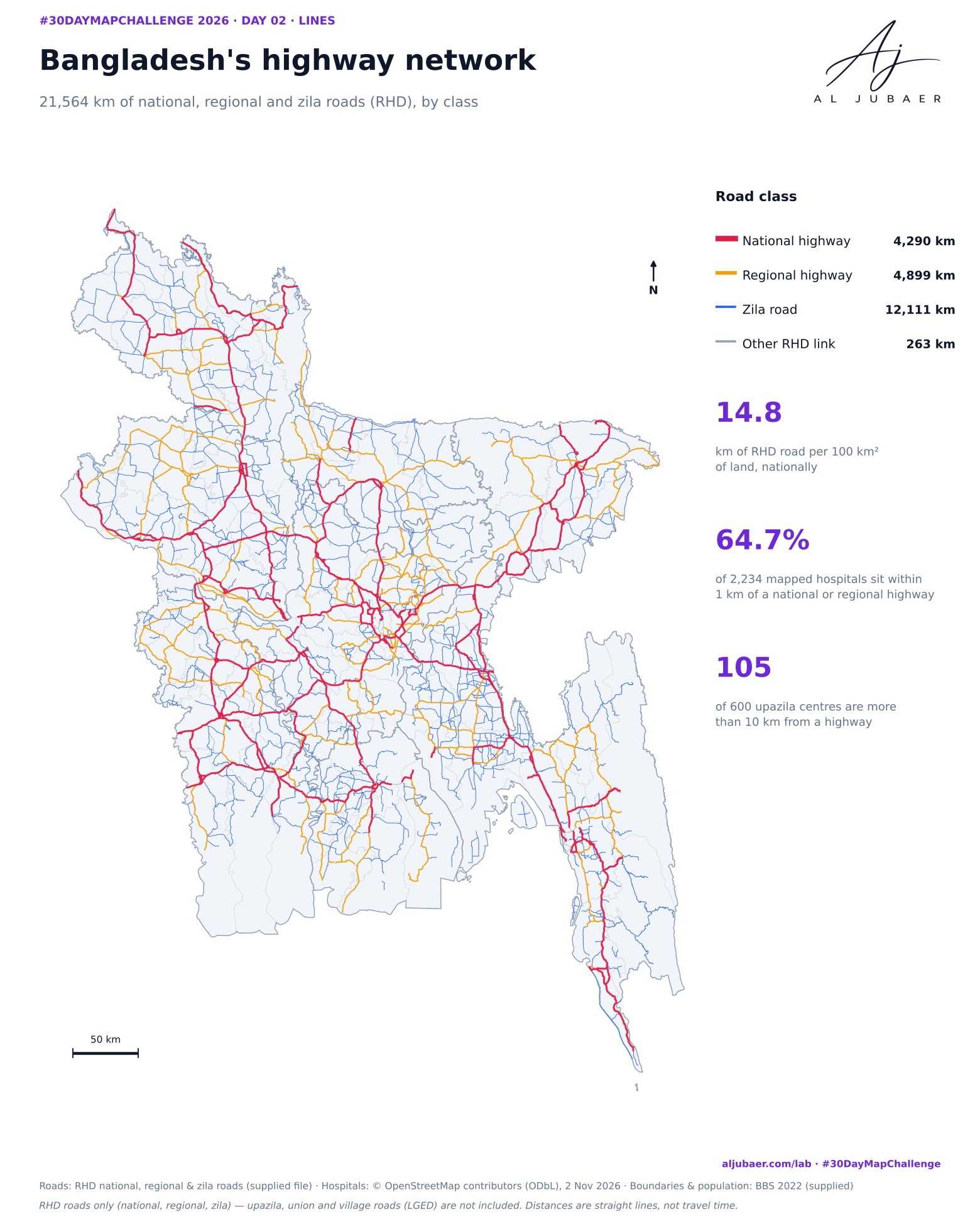
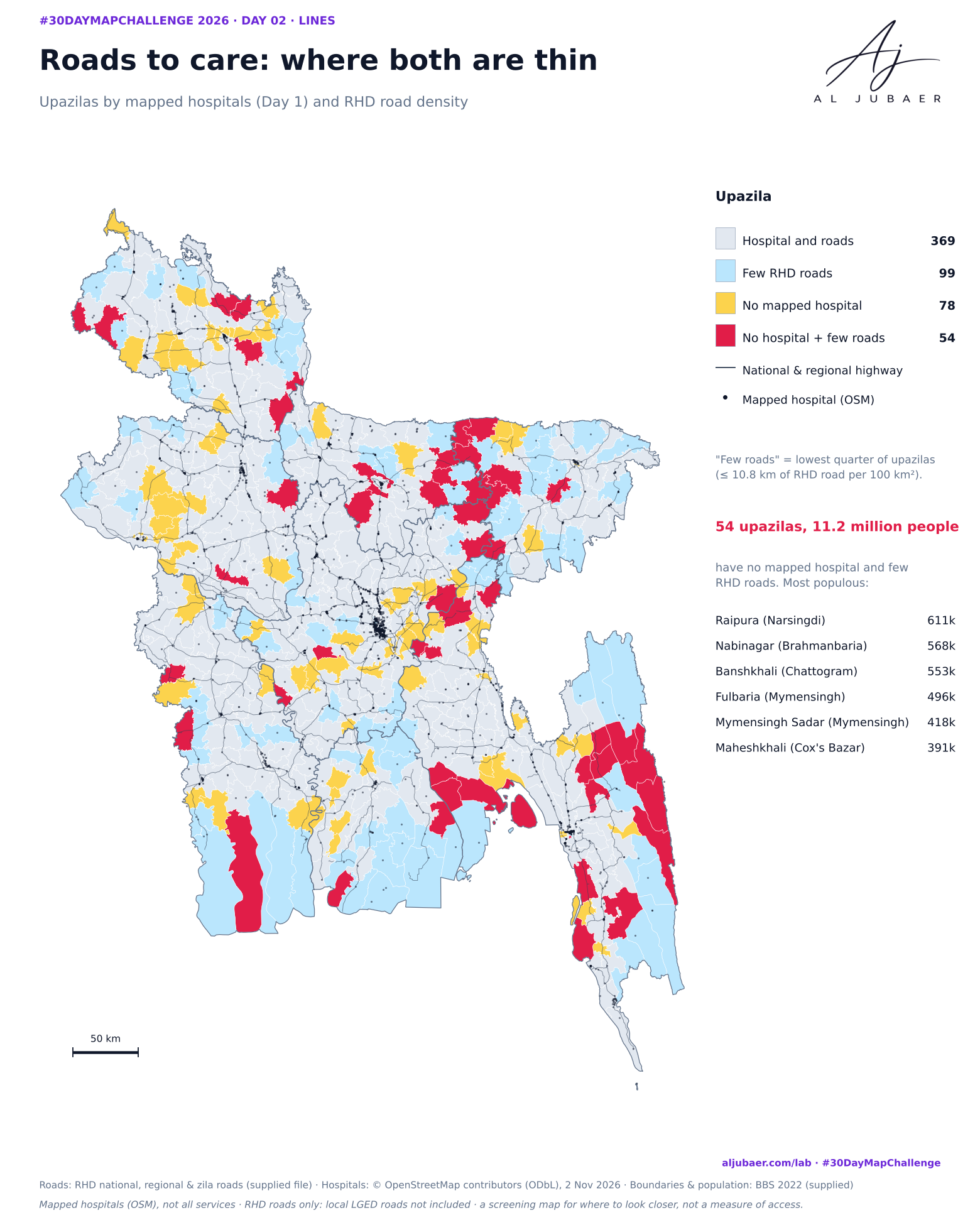
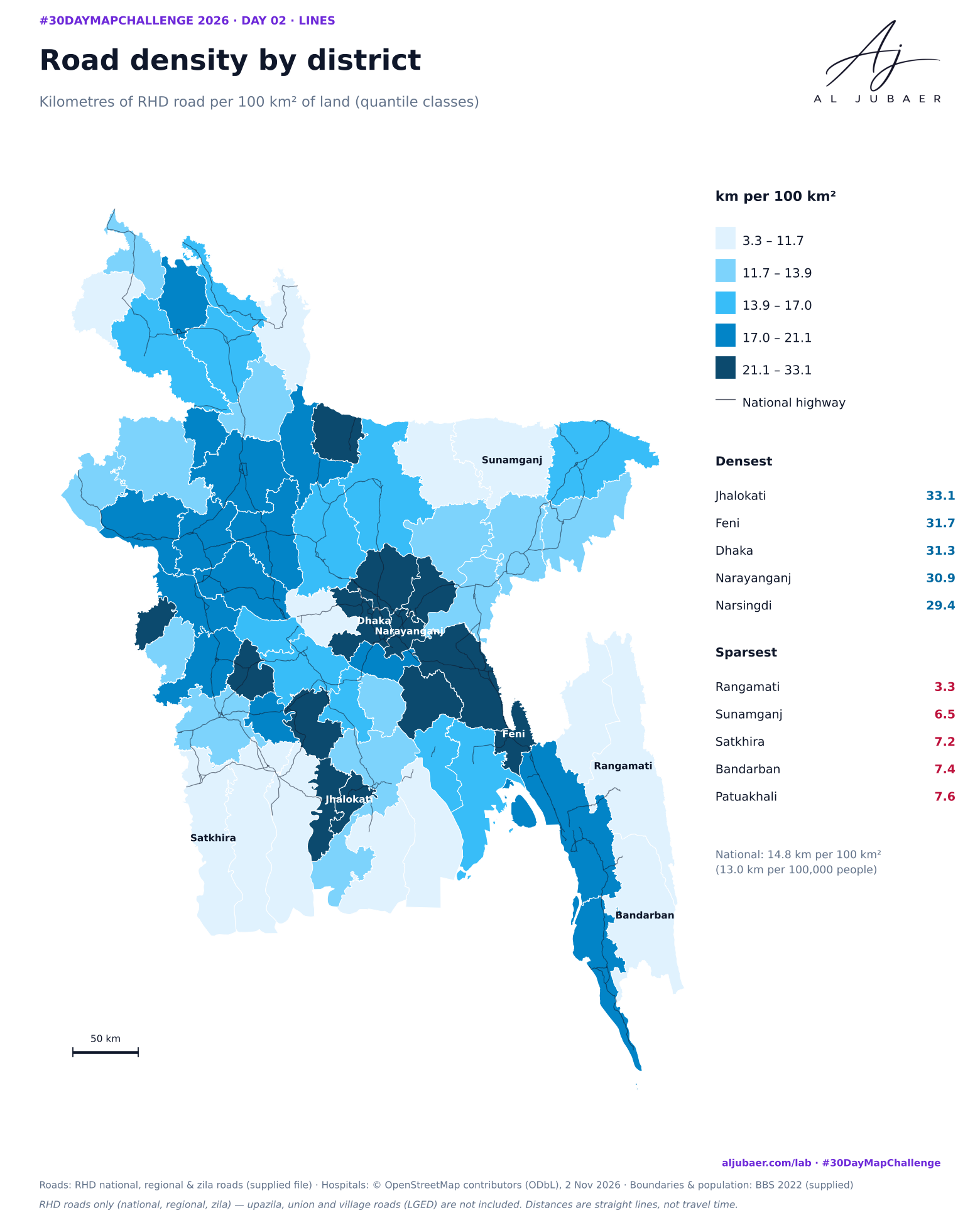
Day 2 · Lines — Roads to care: Bangladesh's highway network
21,564 km of national, regional and zila roads from the Roads and Highways Department, mapped by class and measured against the 2,234 hospitals mapped in OpenStreetMap (Day 1). Most mapped hospitals sit right on the highway network, but 54 upazilas, home to 11.2 million people, have both few RHD roads and no mapped hospital.
More from the Open Lab
 Web map & dashboard
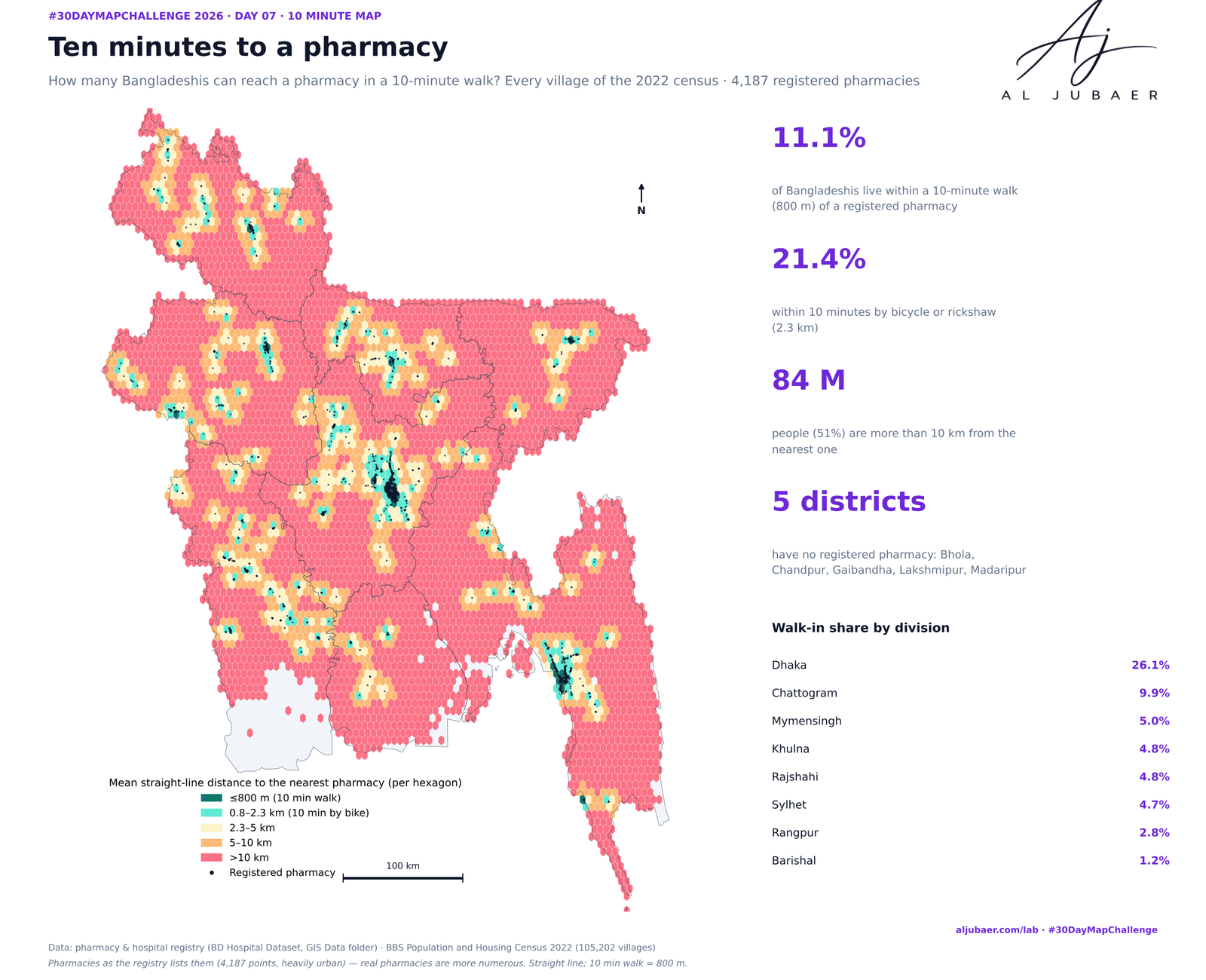
Day 7 · 10 minute map — Ten minutes to a pharmacy: who can walk to medicine?
 Web map & dashboard
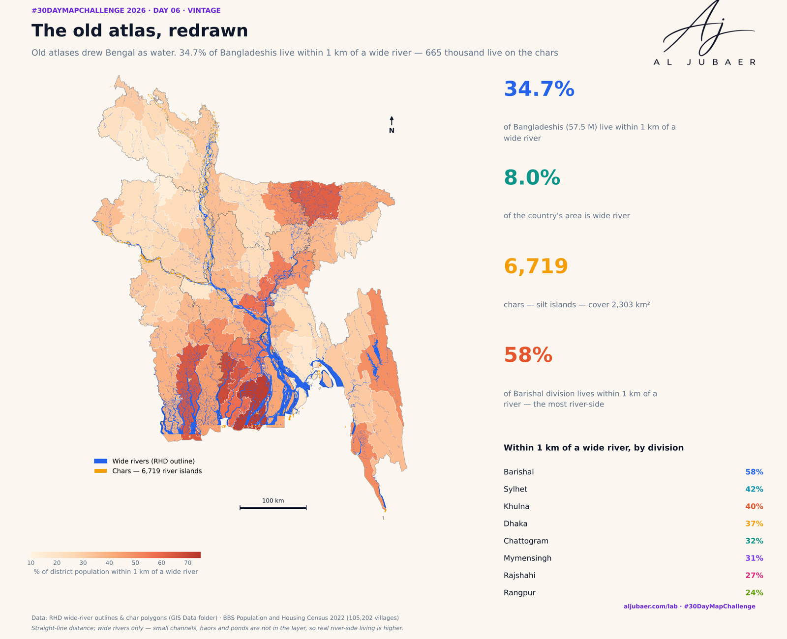
Day 6 · Vintage — The old atlas, redrawn: who lives by Bangladesh's rivers and chars
 Web map & dashboard
Day 5 · Senses: Sight — Out of sight: how far Bangladesh lives from an eye hospital
 Map
Day 1 · Points — Where Bangladesh's health care is mapped