Day 6 · Vintage — The old atlas, redrawn: who lives by Bangladesh's rivers and chars
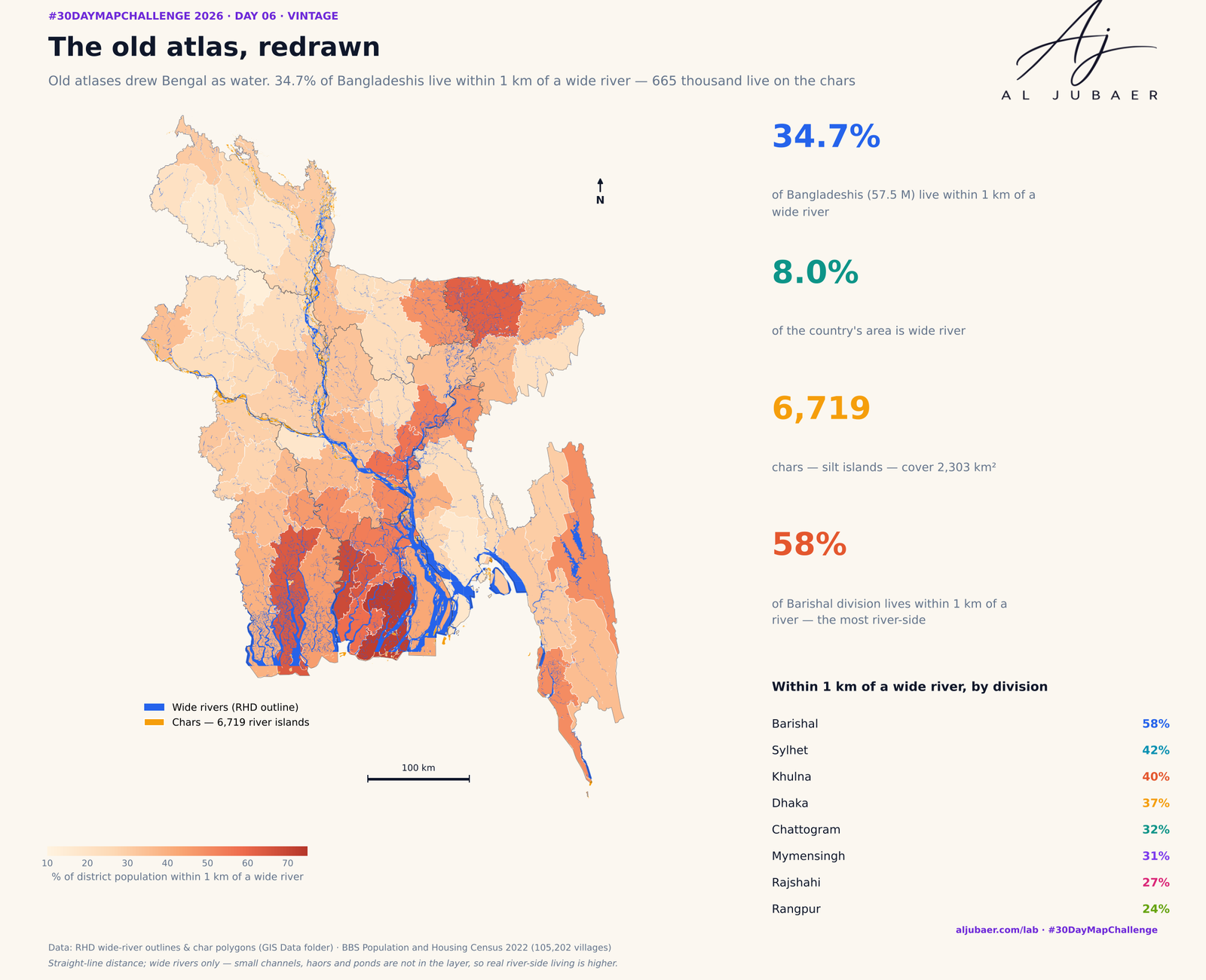
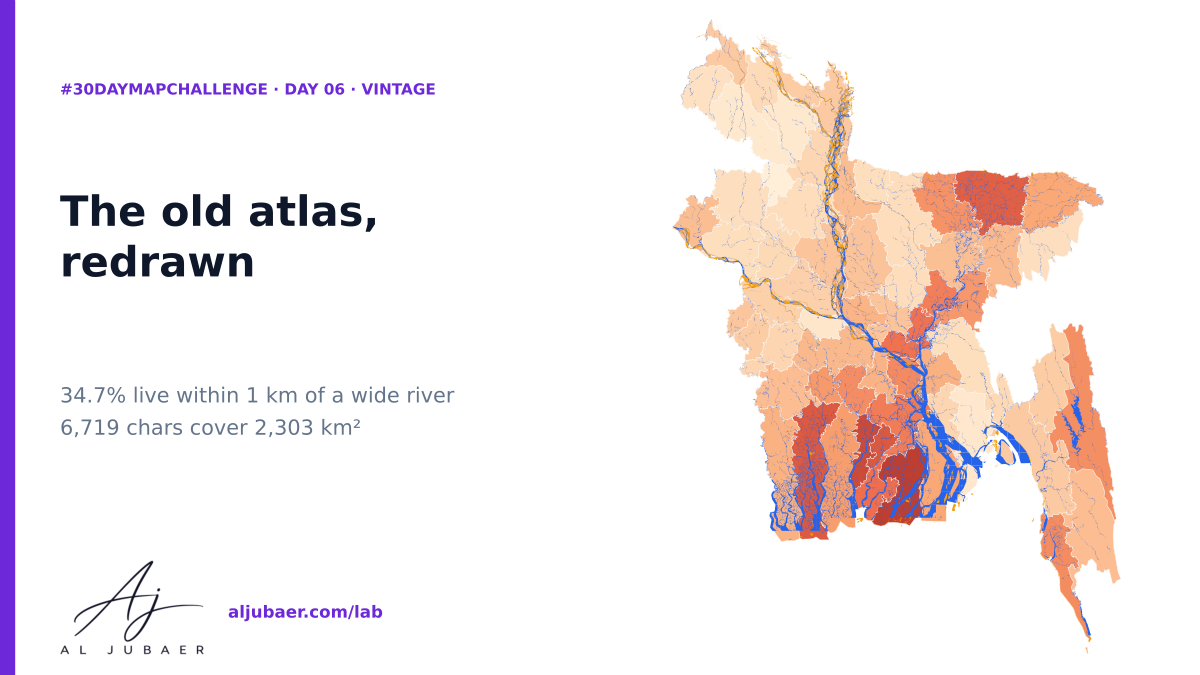
Old atlases drew Bengal as water. Redrawn with open data: the RHD wide-river outlines cover 8.0% of Bangladesh and 34.7% of Bangladeshis (57.5 million) live within 1 km of one — 58% in Barishal division. The 6,719 chars (silt islands) cover 2,303 km² and 665 thousand people live in villages centred on one. Drawn clean, minimal and colourful — the old atlas, redrawn.
Write-up
The question
Where does Bangladesh live in relation to its big rivers — and how many people live on the chars, the islands the rivers keep making and taking?
Data
RHD wide-river outlines and char polygons (GIS Data folder, from the RHD GIS shapefiles). BBS Population and Housing Census 2022 GIS layers (villages). The river layer has wide rivers only; small channels, haors and ponds are missing, so distances are upper bounds for river-side living. Chars change every monsoon; the polygons are one snapshot. Straight-line distance.
Methods
- 7% of Bangladeshis (57.5 million) live within 1 km of a wide river, 18.9% within 500 m and 86.8% within 5 km. Half the country lives within 1.7 km of one.
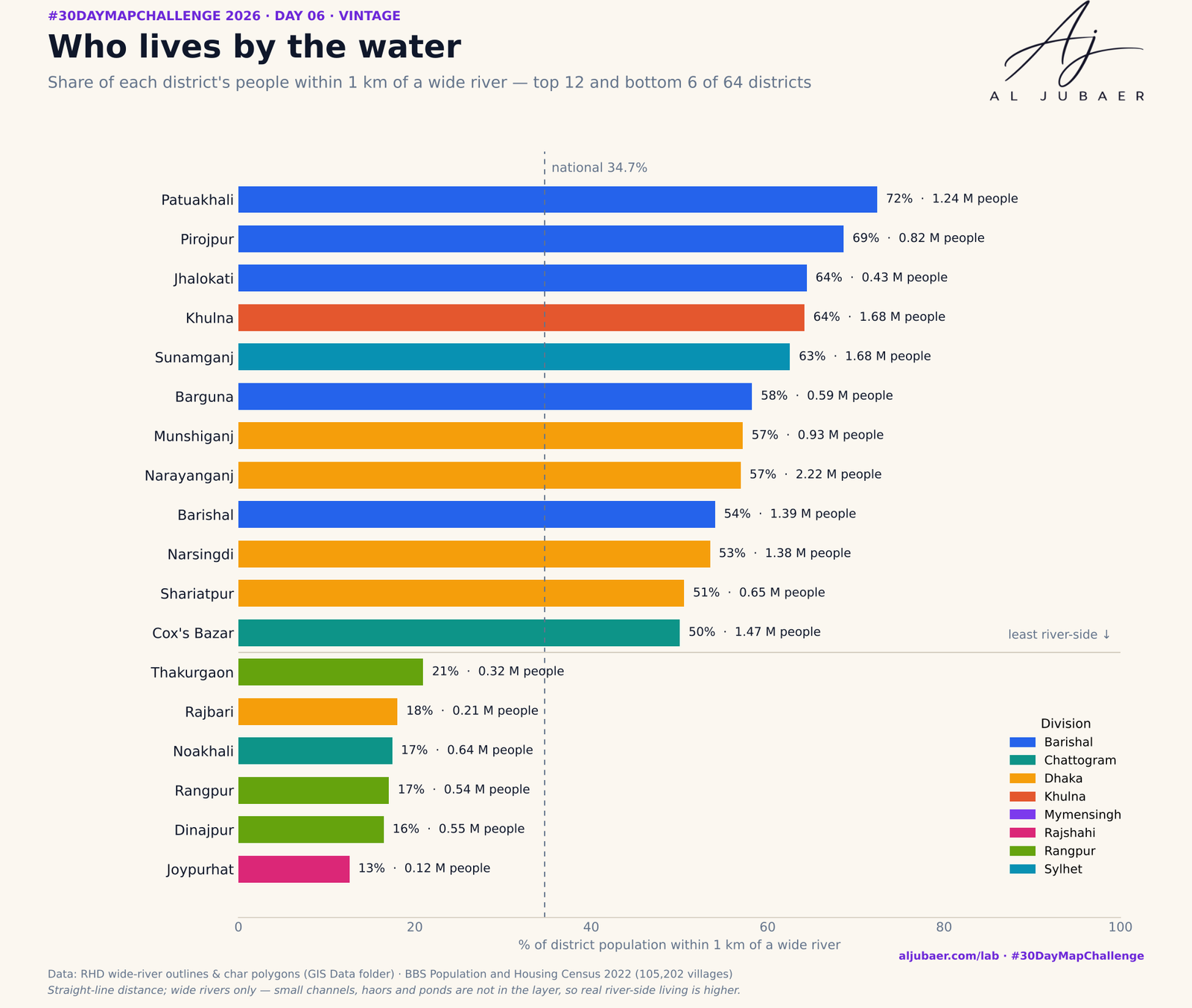
- Wide rivers cover 8.0% of Bangladesh (11,635 km² of 145,868). Barishal division is the most river-side: 58% of people within 1 km; Rangpur the least (24%).
- The most river-side districts: Patuakhali (72%), Pirojpur (69%), Jhalokati (64%), Khulna (64%) and Sunamganj (62%). The farthest from a wide river: Joypurhat (average 5.7 km).
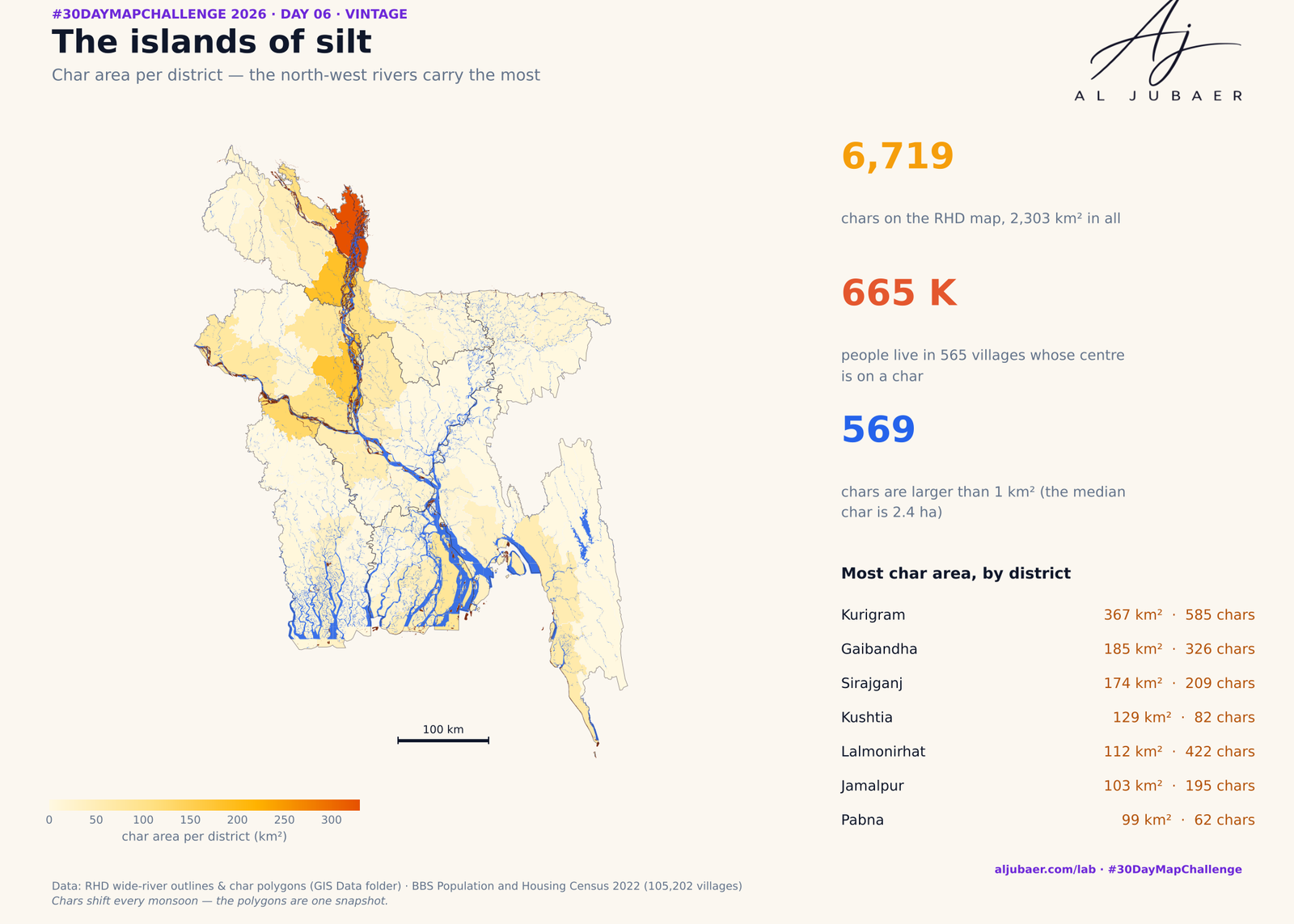
- 6,719 chars cover 2,303 km²; the median char is only 2.4 ha, but 569 are larger than 1 km² and 19 larger than 10 km². The largest (30 km²) is in Kushtia.
- Char area is concentrated in the north-west: Kurigram (367 km²), Gaibandha (185 km²) and Lalmonirhat (112 km²).
- 665 thousand people live in 565 villages whose centre lies on a char — and 6.5% of Bangladeshis (10.8 million) live within 1 km of one. Census villages on moving islands are the hardest to count and to serve.
- Why it matters: river-side and char households face erosion, floods and the longest routes to services; the map shows where that exposure is concentrated.
Findings
Title: Districts: share of people within 1 km of a wide river (%)
Value field: pct_within_1km
Label field: district
Group field: division
Unit: %
Palette: blue
Higher means: more / worse
Popup fields: district, division, population, pct_within_1km, mean_river_km, chars, char_km2, river_pct_of_area
Note: Straight-line distance from each village to the nearest RHD wide river, people-weighted · BBS Census 2022
More from the Open Lab
 Web map & dashboard
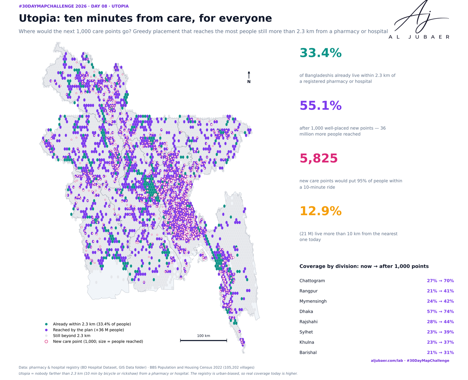
Day 8 · Utopia — Ten minutes from care, for everyone: where the next care points should go
 Web map & dashboard
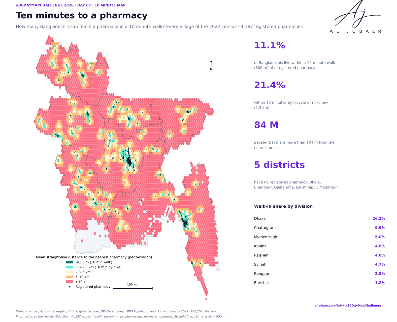
Day 7 · 10 minute map — Ten minutes to a pharmacy: who can walk to medicine?
 Web map & dashboard
Day 5 · Senses: Sight — Out of sight: how far Bangladesh lives from an eye hospital
 Map
Day 1 · Points — Where Bangladesh's health care is mapped