Day 7 · 10 minute map — Ten minutes to a pharmacy: who can walk to medicine?
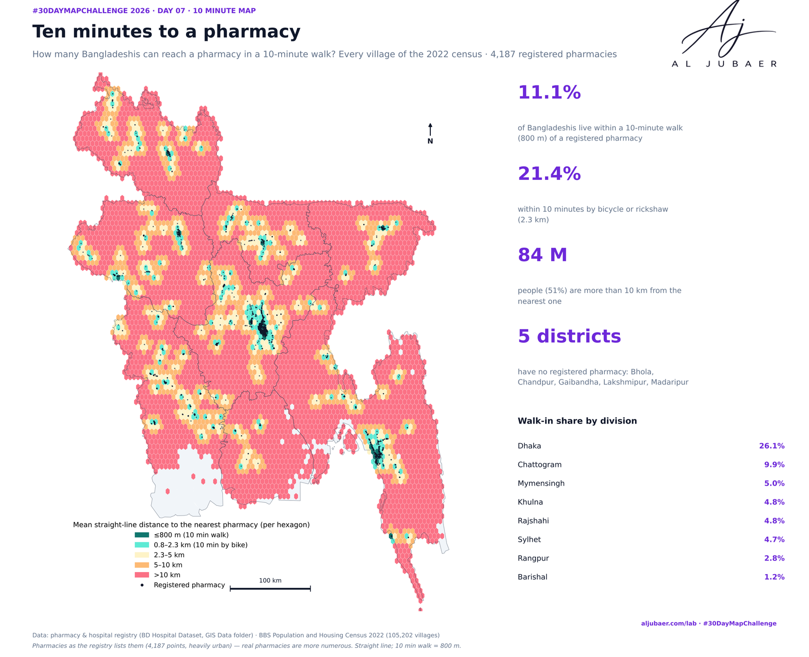
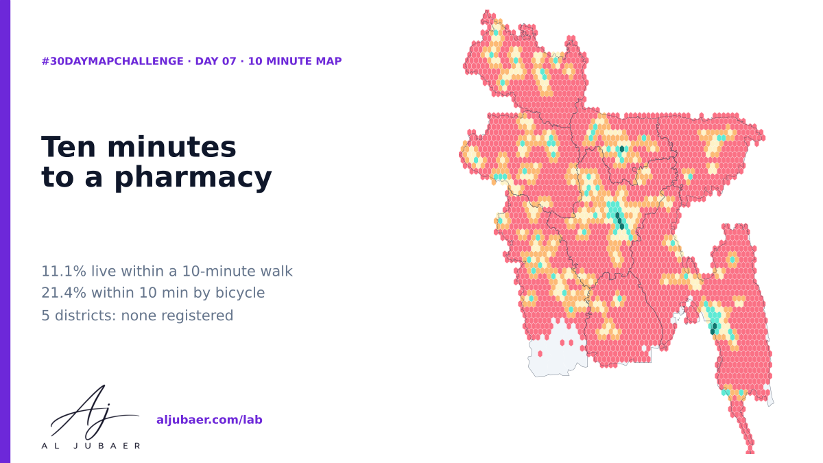
A 10-minute walk is 800 m. Measured from every one of 105,202 populated villages to the 4,187 pharmacies in the national hospital-and-pharmacy registry, only 11.1% of Bangladeshis (18.4 million) live within a 10-minute walk and 21.4% within 10 minutes by bicycle or rickshaw; 84 million are more than 10 km away. 5 districts have no registered pharmacy at all — a gap in the registry as much as in care.
Write-up
The question
How many Bangladeshis can walk to a pharmacy in ten minutes — and how much of Bangladesh's pharmacy network does the registry actually record?
Data
Pharmacy and hospital registry points from the BD Hospital Dataset (GIS Data folder, hospital/pharmacy CSV converted to GeoJSON). BBS Population and Housing Census 2022 GIS layers (villages). The registry is incomplete and urban-biased: unlisted pharmacies are missing, so real distances are shorter in places. Straight-line distance, not travel time; 800 m = 10 minutes at 4.8 km/h.
Methods
- Pharmacies: pharmacies.geojson (4,255 points) and hospitals.geojson (6,619 points) from the BD Hospital Dataset in the GIS Data folder; exact duplicates (same spot, 2 m) merged: 4,187 pharmacies, 5,556 hospitals.
- People: BBS Population and Housing Census 2022 — 105,202 villages with residents (Day 5 village table), 165,498,425 people; each village is its inside point.
- The 10-minute rule: 10 minutes on foot = 800 m (4.8 km/h); 10 minutes by bicycle or rickshaw = 2.3 km (14 km/h). Straight-line distance in WGS 84 / UTM 46N (k-d tree); road distance and travel time are longer.
- Summaries: people within 800 m, 2.3 km, 5 km and 10 km of a pharmacy; by union, district and division; pharmacies per 100,000 people; districts with none.
- Honest limit: the registry is heavily urban (Dhaka district alone has about half of all points), so rural distances here are upper bounds. Python: GeoPandas, SciPy, Matplotlib. Web map: TopoJSON in Leaflet.
Findings
Only 11.1% of Bangladeshis (18.4 million) live within a 10-minute walk (800 m) of a registered pharmacy; 21.4% within 10 minutes by bicycle or rickshaw (2.3 km), 32.1% within 5 km and 49.3% within 10 km.
84 million people (51%) are more than 10 km from the nearest pharmacy in the registry; the median is 10 km and the average 13 km.
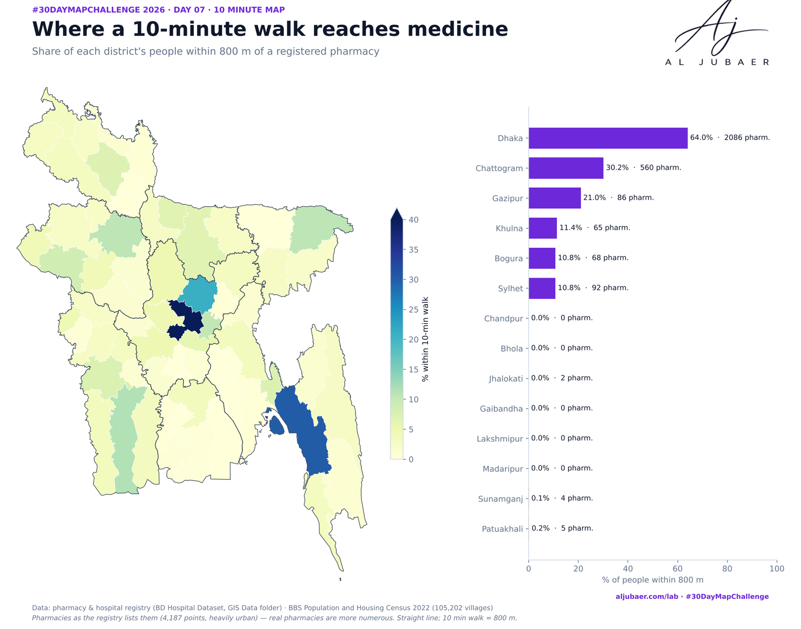
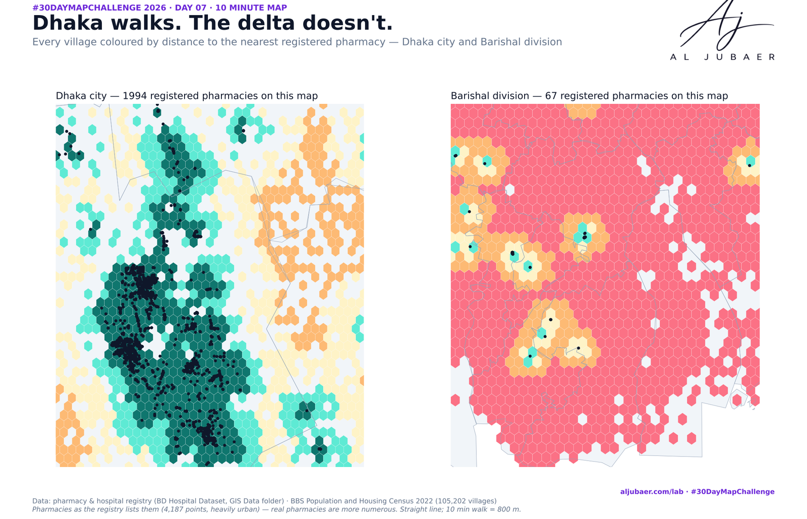
Dhaka is the only division where walking works: 26% within 800 m (Dhaka district 64%), against 10% in Chattogram and 1.2% in Barishal.
5 districts — Bhola, Chandpur, Gaibandha, Lakshmipur, Madaripur; 10.5 million people — have no registered pharmacy; another Jhalokati, Sunamganj, Patuakhali have almost none (under 0.5 per 100,000 people).
The farthest village is Dakkhinpara in Saint Martin (Cox's Bazar): 92 km in a straight line (an island: Saint Martin).
Hospitals are not closer: only 15.3% live within 800 m of a hospital in the registry and 32.3% within 2.3 km; 16.2% within 800 m of either.
The registry itself: 4,187 pharmacies for 165 million people is one per 39,526 people — real coverage is far denser, so part of this gap is a gap in the data. Better pharmacy mapping is a cheap first step.
More from the Open Lab
 Web map & dashboard
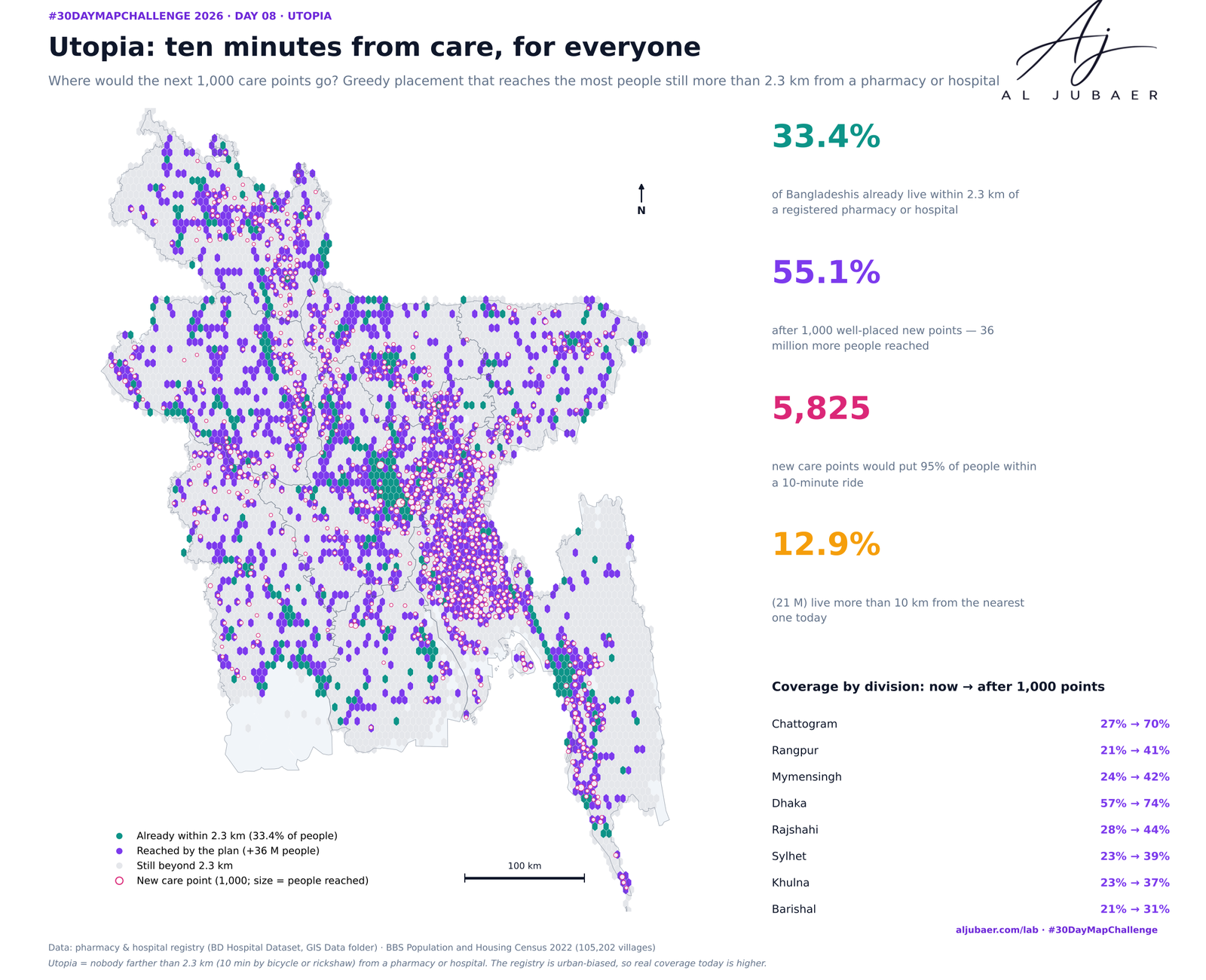
Day 8 · Utopia — Ten minutes from care, for everyone: where the next care points should go
 Web map & dashboard
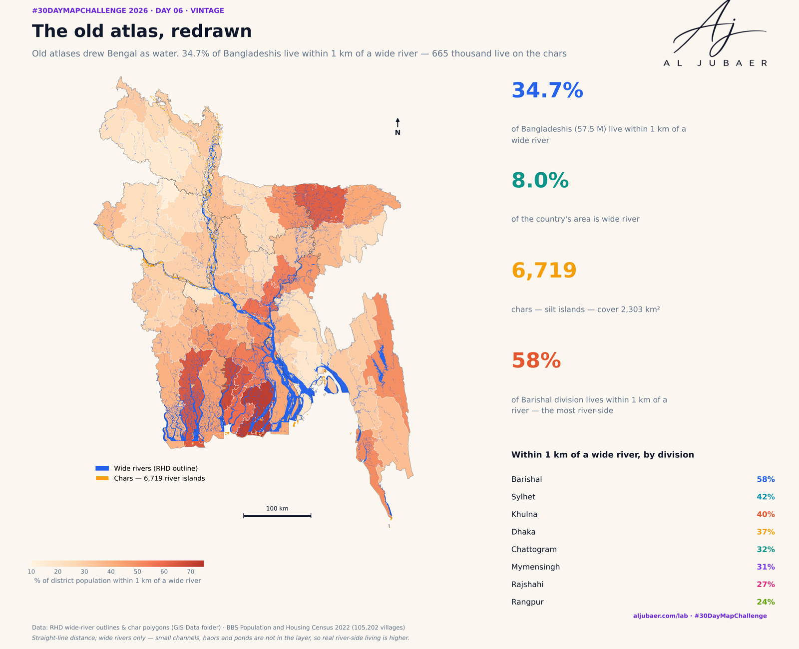
Day 6 · Vintage — The old atlas, redrawn: who lives by Bangladesh's rivers and chars
 Web map & dashboard
Day 5 · Senses: Sight — Out of sight: how far Bangladesh lives from an eye hospital
 Map
Day 1 · Points — Where Bangladesh's health care is mapped