← ALL WORK
UNDP project maps
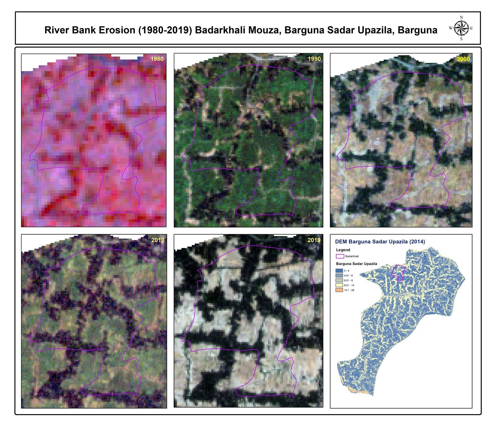
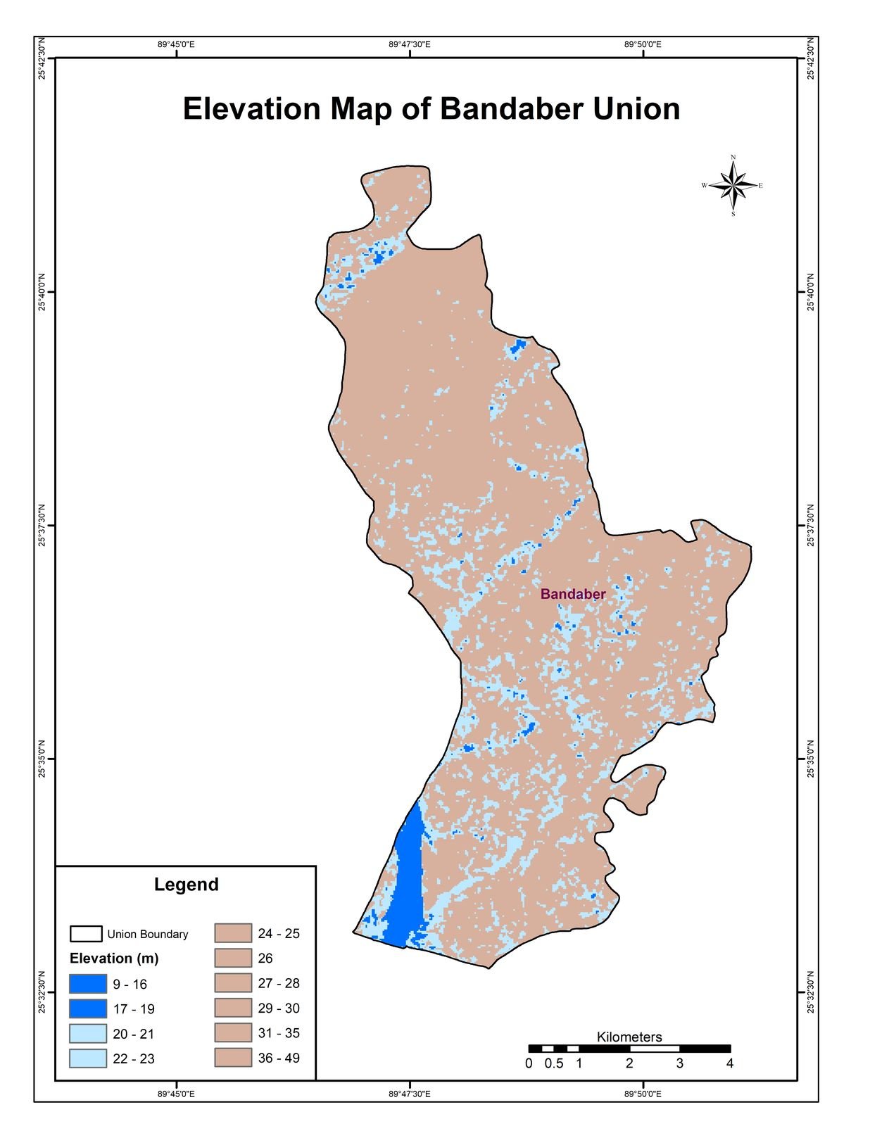
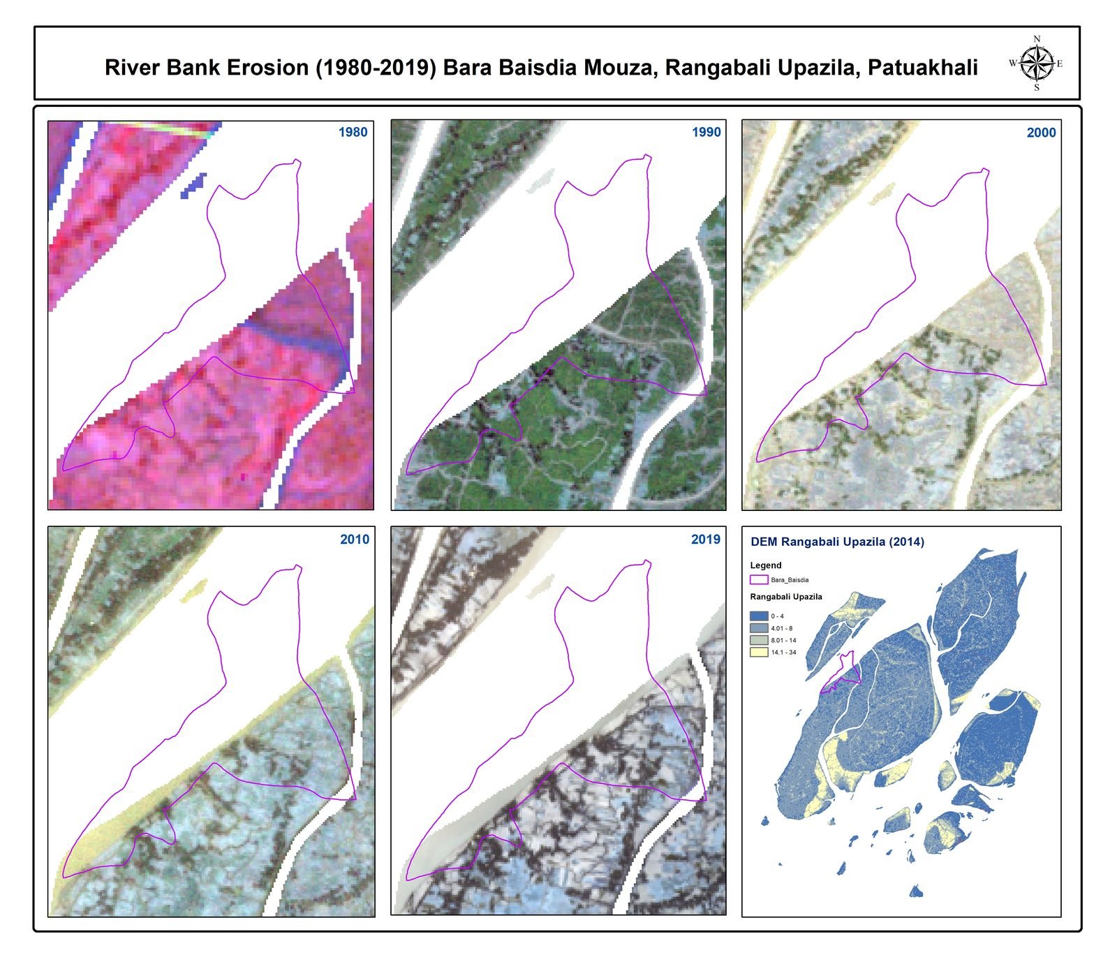
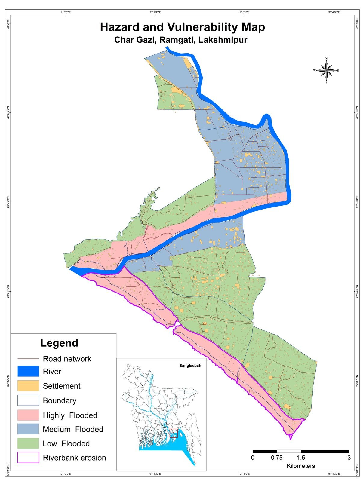
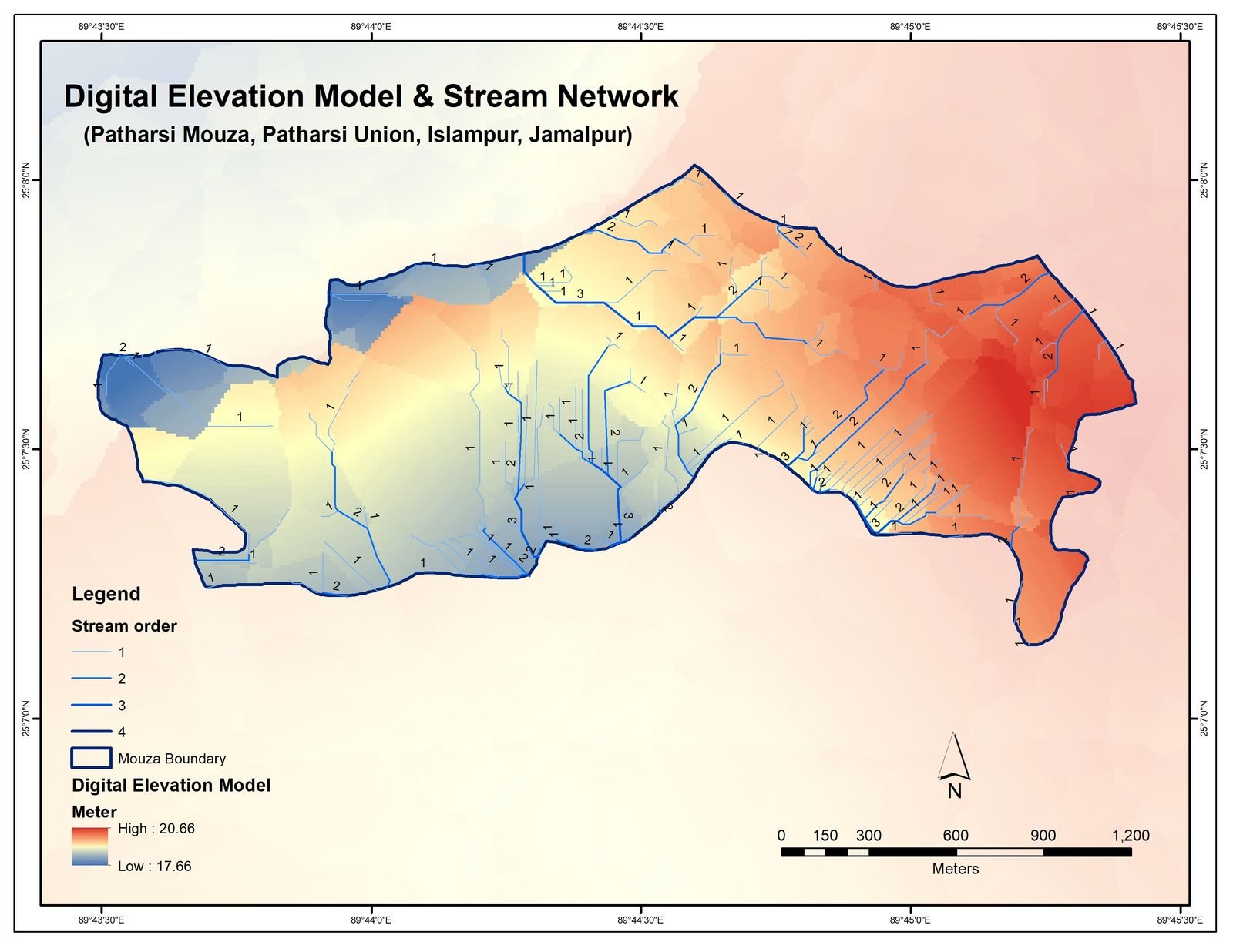
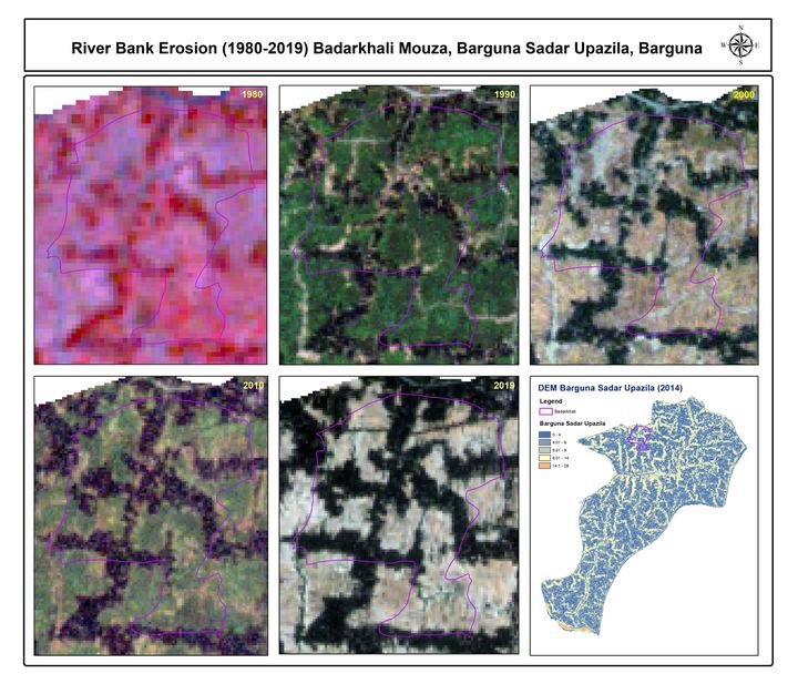
River-bank erosion (1980–2019), base, elevation and stream-network maps for coastal mouzas such as Badarkhali (Barguna), Bara Baisdia, Char Gazi and Patharsi, made for a UNDP project.
Year2020
Client / contextUNDP Bangladesh
Study areaCoastal mouzas (Barguna and nearby), Bangladesh
CategoryMap & Atlas Design
The full case study (problem, approach, result) is being written. Add it in Admin → Projects → Features.