Day 16 · Collaborative map — Two maps of one health system
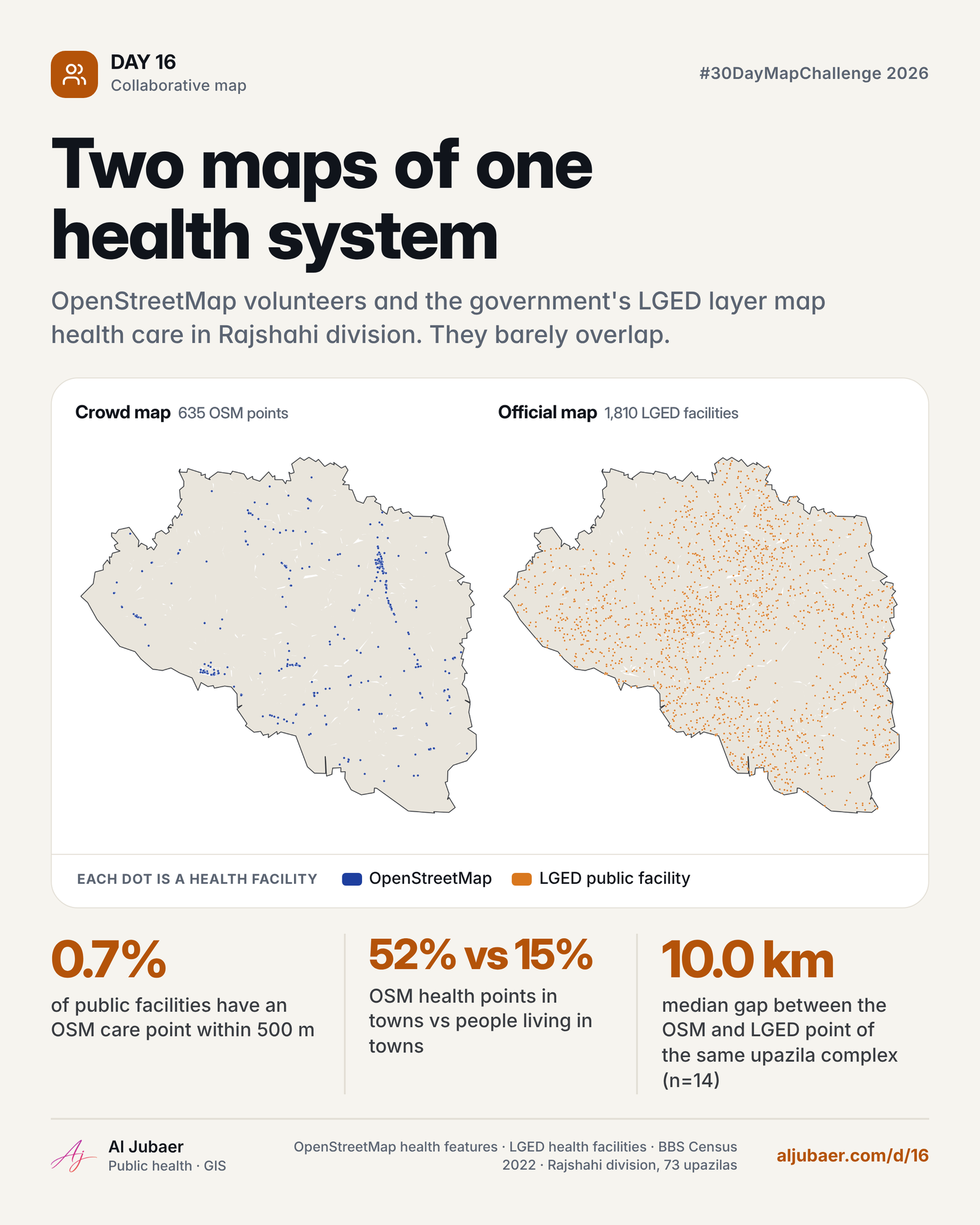
Rajshahi division has 635 health points on OpenStreetMap and 1,810 public facilities in the LGED layer. Only 0.7% of the public facilities have an OSM care point within 500 m. 52% of OSM health points sit in municipalities that hold 15% of the people; the LGED layer puts 7% there.

Write-up
The question
Do the crowd's map and the official map of health care in Rajshahi division describe the same places?
Data
OpenStreetMap health features (BD Hospital Dataset, Complete.csv), LGED health facilities and BBS Census 2022 upazila and municipality layers (GIS Data folder). OSM is volunteer-made and urban-biased; LGED names are generic, so matching is by distance.
Methods
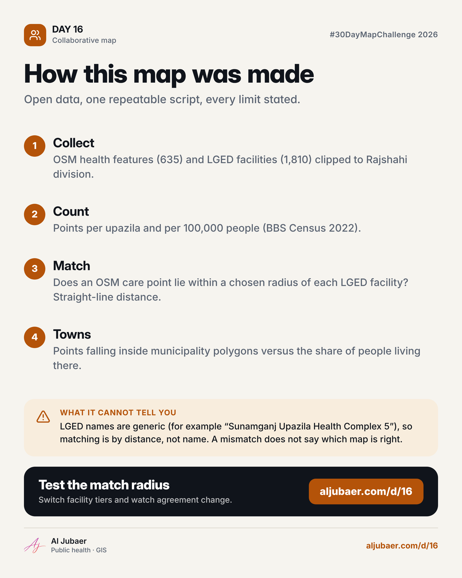
- Data: OpenStreetMap health features from the BD Hospital Dataset (Complete.csv, 8,812 rows, cleaned and clipped to Bangladesh) and the LGED health facility layer (community clinics, union health and family welfare centres, upazila health complexes, district hospitals), both from the GIS Data folder.
- Area: the 73 upazilas of Rajshahi division (BBS Census 2022 polygons and totals).
- Counts per upazila and per 100,000 people; the crowd-to-official ratio divides OSM points by LGED facilities.
- Agreement: for each LGED facility the straight-line distance to the nearest OSM care point (hospital, clinic, centre, doctor, dentist), tested at a radius you choose; the default is 500 m.
- Towns: points inside the 62 municipality polygons of the division's districts, compared with municipality population.
- The browser recomputes agreement for any radius and facility tier using a grid index.
Findings
Rajshahi division has 635 OSM health points and 1,810 public facilities in the LGED layer, for 20.3 million people.
At 500 m, only 0.7% of LGED facilities have an OSM care point (community clinics 0.6%, union centres 1.1%, upazila complexes 0.0%, district hospitals 12.5%).
52% of OSM health points sit inside municipalities, which hold 15% of the people. Only 7% of LGED facilities are in towns.
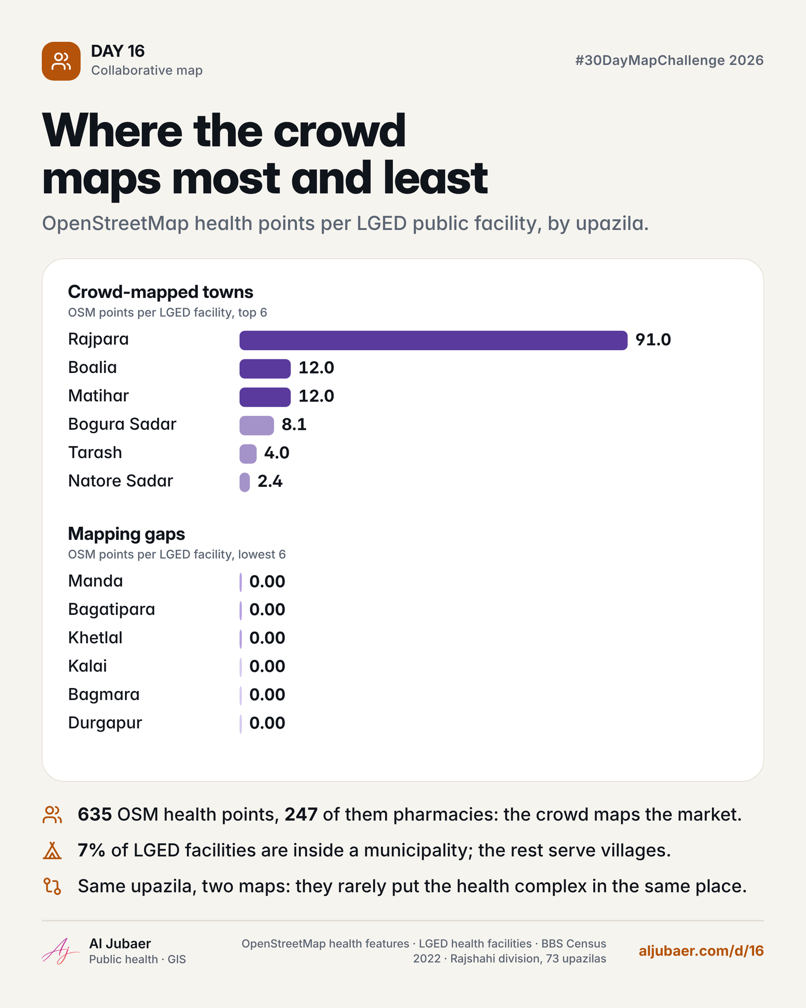
247 of the 635 OSM points (39%) are pharmacies, a market-side picture of care. For the 14 upazilas where both maps hold a health complex, the two points are a median 10.0 km apart.
The most crowd-mapped upazila relative to its public facilities is Rajpara (91.0 OSM points per LGED facility).
A health map is a collaboration: the crowd sees towns and private care, the state sees villages. Neither is complete alone.
Comments & reviews
What you write appears here once it has been approved.
 Web map & dashboard
 Web map & dashboard
 Web map & dashboard
 Web map & dashboard