Open Lab
Open Lab
Maps, dashboards, code & data — open to everyone
Everything behind my geospatial public-health work: live web maps and dashboards, the Python and R code, the data, and how it was done. Explore it, reuse it, cite it.
14items
13live maps & dashboards
0code files
0datasets
▦ Interactive dashboard — every day's map, charts, data & methods
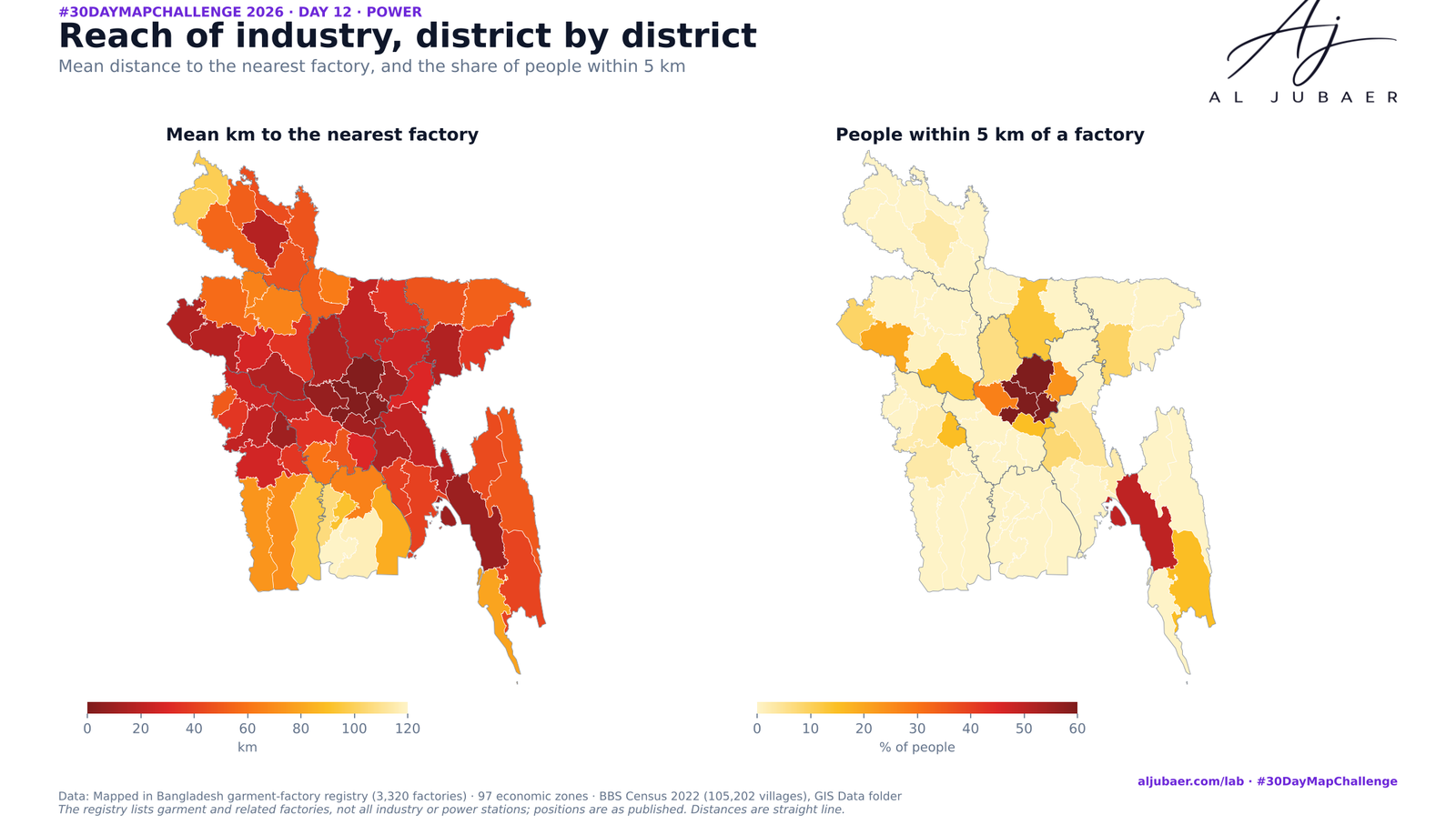 Web map & dashboardDay 12
Day 12 Power — Where the factory floor meets the ward
I read “Power” as industrial power — the garment factories that drive the economy — and measured how far each one is from a hospital, a pharmacy and … ● LivePythonGeoPandasSciPy
12 Nov 2026 · CC BY 4.0
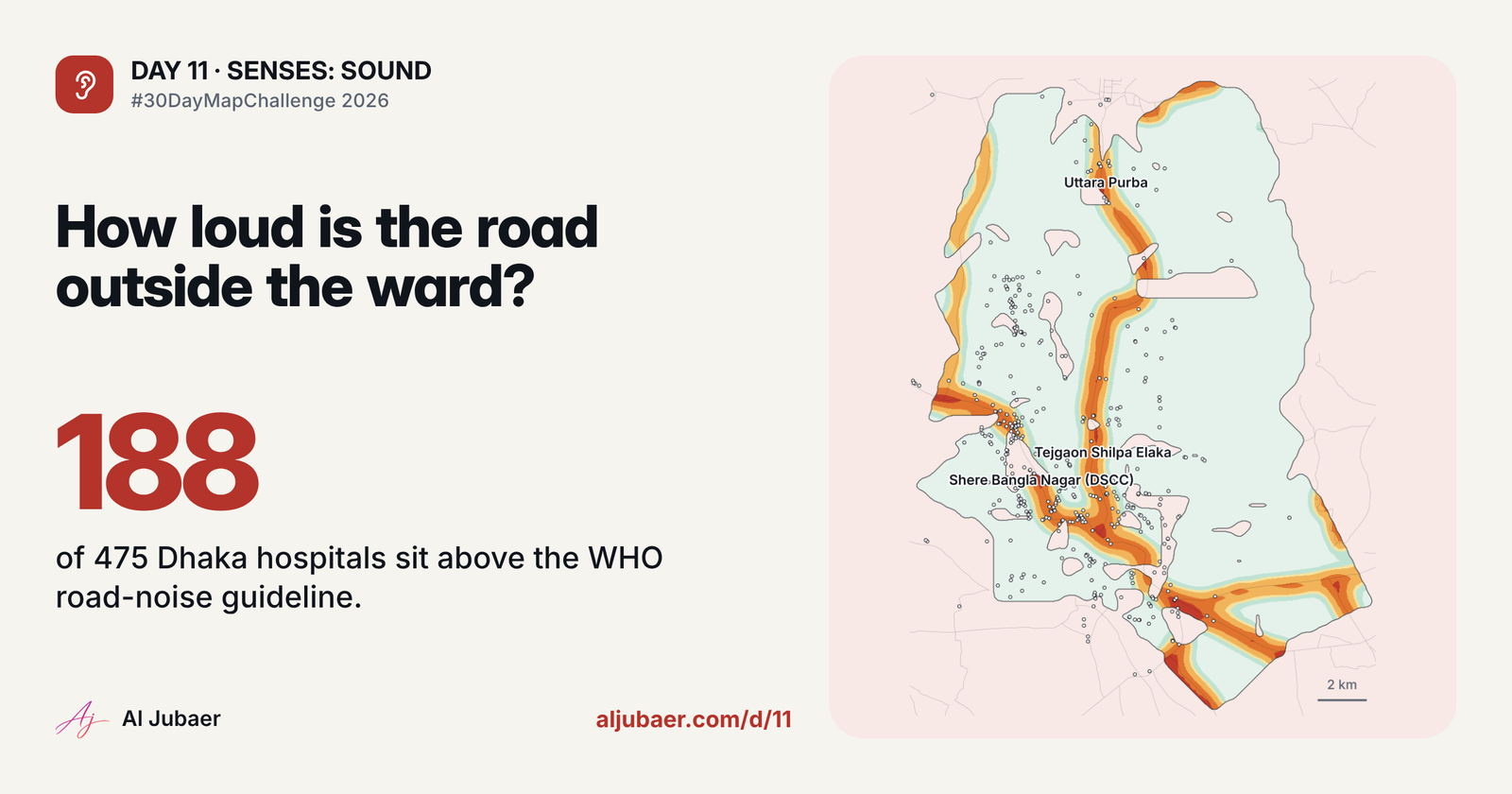 Web map & dashboardDay 11
Day 11 Senses: Sound — The sound of the road outside the hospital
A transparent road-noise model for Dhaka and Chattogram, tested against the WHO 53 dB guideline, with sliders so you can change every assumption — an… ● LivePythonGeoPandasSciPy
11 Nov 2026 · CC BY 4.0
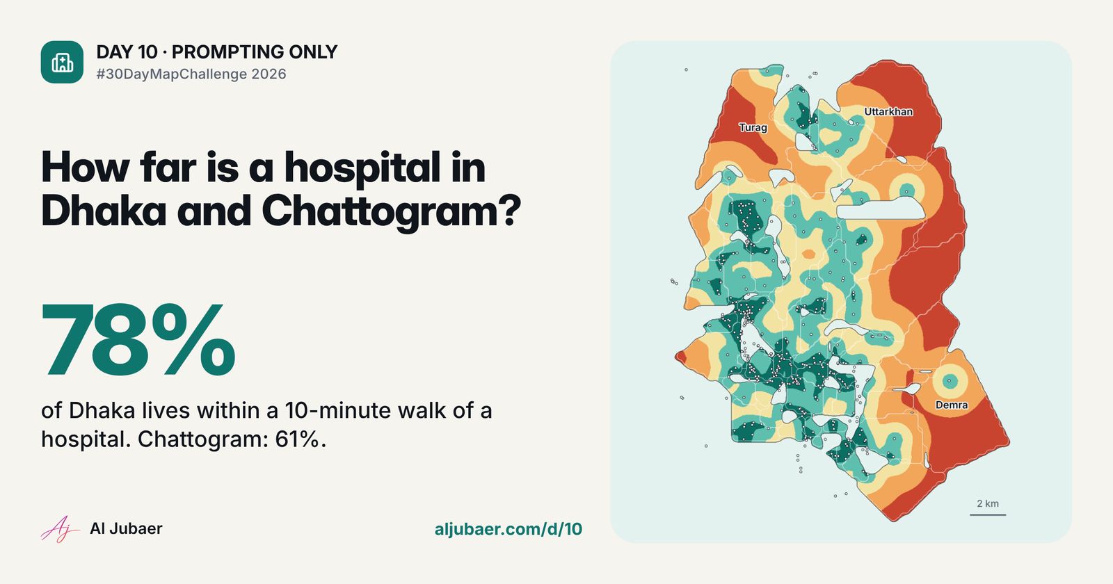 Web map & dashboardDay 10
Day 10 · Prompting only — One sentence, one health map
A single plain-English prompt, a full analysis: how far people in Dhaka and Chattogram live from a hospital, clinic and pharmacy. Dhaka: 77.9% of 10.… ● LivePythonGeoPandasSciPy
10 Nov 2026 · CC BY 4.0
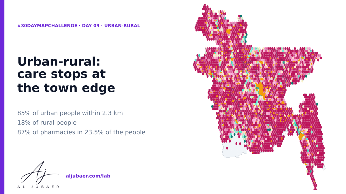 Web map & dashboardDay 9
Day 9 · Urban-rural — Care stops at the town edge: the urban–rural gap in access to pharmacies and hospitals
Bangladesh counts 23.5% of its people in urban wards, yet 87% of registered pharmacies and 75% of hospitals and clinics sit there. 84.7% of urban peo… ● LivePythonGeoPandasSciPy
9 Nov 2026 · CC BY 4.0
 Web map & dashboardDay 8
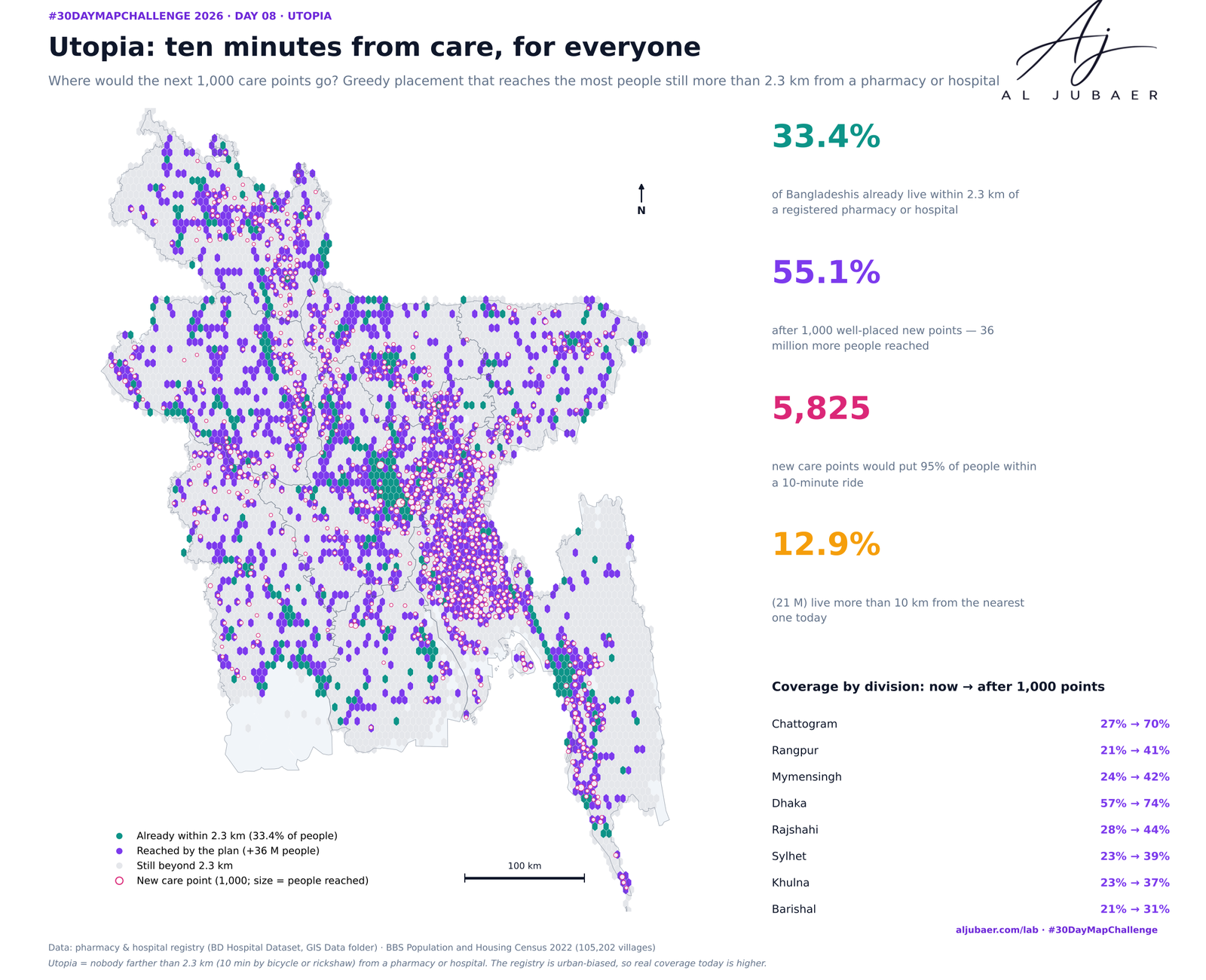
Day 8 · Utopia — Ten minutes from care, for everyone: where the next care points should go
Utopia is a Bangladesh where nobody is more than a 10-minute bicycle ride (2.3 km) from a pharmacy or hospital. Today only 33.4% of Bangladeshis are.… ● Live
8 Nov 2026 · CC BY 4.0
 Web map & dashboardDay 7
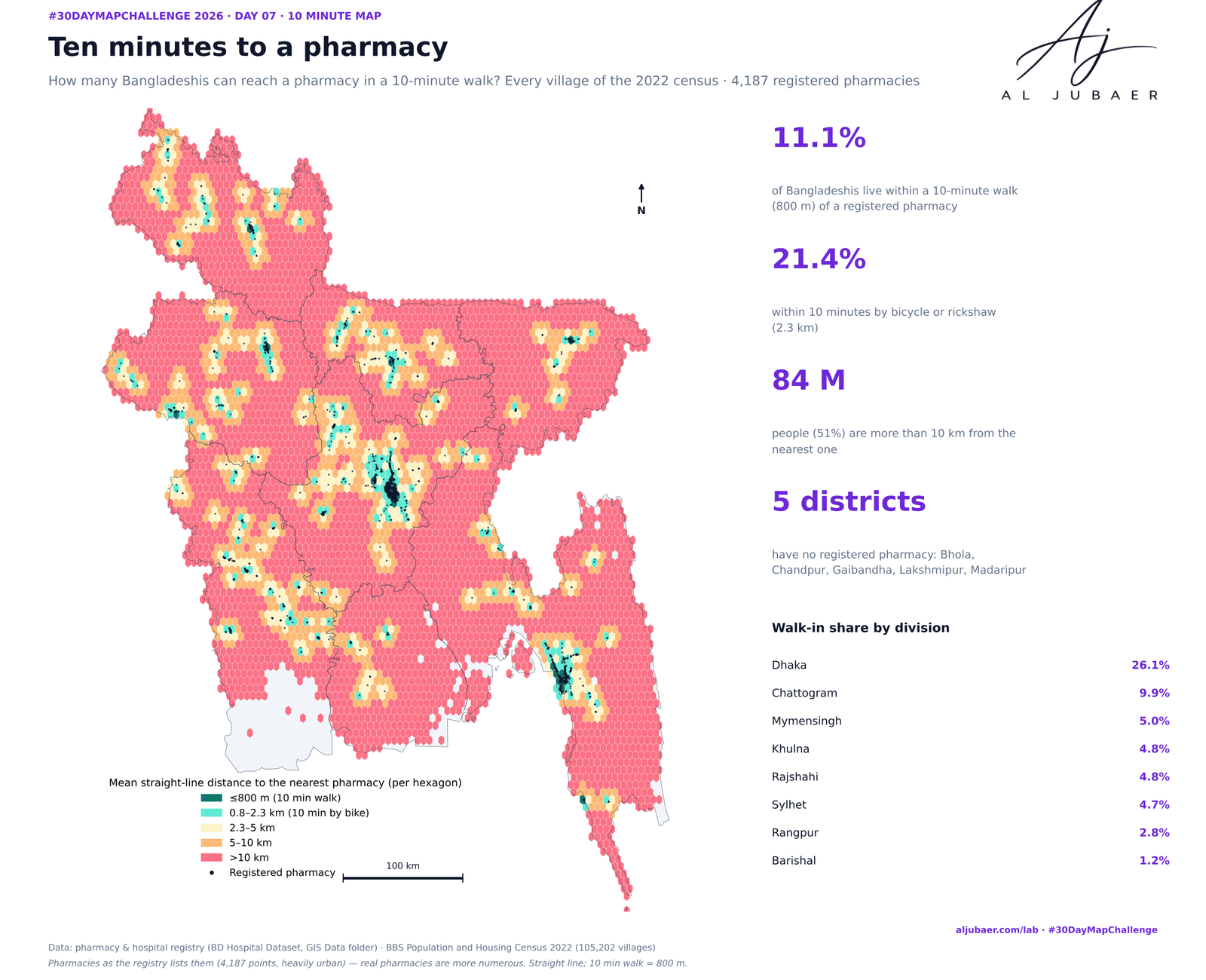
Day 7 · 10 minute map — Ten minutes to a pharmacy: who can walk to medicine?
A 10-minute walk is 800 m. Measured from every one of 105,202 populated villages to the 4,187 pharmacies in the national hospital-and-pharmacy regist… ● LivePythonGeoPandasSciPy
7 Nov 2026 · CC BY 4.0
 Web map & dashboardDay 6
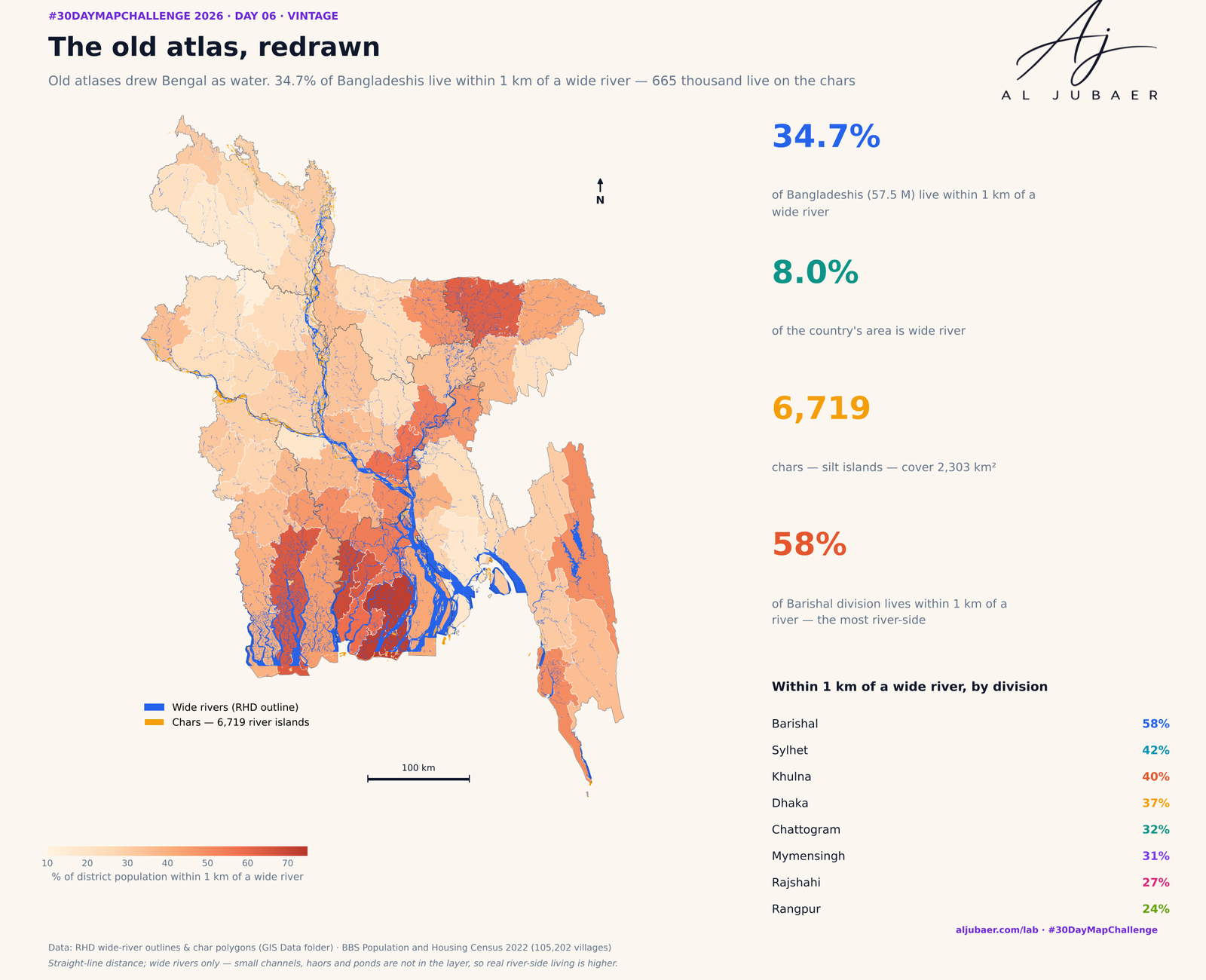
Day 6 · Vintage — The old atlas, redrawn: who lives by Bangladesh's rivers and chars
Old atlases drew Bengal as water. Redrawn with open data: the RHD wide-river outlines cover 8.0% of Bangladesh and 34.7% of Bangladeshis (57.5 millio… ● LivePythonGeoPandasShapely
6 Nov 2026 · CC BY 4.0
 Web map & dashboardDay 5
Day 5 · Senses: Sight — Out of sight: how far Bangladesh lives from an eye hospital
OpenStreetMap contributors, health facilities for Bangladesh (oex export, snapshot 2 Nov 2026), ODbL. BBS Population and Housing Census 2022 GIS laye… ● LivePythonGeoPandasSciPy
5 Nov 2026 · CC BY 4.0
 Web map & dashboardDay 4
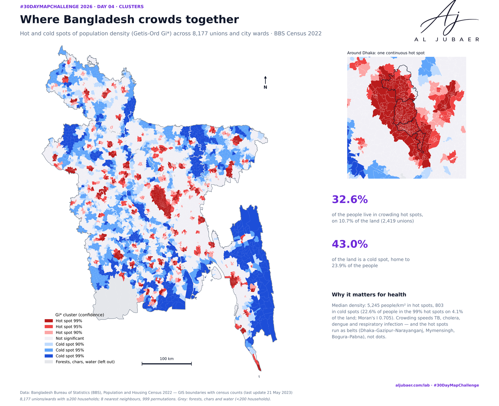
Day 4 · Clusters — Where Bangladesh gathers: crowding, leaving and the missing men
Three kinds of clusters in the 2022 census, union by union. Crowding: 32.6% of Bangladeshis live in density hot spots on 10.7% of the land. Leaving: … ● LivePythonGeoPandasPySAL (esda)
4 Nov 2026 · CC BY 4.0
 MapDay 1
Day 1 · Points — Where Bangladesh's health care is mapped
8,230 OpenStreetMap health facilities across Bangladesh, coloured by type, with district rates per 100,000 people and the distance from every upazila… PythonGeoPandasShapely
4 Nov 2026 · ODbL 1.0
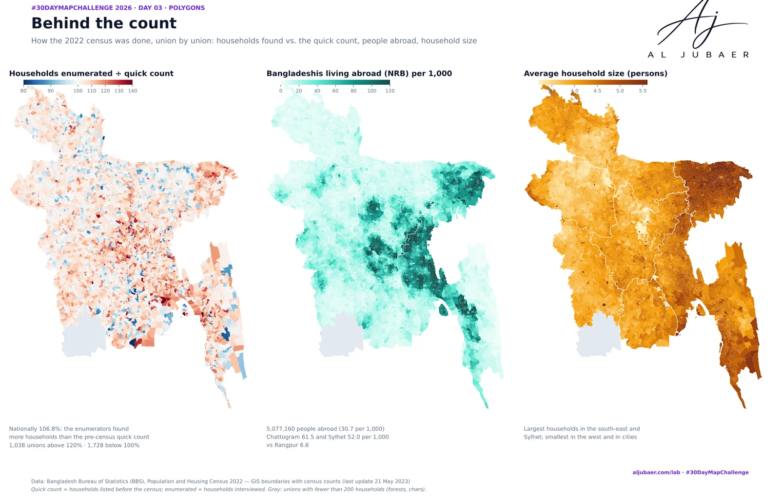 Web map & dashboardDay 3
D_3_Polygon Bangladesh Population Density Map
The same 165.5 million people, drawn with 8, 64, 600, 8,202 and 107,955 polygons. By division, half of Bangladesh lives on 44.9% of the land; village… ● LivePythonGeoPandasMatplotlib
3 Nov 2026 · CC BY 4.0
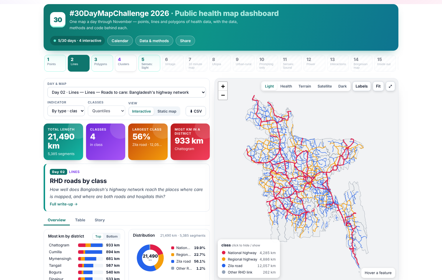 MapDay 2
Day 2 · Lines — Roads to care: Bangladesh's highway network
21,564 km of national, regional and zila roads from the Roads and Highways Department, mapped by class and measured against the 2,234 hospitals mappe… ● LivePythonGeoPandasShapely
2 Nov 2026 · All rights reserved
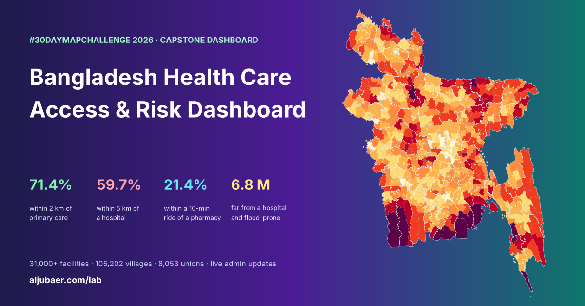 Web map & dashboard
Bangladesh Health Care Access & Risk Dashboard
71.4% of Bangladeshis live within 2 km of primary care, but only 59.7% are within 5 km of a hospital and 21.4% within a 10-minute ride of a pharmacy;… ● LivePythonGeoPandasSciPy
9 Nov 2026 · CC BY 4.0
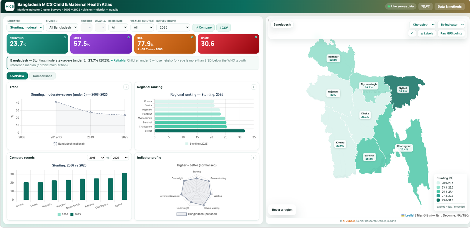 Web map & dashboard
Bangladesh MICS Child & Maternal Health Atlas
Bangladesh MICS Child & Maternal Health Atlas ● Live
1 Nov 2026 · All rights reserved
Nothing matches. Try another word or tool.