Bangladesh Health Care Access & Risk Dashboard
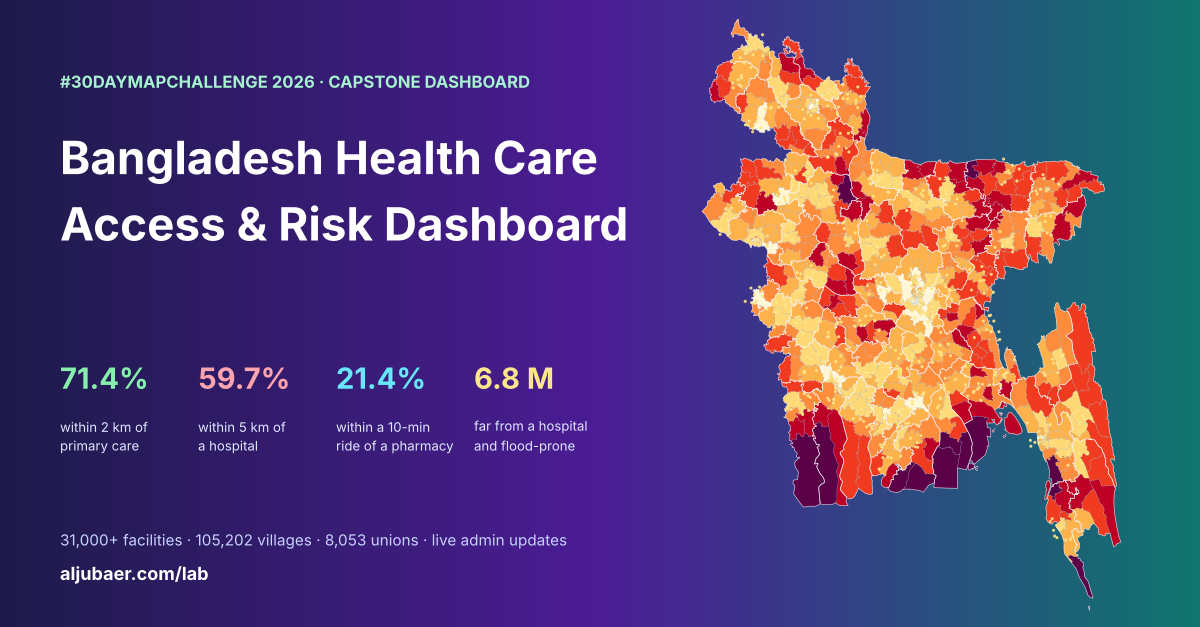
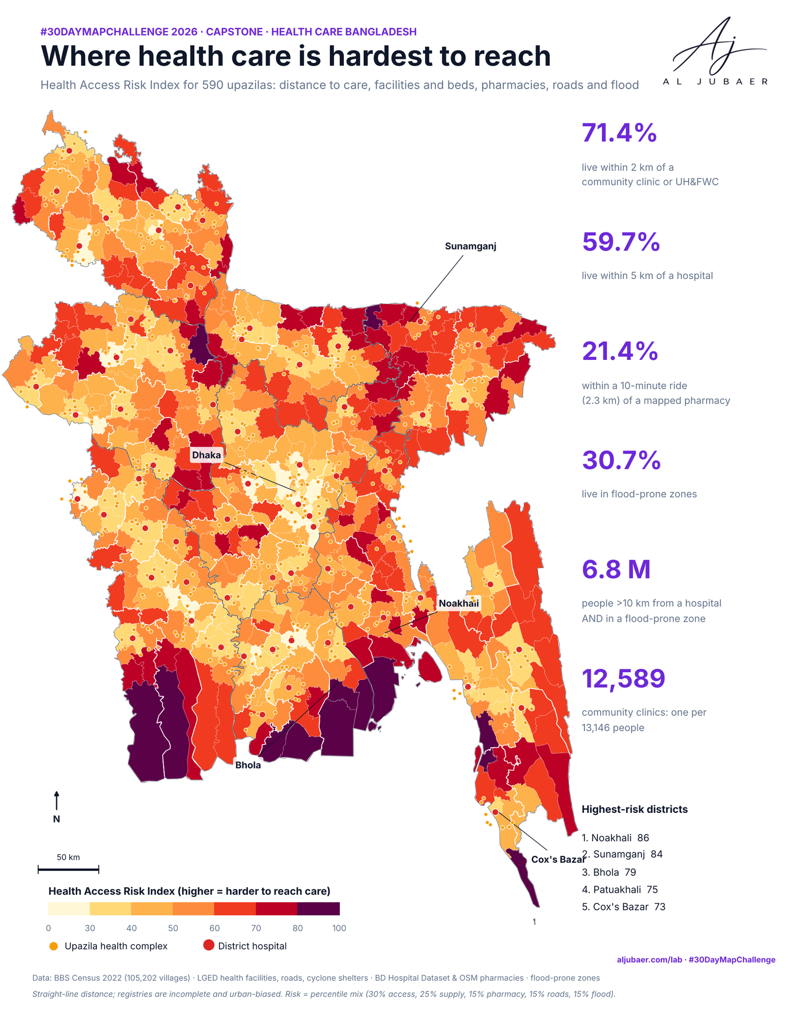
71.4% of Bangladeshis live within 2 km of primary care, but only 59.7% are within 5 km of a hospital and 21.4% within a 10-minute ride of a pharmacy; 6.8 million are both far from a hospital and in a flood-prone zone. Explore 24,800+ health facilities and pharmacies from division to union, re-weight the risk index, and find the nearest care from any point.
Write-up
The question
Who in Bangladesh can reach health care, which places carry the highest risk when distance, supply, pharmacies, roads and floods are combined, and how can the data be kept up to date?
Data
BBS Population and Housing Census 2022 GIS layers (105,202 villages, 165.5 M people; unions, upazilas, districts, divisions). LGED health facilities (12,589 community clinics, 3,150 union health & family welfare centres, 504 upazila health complexes, 63 district hospitals), LGED roads and cyclone shelters. Bangladesh Hospital Dataset (OpenStreetMap, DGHS, Wikipedia; synthetic rows removed): 2,171 hospitals and 2,094 clinics/diagnostic centres. OpenStreetMap pharmacies (4,255). National flood-prone zone map. Distances are straight-line in UTM 46N. The hospital and pharmacy registries are incomplete and urban-biased, and the LGED layer misses some upazila health complexes (e.g. Rajbari). Admin updates on the live dashboard are not part of these files.
Methods
- People: 105,202 populated census villages (BBS Census 2022), one inside point each, 165.5 million people.
- Facilities: LGED community clinics, union health & family welfare centres, upazila health complexes and district hospitals; BD Hospital Dataset hospitals and clinics (synthetic rows removed); OSM pharmacies; LGED cyclone shelters.
- Distance: straight-line km in UTM 46N from every village to the nearest facility of each type, using a k-d tree.
- Roads: LGED paved roads (national, regional, zila, upazila and paved village roads) sampled every 250 m; distance from each village to the nearest one.
- Flood: each village placed in the national flood-prone zone map (severe and moderate river, flash flood and tidal surge zones).
- Areas: villages summed to 8,053 unions, 590 upazilas (dissolved from unions), 64 districts, 8 divisions and 10 km hexagons; all shares are people-weighted.
- Health Access Risk Index: each input becomes a percentile rank among areas at the same level; five components (access 30%, supply 25%, pharmacy 15%, roads 15%, flood 15%) are averaged; the dashboard sliders recompute it live.
- Web: Leaflet dashboard with 5 map levels, 23 indicators, 8 facility layers, a nearest-care tool and 30 day-modules; a PHP admin panel stores facility, population and alert updates in a JSON store kept outside the app folder.
- Limits: straight-line distance is not travel time; registries are incomplete and urban-biased; some upazila health complexes are missing from the LGED layer.
Findings
71.4% of people live within 2 km of a community clinic or union health & family welfare centre; one community clinic serves 13,146 people on average.
Only 59.7% live within 5 km of a hospital (UHC, district hospital or registry hospital); 10.9% — about 18 million — live more than 10 km away. The average person is 4.9 km from a hospital.
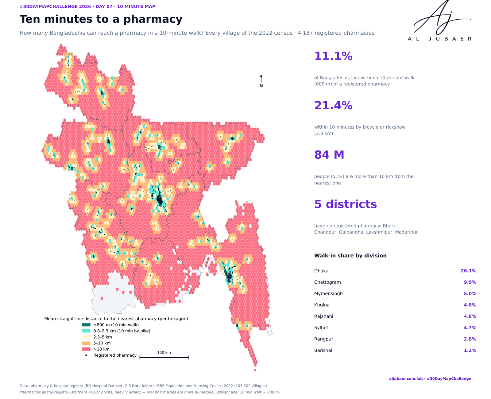
Only 21.4% live within a 10-minute ride (2.3 km) of a mapped pharmacy, and half live more than 10 km away. The registry is urban-biased, so real access is better.
42.2% of people live more than 1 km from a paved road; 30.7% live in a flood-prone zone (9.0% severe).
6.8 million people carry a double burden: more than 10 km from a hospital and in a flood-prone zone.
Highest-risk districts: Noakhali, Sunamganj, Bhola, Patuakhali and Cox's Bazar. Lowest: Dhaka, Rajshahi, Munshiganj.
Highest-risk upazilas: Hatiya, Shyamnagar, Kalapara, Koyra and Charfasson — islands, haors and the coast.
By division, Sylhet has the highest risk (68) and the lowest primary-care coverage (53.9% within 2 km); Dhaka the lowest risk (22).
The farthest village from any hospital is Dakkhinpara on Saint Martin's Island, 53.5 km in a straight line.
Rajbari has no upazila health complex or district hospital in the LGED layer: a data gap that the admin panel can now close.
Comments & reviews
What you write appears here once it has been approved.
More from the Open Lab
 Web map & dashboard
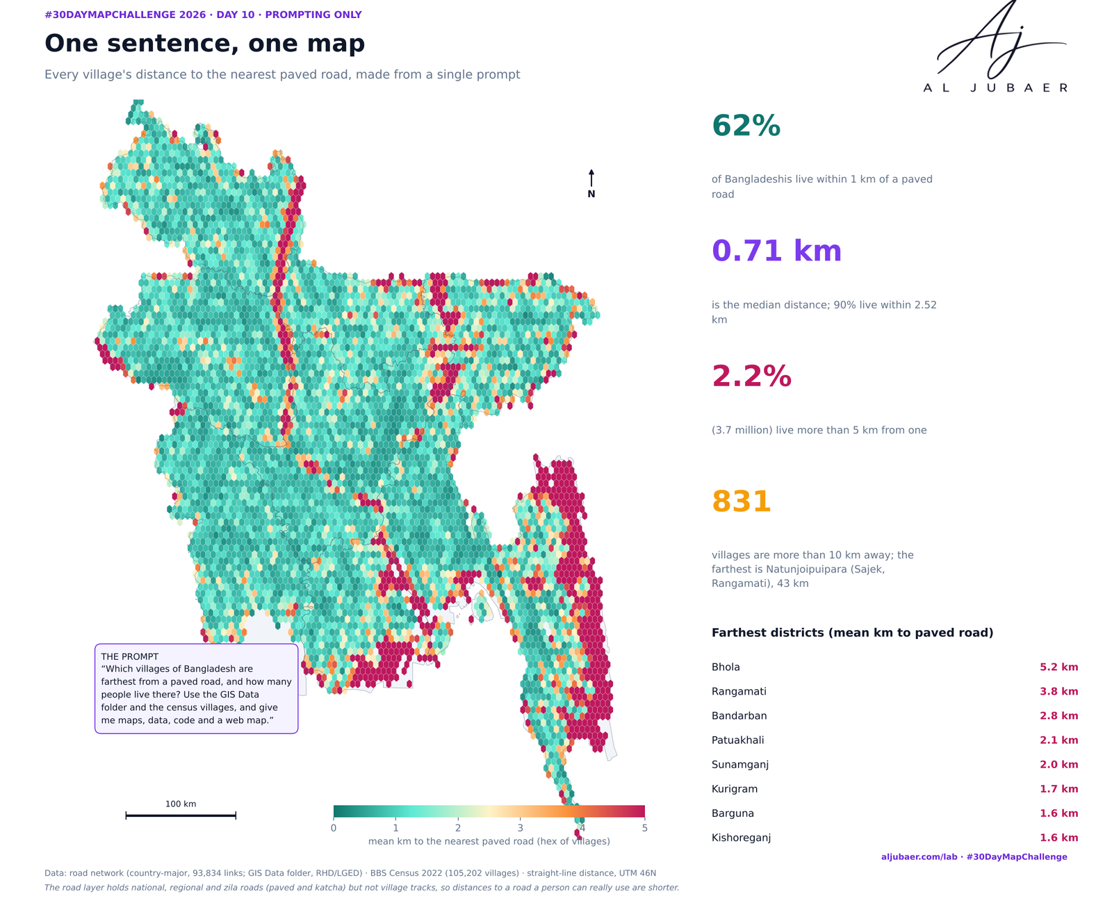
Day 10 · Prompting only — One sentence, one health map
 Web map & dashboard
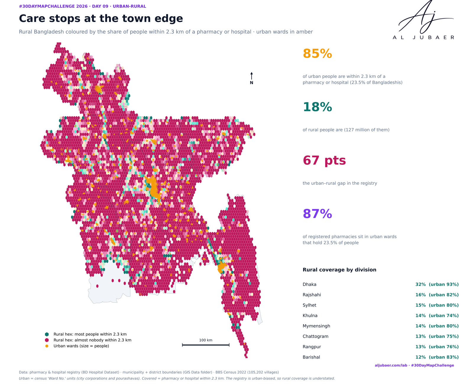
Day 9 · Urban-rural — Care stops at the town edge: the urban–rural gap in access to pharmacies and hospitals
 Web map & dashboard
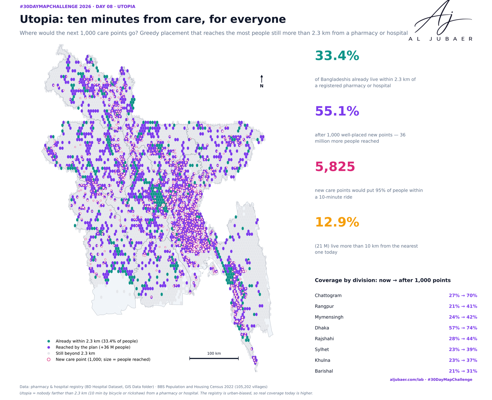
Day 8 · Utopia — Ten minutes from care, for everyone: where the next care points should go
 Web map & dashboard
Day 7 · 10 minute map — Ten minutes to a pharmacy: who can walk to medicine?